Dates & prices
No upcoming dates yet.
This operator hasn't scheduled new dates for this trip.
About Achalu Betta Trek
Everything from the adventure page, so you do not have to leave this trip.
A 3.3 km climb up a bamboo-covered granite hillock above Achalu village in Kanakapura taluk, about 71 km by road from central Bengaluru, ending at a stone Nandi that looks back at the city. Elephants use the trail, there is no check post and no guide, and Karnataka's Forest Department has not reopened routes like this one — so read this as a hill to plan carefully for, not one to turn up at.
Trip details
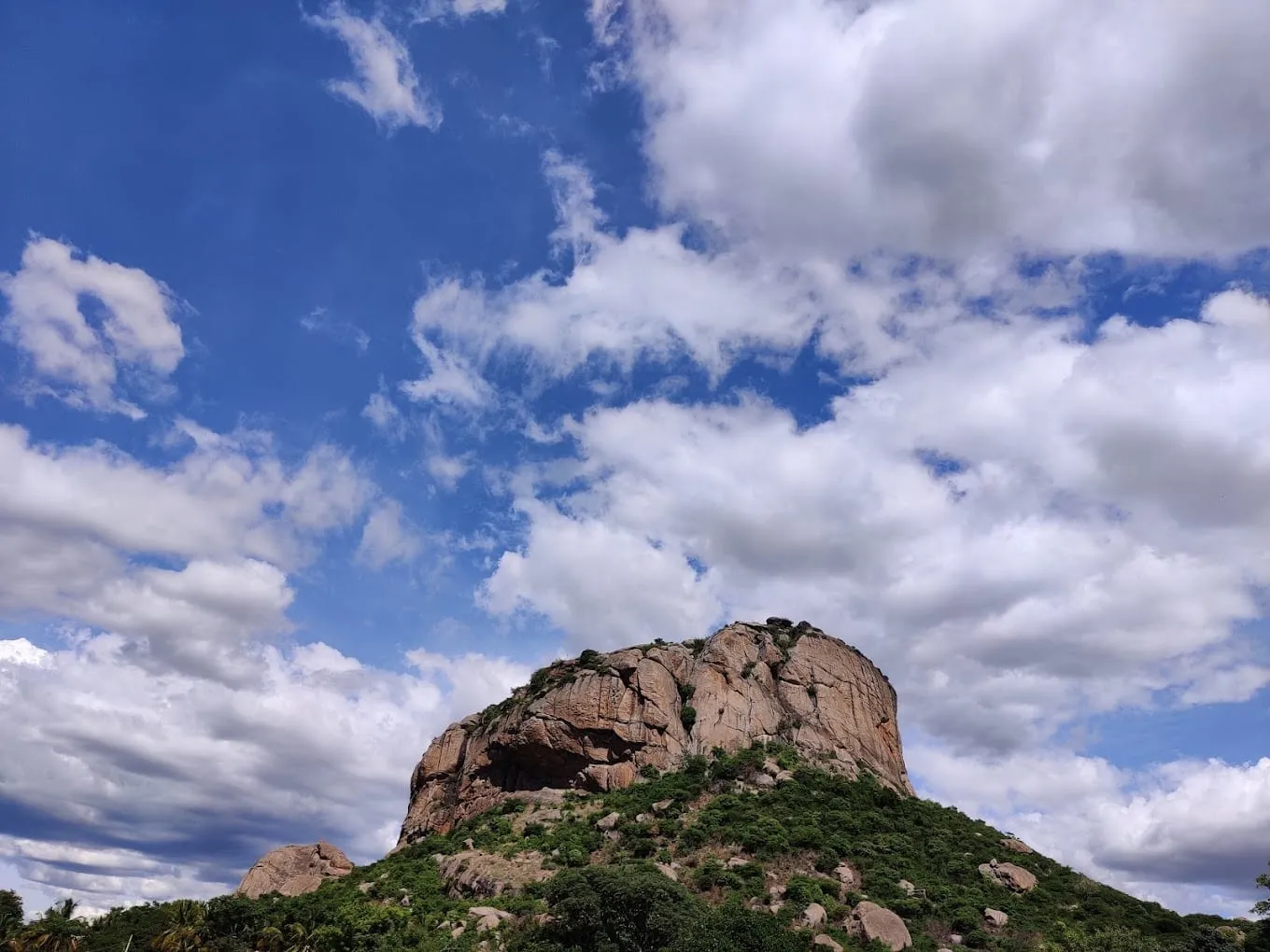
There is a hill an hour and a quarter south-west of Bengaluru with a stone bull sitting on top of it, and almost nothing written about it. Achalu Betta rises out of the farmland above Achalu village in Kanakapura taluk, and what draws people up it is the Nandi — the bull that is Shiva's mount and his doorkeeper, which in South Indian Shiva temples sits on the central axis facing the shrine. Here the shrine is a rock. The Lost Lander, who climbed it after a friend saw the hill in a YouTube documentary, found the Nandi looking out over the plain with a small Shiva shrine opposite it: "a small rocky outcrop under a large tree which is worshipped as the presiding deity". There is no ticket, no board and nobody collecting anything; the Lost Lander found only the Nandi and that rock shrine, though Escape2Explore and a 2017 Bangalore Trekking Club group both describe a Muneshwara temple at the top, so expect a small shrine rather than nothing at all. There is a bull on a rock, and a great deal of sky. The walk to it is short and better than its numbers suggest. OpenStreetMap carries the route as a named way — "Achalu betta hiking trail" — tagged as a dirt track of the roughest tracktype the tagging scheme has, and it measures 2,476 m, passing within 23 m of the Nandi about 2.3 km along before running on past it. Add the kilometre of kaccha road up from the village and call it 3.3 km to the bull, 6.6 km on the day. It starts as a kaccha road wide enough to drive, which is exactly how the Lost Lander's group found it — they walked the first kilometre before realising "vehicles could have been driven until that point" — and then it climbs into bamboo. That bamboo is the surprise of this hill. This is dry Deccan country, granite and scrub and silk farms, and the upper trail runs through "a thick canopy of bamboo forests" with the light broken into pieces. Above it the canopy opens onto bare rock, a panorama with Bengaluru's skyline smudged along the horizon, an abandoned guesthouse that night visitors use for bonfires, a short paved path, and a pond covered in white lilies with the Nandi standing behind it. What the three Bangalore Trekking Club reports from 2017 add is the grain of the thing. "The first kilometre was pretty easy. The next two kms became difficult as we have climb rocks to reach the top," one of them says, and the group reached the peak "after an hour of climb and many stops for rest". Another arrived through a village of "colorful houses each having a white rangoli outside their doors", many with "wooden basket with silk worms" — Kanakapura is the largest cocoon silk producer in India, and that is what the fields at the bottom are for. A third had to hunt for the trailhead entirely: "Finding the start of the trek was quite a difficult task as the trail was new for all of us", and above it "overgrown bushes, prickly thorns, and path blocking bamboos and boulders". They found the Nandi only because five of them pushed past a lunch stop, and it turned out to be "just 100 to 150m metres from the rest spot". And then the part nobody selling this trek will lead with. In that same 2017 report, as the group entered Achalu village, "there came villagers to scare us by telling there is an elephant and a cheetah in and around the hillock" — cheetah, in Indian English, meaning leopard. Seven years later the Lost Lander wrote the same hill up in one flat sentence: "It is frequented by elephants which was evident with freshly dropped dungs enroute." That is not a warning transplanted from somewhere else. One party saw sign on the trail; the other was told about it at the foot of the hill and walked on regardless, seeing nothing. Seven years apart, same hill. It is also the single fact that decides how you should treat this hill in September 2026, because Karnataka's Chief Wildlife Warden suspended trekking on exactly such routes on 11 May 2026, and nothing published since reopens this one.
- The Nandi at the top — a stone bull on the summit rock, facing out over the plain, with a small Shiva shrine opposite it. OpenStreetMap records it as a Hindu place of worship named "Nandi Achalu Betta" at 12.47230 N, 77.36462 E. The Lost Lander describes the shrine facing it as an outcrop under a large tree rather than a building.
- A pond of white lilies a few steps below the Nandi, reached by a short paved path from the rock terrace. One 2017 group, walking in late October, found it "filled with the monsoon rains" with lotus in bloom around it. Late in a dry spring it may be mud.
- Bamboo. The middle third of the climb runs under what the Lost Lander calls a thick canopy of bamboo forest, which is unusual company on a Deccan granite hill and the best reason to walk this one rather than the better-known domes nearer the city.
- Bengaluru from 60 km away. The canopy opens onto a rocky outcrop with, in the Lost Lander's words, "a panoramic view of Bengaluru cityscape at the horizon", and the 2017 groups describe hillocks, coconut plantations and green farmland in every other direction.
- Kabbalu, 8.8 km west-north-west of the trailhead — the hill sold by operators under the spelling Kabbaladurga. Escape2Explore's listing promises views of "Kabalidurga and other nearby hillocks" from the top of this one.
- An abandoned guesthouse on the upper shoulder. The Lost Lander found it derelict and "used by nighthawkers as a place to have a bonfire party", which is also a fair description of what you may find left behind up there.
- Achalu village at the foot: rangoli at the doorsteps, and wooden trays of silkworms in the houses. Kanakapura taluk is the largest cocoon silk producer in India, and the walk starts by crossing those fields.
- Boulder fields and open granite on the descent line the Lost Lander's group improvised by following a power line down — "lot of green bamboo patches scattered amidst large brown boulders". Read their account of that shortcut before you copy it; it ends badly.
Train for the surface, not the distance. About 6.6 kilometres round trip from the village with roughly 217 m of climbing is nothing to a regular walker; what catches people on this hill is that the top half has no made path. The Forest Department has never built one here, and OpenStreetMap's own tagging says as much — the trail is recorded as a dirt track with smoothness "horrible" and tracktype grade 5 — the roughest tracktype the scheme has, and near the bottom of its smoothness scale. Expect to use your hands on rock, and expect thorn scrub to reach you: the May 2017 group wrote that "the climb and the path to the top were laden with weeds and thorns which rubbed and scratched trekkers' arms and legs". Wear long sleeves and long trousers rather than shorts, and take shoes with a real edge to them. Go up early and be off the hill well before dusk. This is elephant country and elephants move at dawn and dusk; the trail is also unlit, unmarked and unpatrolled, and the nearest hospital is in Kanakapura, 12.3 km and about 19 minutes away by road. Carry two litres of water per person — there is none on the hill, and the lily pond is scenery, not a water source. Tell somebody not on the walk where you are and when you will be down. And check the legal position before you drive out, because as of September 2026 the honest answer is that this walk is not sanctioned: see the permits note below.
- Elephants use this trail, and that is the fact to plan around. The Lost Lander's 2024 account says plainly: "It is frequented by elephants which was evident with freshly dropped dungs enroute." A 2017 Bangalore Trekking Club group was warned by villagers at Achalu itself of "an elephant and a cheetah in and around the hillock" — cheetah being Indian English for leopard. One party saw sign on the trail; the other was warned at the foot of the hill and walked on regardless. Seven years apart, same hill. The night-trek and sunrise itineraries sold for this hill put you on that trail in the dark, on a route where the fullest published account found fresh dung. We would not walk it at night.
- As of September 2026 this is not a sanctioned trek, and nobody's permit covers it. On 11 May 2026, after a leopard killed a ten-year-old at MM Hills, the Principal Chief Conservator of Forests (Wildlife) and Chief Wildlife Warden issued a circular suspending trekking on forest routes frequented by leopards, tigers, elephants and bears until further orders, and a second suspending trekking anywhere the department's April 2026 safety procedure could not be fully complied with and certified. A fresh SOP on 30 August 2026 requires a route-by-route assessment before any trail reopens, with trained local escorts, daily entry caps and GPS tracking; the first reopenings under it went to the Kudremukh Wildlife Division. On 11 September 2026 the department's booking portal, Aranya Vihaara, offered treks in exactly four districts — Bengaluru Rural, Chikkamagaluru, Dakshina Kannada and Kalaburagi. Bengaluru South is not one of them, and the taluk, the village and the hill appear nowhere on the site. There is no counter here to buy a ticket at and no office that has certified this route.
- Both spellings are correct, and you need both to search. OpenStreetMap has the village as Achalu (ಅಚಲು) and the path as the "Achalu betta hiking trail"; Google Maps lists the hill as Acchalu Betta; the Lost Lander writes Acchalu throughout; Escape2Explore and Bangalore Trekking Club write Achalu. Betta is simply Kannada for hill.
- Ignore the published heights — all of them. Escape2Explore's page gives "Achalu Betta Height: 1,022 ft." and calls it a hill "around 1000 feet high". Two independent 30 m elevation datasets sampled at all 228 nodes of the OSM trail say otherwise. NASA's SRTM puts the trailhead at 701 m and the highest ground the trail crosses at 918 m; ASTER reads 690 m and 909 m. Call the top 909-918 m, or roughly 2,980 to 3,010 ft, and the climb 217-219 m, or about 715 ft. So 1,022 ft is neither the altitude nor the climb — it is 311 m, half as much again as the gain — and we could not trace it to any source. No survey height for this hill is published anywhere we could find.
- The mapped trail is 2.5 km each way; the walk from the village is nearer 3.3. OpenStreetMap's way measures 2,476 m, but it begins about a kilometre east-south-east of Achalu village, where the drivable kaccha road gives out — so if you park at the village temple, as most groups do, budget at least 3.3 km up and about 6.6 km on the day. That is why Escape2Explore's "3-4 km" and the May 2017 group's "first kilometre … next two kms" agree with each other and with the map. The way passes within 23 m of the Nandi about 2.3 km along and then runs on past it, so you leave the line briefly rather than at the end. Escape2Explore budgets 1.5 to 2 hours each way; the May 2017 group took about an hour from the foot of the hill. Budget three to four hours on the hill including the top, and more if you have to find the line yourself.
- There is no guide to hire and no trailhead to speak of. One 2017 group wrote that "finding the start of the trek was quite a difficult task as the trail was new for all of us" and got down only because local children showed them the way. Another found the Nandi only after pushing 100-150 m beyond where the group had stopped for lunch, having failed to spot it from below. Load the OSM way onto your phone before you leave the road, and do not rely on mobile data at the top.
- Do not improvise the descent the way the Lost Lander's group did. They followed a power line down as a shortcut and found the old line swallowed by thorn: "thick thorny bushes had taken over the trail… we slid a few slopes, our clothes and hair got entangled in the bushes and we came out with bruises all over our limbs, bums and back." It is steeper and harder than the way up. Go down the way you came.
- Nothing is sold on the hill and very little at the bottom. Kanakapura, 12.3 km away by road, is the nearest town with shops, a bus stand and a hospital; Bengaluru is 71 km by road from MG Road and 61.5 km from Banashankari. Achalu village is a farming settlement, not a trailhead with facilities. Carry your water, your food and your rubbish, in both directions.
- The Cauvery Wildlife Sanctuary is nearby but this hill is not inside it. Its nearest boundary lies about 7 km away, recomputed from the sanctuary's own OpenStreetMap outline. If you see this trek described as being at the edge of the sanctuary, that is a real neighbourhood written up as a false address. We could not establish how the hill itself is classified — no source we could fetch gives its land status — but there is no gate and nobody checking on you.
Achalu village sits at 12.4749 N, 77.3630 E, 12.3 km and about 19 minutes south-west of Kanakapura town by road, with the mapped trail starting about a kilometre east-south-east of it at 12.4728 N, 77.3717 E. From central Bengaluru, OSRM routes MG Road to the trailhead at 71.0 km and about 76 minutes, and Banashankari at 61.5 km and about 66 minutes; the drive is Kanakapura Road (NH 948, the old NH 209) most of the way, then minor roads west of Sathanur. Drive to the village temple at the foot, where the Lost Lander's group parked; a kaccha road continues past it to a second temple with an open field where vehicles can also be left, and starting there saves about a kilometre — but that first kilometre had been "washed down by the recent rain" when they walked it, so in or after the monsoon expect to park low and walk up. There is no bus to Achalu. Buses run Bengaluru to Kanakapura all day and one 2017 group travelled by KSRTC from KR Market, but the last stretch to the village is a hired auto or a taxi. There is no railway station nearer than Bengaluru's, and the nearest airport is Kempegowda International at Devanahalli, on the far side of the city. Set your map to Achalu or Acchalu Betta, Kanakapura taluk — there is no Forest Department signage to navigate by once you are off the tar.
- Shoes with a stiff sole and a real edge — the top half is rock and loose granite grit, not a graded path
- Long trousers and long sleeves for thorn scrub, which two separate groups report drawing blood
- Two litres of water per person; there is none on the hill and the lily pond is not a water source
- The OSM trail downloaded offline on your phone, plus a power bank — the trailhead is hard to find and the upper line is unmarked
- A head torch per person even on a day walk, in case the descent runs late; you do not want to be on this hill after dark
- Sun hat and SPF 50+ for the open rock above the bamboo
- A small first-aid kit with antiseptic, blister cover and an elastic bandage — thorn scratches here are the norm, not the exception
- Food for the day and a bag to carry every wrapper back down; nothing is sold above the village
- A charged phone, the number of someone not on the walk, and an agreed turnaround time
- Cash for parking, autos and tea in Kanakapura — card acceptance in the village is not something to count on
Safety, verified
Safety details last verified 11 Sept 2026 by MadClub.
- Known hazardsVerified
Elephants, first and above everything else. The Lost Lander's 2024 report states the trail "is frequented by elephants which was evident with freshly dropped dungs enroute", and a 2017 Bangalore Trekking Club group was warned by Achalu villagers of "an elephant and a cheetah in and around the hillock" — cheetah meaning leopard in Indian English. One party saw sign on the trail; the other was warned at the foot of the hill and walked on regardless. Seven years apart, same hill. The bamboo section gives short sightlines, which is the worst possible geometry for meeting one; make noise, walk in a group, and retreat rather than pass fresh sign. Second, route-finding: no signage, no check post, an unworn line on rock, and two of the three available trip reports describing getting lost — one at the trailhead, one at the summit. Third, thorn scrub, which draws blood on this hill as a matter of routine rather than bad luck, and which turned the Lost Lander's shortcut into a slide down a slope with "bruises all over our limbs, bums and back". Fourth, rock: the top half is granite that must be climbed, slick in the monsoon and gritty in the dry, with no protection and no rescue nearer than Kanakapura. Fifth, heat and no water above the village on a shadeless upper slope. Sixth, the abandoned guesthouse on the shoulder, which the Lost Lander describes as a bonfire spot for night visitors — treat broken glass and old fire sites as a real hazard underfoot, and do not plan to shelter there.
- https://thelostlander.com/2024/08/02/day-hike-from-bengaluru-acchalu-betta/
- https://www.bangaloretrekkingclub.com/2017/06/achalu-betta-trek.html
- https://www.bangaloretrekkingclub.com/2017/11/day-trek-to-achalu-betta-on-28th-oct.html
- https://www.openstreetmap.org/way/1386108496
- https://aninews.in/news/national/general-news/karnataka-govt-suspends-trekking-in-forest-routes-after-10-year-old-killed-in-leopard-attack20260512235721/
- Permits requiredVerified
None is issued, and that is the problem rather than the convenience. There is no Forest Department check post, ticket counter or booking page for this hill. The department's current portal, Aranya Vihaara, offers treks by district, and on 11 September 2026 its district list held exactly four entries — Bengaluru Rural, Chikkamagaluru, Dakshina Kannada and Kalaburagi. Bengaluru South is not among them, and neither Kanakapura, Achalu nor Sathanur appears anywhere on the site. Three state-wide orders sit above that. Two circulars of 11 May 2026 from the PCCF (Wildlife) and Chief Wildlife Warden, issued after a leopard killed a ten-year-old at MM Hills: the first suspended trekking on forest routes frequented by leopards, tigers, elephants and bears until further orders. Its text is written for forest areas and its addressees are the tiger reserves and the wildlife divisions; this hill is in neither, so whether the order formally reaches it is not something we can settle from the published circular. What is settled is the practical position: nobody has assessed this route, nobody has certified it, and nothing has reopened it. the second suspended trekking anywhere the department's April 2026 safety procedure cannot be fully complied with and certified, and barred a restart until a departmental officer certifies compliance. Third, an SOP issued on 30 August 2026 requires a route-wise assessment before any trail reopens and adds trained local escorts, daily entry limits and GPS-enabled tracking; the first reopenings under it went to the Kudremukh Wildlife Division, not to this district. The practical position in September 2026 is that this walk is neither permitted nor policed. Commercial operators running night treks here list "permission charges" in their inclusions without saying whose permission; do not read that as a Forest Department permit. Confirm the current position before travelling on the portal helpline 1926 or at [email protected].
- https://aranyavihaara.karnataka.gov.in/
- https://aninews.in/news/national/general-news/karnataka-govt-suspends-trekking-in-forest-routes-after-10-year-old-killed-in-leopard-attack20260512235721/
- https://www.deccanherald.com/india/karnataka/following-recent-incidents-karnataka-rolls-out-trekking-sop-with-mandatory-guides-gps-tracking-3971081
- https://aninews.in/news/national/general-news/karnataka-forest-department-unveils-new-safety-framework-strict-sops-for-forest-treks20260830221229/
- https://thebengalurulive.com/karnataka-forest-department-issues-new-trekking-sop-with-entry-caps-trained-guides-and-gps-safety-monitoring/
- https://www.escape2explore.com/tours/sunrise-treks/achalu-betta-sunrise-trek/47
- Best seasonVerified
November to February. IMD's 1991-2020 normals for Bengaluru, the nearest long-record station, give 64.5 mm of rain in November, 15.4 mm in December, 1.6 mm in January and 7.1 mm in February, against 208.3 mm in September and 186.4 mm in October — so early October is often still wet. The monsoon is when the bamboo is greenest and the summit pond actually holds lilies, and also when the granite is slick and the kaccha approach road washes out, which is exactly what the Lost Lander's group found. Avoid March to May: April's mean daily maximum at Bengaluru is 34.1 °C and the upper half of this walk has no shade at all.
- Maximum altitudeVerified
About 909-918 m (roughly 2,980-3,010 ft) on the highest ground the mapped trail crosses, from two independent 30 m elevation datasets — NASA SRTM and ASTER — sampled at all 228 nodes of the OSM way. SRTM reads 918 m and ASTER 909 m; the trailhead reads 701 m and 690 m on the same two, giving a net gain of 217-219 m (about 715 ft). opentopodata's Mapzen layer returns SRTM's values node for node here, so it is not a third opinion and we do not count it as one. No official survey height for this hill is published anywhere we could find. Escape2Explore prints "Achalu Betta Height: 1,022 ft." and describes a summit "around 1000 feet high"; 1,022 ft is 311 m, which matches neither the summit nor the climb, and we could not trace it. Note also that both datasets read 823-846 m at the Nandi's own coordinate, lower than the maximum along the trail — a 30 m grid smooths a small rock summit, so read the higher figure as the hill and the lower one as the limit of the data.
- https://api.opentopodata.org/v1/srtm30m?locations=12.4727869,77.3717395|12.4711115,77.3655351|12.4712802,77.3653511|12.4722951,77.3646192
- https://api.opentopodata.org/v1/aster30m?locations=12.4727869,77.3717395|12.4711115,77.3655351|12.4712802,77.3653511|12.4722951,77.3646192
- https://api.opentopodata.org/v1/mapzen?locations=12.4727869,77.3717395|12.4711115,77.3655351|12.4712802,77.3653511|12.4722951,77.3646192
- https://www.openstreetmap.org/way/1386108496
- https://www.openstreetmap.org/node/12833506820
- https://www.escape2explore.com/tours/sunrise-treks/achalu-betta-sunrise-trek/47
- Getting thereVerified
Achalu village is at 12.4749 N, 77.3630 E in Kanakapura taluk, with the mapped trail starting about a kilometre east-south-east of it at 12.4728 N, 77.3717 E. By road OSRM gives 71.0 km and about 76 minutes from MG Road in central Bengaluru, 61.5 km and about 66 minutes from Banashankari, and 12.3 km and about 19 minutes from Kanakapura town — take Kanakapura Road (NH 948, the old NH 209) south, then minor roads west beyond Sathanur. Escape2Explore's page gives the distance from Bangalore as 70 km in one line and about 75 km in another, which brackets the same drive. Park at the village temple at the foot; a kaccha road continues to a second temple with an open field where vehicles can also be left, saving about a kilometre of walking, but the Lost Lander found that first stretch washed out after rain, so in and after the monsoon expect to park low. There is no bus to Achalu and no railway station nearer than Bengaluru; buses run to Kanakapura all day, including KSRTC services one 2017 group took from KR Market, and the last leg is a hired auto or taxi. Nearest airport is Kempegowda International at Devanahalli, on the far side of Bengaluru. Set your map to Achalu or Acchalu Betta, Kanakapura — there is no departmental signage to steer by once the tar ends.
- https://router.project-osrm.org/
- https://www.openstreetmap.org/node/6688977474
- https://www.openstreetmap.org/way/1386108496
- https://thelostlander.com/2024/08/02/day-hike-from-bengaluru-acchalu-betta/
- https://www.bangaloretrekkingclub.com/2017/11/day-trek-to-achalu-betta-on-28th-oct.html
- https://www.escape2explore.com/tours/sunrise-treks/achalu-betta-sunrise-trek/47
- https://en.wikipedia.org/wiki/Kanakapura
- https://bengalurusouth.nic.in/en/
- Difficulty noteVerified
Easy on effort, and everything that makes people careful here is surface and route-finding rather than exertion. The mapped trail is 2,476 m each way, on top of about a kilometre of approach road, with roughly 217 m of gain — numbers a regular walker will find trivial — but OpenStreetMap records the way as a dirt track tagged smoothness "horrible" and tracktype grade 5 — the roughest tracktype in the scheme, and close to the bottom of the smoothness scale — and the trip reports match: "The first kilometre was pretty easy. The next two kms became difficult as we have climb rocks to reach the top" (Bangalore Trekking Club, May 2017), and "overgrown bushes, prickly thorns, and path blocking bamboos and boulders" (same club, October 2017). Escape2Explore grades it Moderate at the head of its page, though the same page says "easy to moderate" lower down; we publish easy, because the effort is easy and the real problems are elsewhere. The first of them is navigational: there is no signage, the upper line is faint, one group could not find the start and another walked past the summit without seeing it. The descent the Lost Lander improvised down a power line is harder again — "shorter but was steeper and harder for amateur hikers" — and should not be copied.
- https://www.openstreetmap.org/way/1386108496
- https://www.bangaloretrekkingclub.com/2017/06/achalu-betta-trek.html
- https://www.bangaloretrekkingclub.com/2017/11/day-trek-to-achalu-betta-on-28th-oct.html
- https://thelostlander.com/2024/08/02/day-hike-from-bengaluru-acchalu-betta/
- https://www.escape2explore.com/tours/sunrise-treks/achalu-betta-sunrise-trek/47
- Safety equipmentVerified
Shoes with a stiff sole and a real edge for granite; long trousers and long sleeves against thorn scrub that two separate groups report drawing blood; two litres of water per person, because there is none on the hill and the summit pond is scenery; the OSM trail downloaded for offline use plus a power bank, since the trailhead is hard to find and the upper line is unmarked; a head torch each even on a day walk, so that a late descent is inconvenient rather than dangerous; a first-aid kit with antiseptic, blister cover and an elastic bandage; sun hat and SPF 50+ for the open rock above the bamboo; and a charged phone with an agreed turnaround time held by somebody not on the walk.
- Guide requirementVerified
No guide service exists at Achalu, and no departmental rule is being applied here because no department is present. That is a gap, not a freedom. The Forest Department's own standard operating procedure of 18 April 2026, announced the day before, puts one nature guide with every ten trekkers on trails under its jurisdiction, with a guide provided even for a single registered trekker and a cap of 150 people on a trail, and the SOP of 30 August 2026 adds locally trained escorts, daily entry caps and GPS-enabled tracking. None of that machinery reaches this hill. In practice, groups find their way by asking in the village — one 2017 party got off the hill only because local children walked them down — and anyone going up should carry the mapped route offline, keep the group together, and treat local advice about elephant movement that morning as the most valuable information available.
- https://www.deccanherald.com/india/karnataka/following-recent-incidents-karnataka-rolls-out-trekking-sop-with-mandatory-guides-gps-tracking-3971081
- https://aninews.in/news/national/general-news/karnataka-forest-department-unveils-new-safety-framework-strict-sops-for-forest-treks20260830221229/
- https://thebengalurulive.com/karnataka-forest-department-issues-new-trekking-sop-with-entry-caps-trained-guides-and-gps-safety-monitoring/
- https://www.bangaloretrekkingclub.com/2017/11/day-trek-to-achalu-betta-on-28th-oct.html
- https://aranyavihaara.karnataka.gov.in/
- Emergency protocolVerified
Know before you start that help is 12 km away and will take time to arrive. Kanakapura town is 12.3 km and about 19 minutes from the trailhead by road and is the nearest place with a hospital, a police station and taxis; Bengaluru's major hospitals are 61-71 km away, an hour or more in clear traffic and considerably longer in the evening. There is no forest check post, no ranger and no signage on this hill, so there is nobody at the bottom who knows you went up unless you tell them — stop at the village temple where cars park and say who you are and when you expect to be down. The all-India emergency number is 112 and the Forest Department helpline is 1926; carry both written down rather than only in a phone that may be dead by the time you need them. Mobile coverage on the upper hill is not something to rely on. If you meet an elephant, do not run downhill on the trail into its line — move sideways off the path, put trees or rock between you and it, and give it the route. Agree a turnaround time with somebody who is not on the walk, and stick to it whether or not you have reached the Nandi.
- Fitness prerequisiteVerified
Low to moderate. Roughly 6.6 km round trip from the village with about 217 m of climbing, the hill itself done inside an hour of walking by one 2017 group with several rests. Anyone who walks regularly has the fitness. What this hill asks for beyond fitness is the ability to scramble on rock with your hands, to keep going on an unmarked line, and to move away promptly if you meet something large — which is why we would not bring anyone here who cannot do all three, and why the risk tier on this activity is high despite the modest numbers.
Payment protected — held until your trip starts.
Safety details & FAQ
Where exactly is Achalu Betta?
Above Achalu village in Kanakapura taluk, Bengaluru South district, Karnataka — the district called Ramanagara until it was renamed on 23 May 2025. OpenStreetMap puts the village at 12.4749 N, 77.3630 E and the Nandi at the top at 12.4723 N, 77.3646 E. It is 12.3 km by road from Kanakapura town and 71.0 km from MG Road in Bengaluru. Google Maps lists the hill as Acchalu Betta; OSM spells the village Achalu. Both find it.
How high is it, really?
The highest ground the mapped trail crosses reads 918 m on NASA's SRTM and 909 m on ASTER — about 2,980 to 3,010 ft — with the trailhead at 701 m and 690 m on the same two datasets. That makes the climb 217-219 m, or about 715 ft. The figure you will see quoted, 1,022 ft, is published by Escape2Explore as the hill's height. It is 311 m, which matches neither the summit nor the climb, and we could not trace it to any source. No survey number for this hill is published anywhere we could find.
How long is the walk and how long does it take?
2,476 m each way on the mapped trail, plus about a kilometre of kaccha road up from the village — so roughly 3.3 km to the Nandi and 6.6 km on the day, with about 217 m of climbing. A 2017 group reached the top in about an hour with several rests; Escape2Explore budgets 1.5 to 2 hours each way. Allow three to four hours on the hill with time at the Nandi, and add a margin if you are finding the route yourself — two of the three trip reports we have describe getting lost.
Is it legal to trek here right now?
Not in any sanctioned sense. Karnataka's Chief Wildlife Warden suspended trekking on forest routes frequented by elephants, leopards, tigers and bears on 11 May 2026, and elephants use this one — though whether that order formally reaches land outside a wildlife division is not clear from its published text; a second circular the same day suspended trekking wherever the April 2026 safety procedure is not certified, and no certification exists for this route. The 30 August 2026 SOP requires a route-by-route assessment before a trail reopens, and the first reopenings went to Kudremukh. The department's booking portal, Aranya Vihaara, offered treks in only four districts when we checked on 11 September 2026, and Bengaluru South was not one of them. There is no permit counter here to make it right. Call 1926 or write to [email protected] before you plan a date.
Are there really elephants?
Yes, and this is not a generic disclaimer. The Lost Lander's 2024 account records fresh elephant dung on the trail, and a 2017 Bangalore Trekking Club group was warned by Achalu villagers about an elephant and a leopard around the hill — hearsay the group treated as an attempt to scare them, and they saw nothing. Seven years apart, same path; one report is sign on the trail, the other is what the village says. Treat dawn and dusk as their hours, make noise on the bamboo section where sightlines are short, and turn around rather than walk past fresh sign.
When is the best time to go?
November to February. IMD's 1991-2020 normals for Bengaluru, the nearest long-record station, give 64.5 mm of rain in November, 15.4 mm in December, 1.6 mm in January and 7.1 mm in February, against 208.3 mm in September and 186.4 mm in October. The monsoon is when the bamboo and the lily pond are at their best and also when the rock is slick and the approach road washes out. March to May is hot on open granite: April's mean daily maximum at Bengaluru is 34.1 °C.
Can beginners do it, and can children?
A fit beginner can manage the distance easily. The reasons to think twice are not fitness ones: unmarked route-finding on rock, thorn scrub, elephants on the trail and no help within 12 km. If you are bringing anyone who cannot scramble or cannot move quickly if asked to, pick a different hill. There is no age rule here because there is no authority here.
Is there an entry fee or a guide?
No fee, and no guide you can hire at the hill. There is no check post, no ticket and no guide service at Achalu — one 2017 group got down only because village children showed them the path. Operators selling this as a package do include a guide of their own, and include what they call permission charges in the price; what that buys is not published, and it is not a Forest Department trek permit, because no such permit is on sale for this district.
What's included
- A trek leader from Elegant Adventurers, with the group from the trailhead to the Nandi and back.
- The mapped OpenStreetMap route loaded offline, and the line walked at the front of the group — there is no signage on this hill and two of three published reports describe getting lost.
- Head torches for anyone who does not bring one, for the dark first hour.
- First-aid kit, a pulse oximeter and a thorn-scratch kit carried by the leader.
- Electrolyte mix and a light snack at the top.
What's not included
- Travel between Bengaluru and Achalu. Arrange your own vehicle or ask us to add you to a shared cab.
- All meals. There is nothing to buy on the hill or in the village, so carry what you need.
- Personal gear, including footwear with real grip, full-length sleeves and trousers against the thorn scrub, a head torch and at least two litres of water.
- Personal insurance and evacuation costs. The nearest hospital is at Kanakapura, about 25 minutes away, and there is no rescue service on this hill.
- Any permit or entry fee, because none exists for this hill. Nobody is selling one and you should not pay anybody who offers.
Day-by-day itinerary
Achalu Betta trailhead to the summit Nandi and back. About 6.6 km round trip from the village with roughly 217 m of climbing, three to four hours on the hill. Meet and brief at the trailhead at 5:30 AM, walking by 5:45 with torches, up the kaccha road and into the bamboo. The canopy opens onto bare granite for the last stretch, hands on rock, reaching the Nandi and the rock shrine for sunrise. Back at the trailhead by mid-morning, breakfast in Kanakapura on the way, and into Bengaluru by early afternoon.
Reviews
Safety details last verified 11 Sept 2026