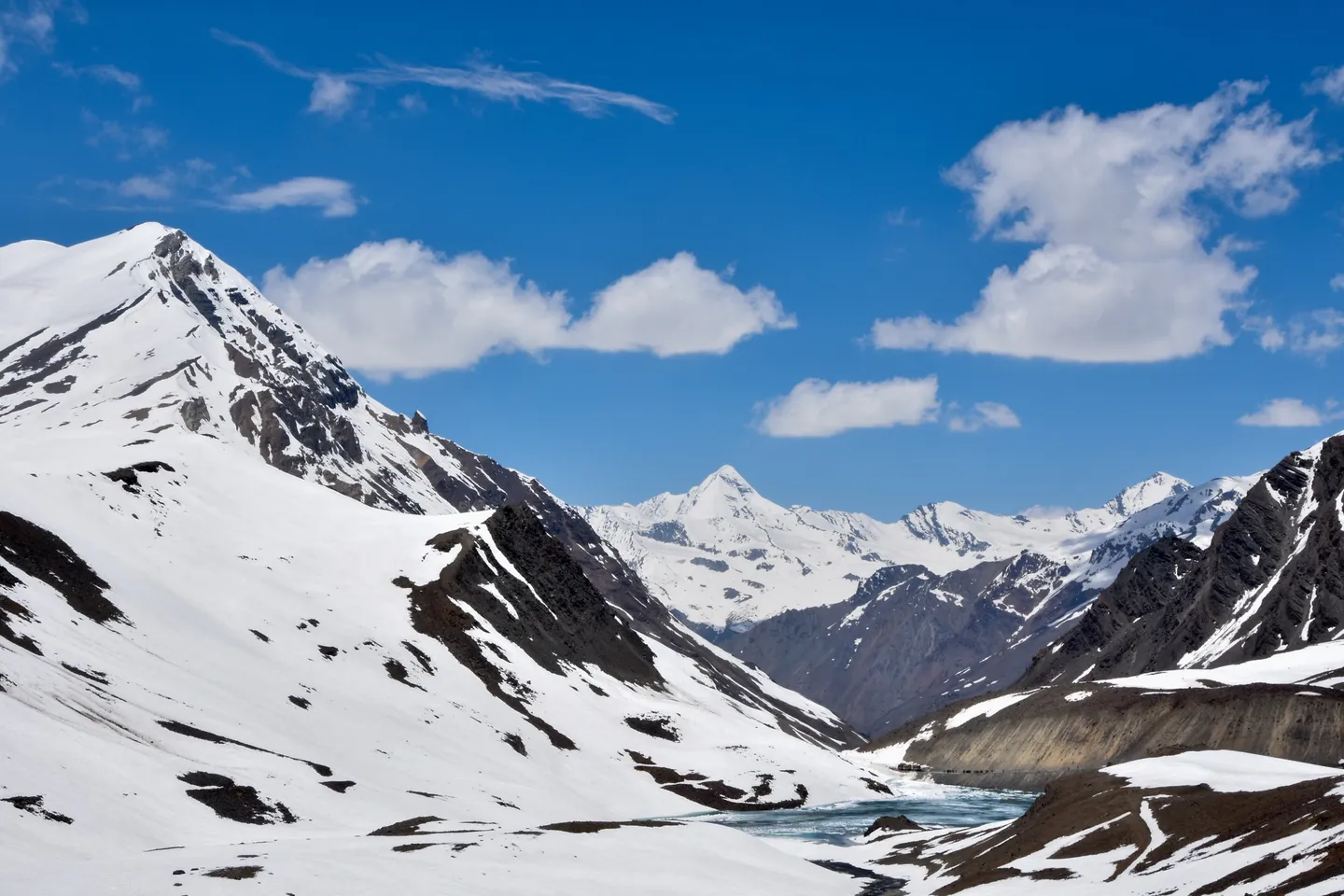
Yunam Peak
Hosted by The Crazy Mountaineers
A 6,111 m peak above Baralacha La whose base camp sits at 4,700 m on the Manali-Leh road - a genuine 6,000 m expedition wrapped in a two-day drive.
Route map
Real terrain from satellite imagery, 10 Sep 2026. Pick a day to fly it.
- Distance8.3 kmon the mapped trailoperators quote 15.5 km
- Days3 trekking7 with travel
Measured along the mapped trail, starting at Bharatpur. The distance you actually walk can differ with where your trek starts, the route your team takes and any side trips.
Skip the 3D map
Day by day
Day 3 starts at Bharatpur. Open start point in Google Maps (opens in a new tab)
| Day | From → To | Distance | Climb / descent | Highest | Map |
|---|---|---|---|---|---|
| Day 1 | Manali → Bharatpur by roadOvernight: Bharatpur tented camp, 4,700 m | — | — | — | |
| Day 2 | Acclimatisation at BharatpurOvernight: Bharatpur tented camp, 4,700 m | — | — | — | |
| Day 3 | Bharatpur → Summit CampOvernight: Summit Camp tents, 5,250 m | 1.7 kmoperators quote 4.5 km | +550 m 0 m | 5,250 m | |
| Day 4 | Acclimatisation at Summit CampOvernight: Summit Camp tents, 5,250 m | — | — | — | |
| Day 5 | Summit Camp → Yunam Peak → Summit CampOvernight: Summit Camp tents, 5,250 m | 4.9 kmoperators quote 6.5 km | +861 m −861 m | 6,111 m | |
| Day 6 | Summit Camp → BharatpurOvernight: Manali hotel (after the drive) | 1.7 kmoperators quote 4.5 km | 0 m −550 m | 5,250 m | |
| Day 7 | Reserve dayOvernight: Manali | — | — | — |
Peaks you can see from Yunam Peak
- Mulkila — 6,517 m, 30 km from Yunam Peak
- CB 13 — 6,264 m, 54 km from Yunam Peak
Imagery: contains modified Copernicus Sentinel-2 data 2026, processed by MadClub · Terrain: AWS Terrain Tiles (SRTM) · Trails, rivers: © OpenStreetMap contributors (ODbL) · Trail line may be approximate; not for navigation.
Route and day plan compiled from published trek guides and verified by MadClub. Satellite image date: 10 Sep 2026.
Trip details
Yunam stands north of Baralacha La in upper Lahaul, and almost everything that makes it attractive also makes it dangerous. The mountain itself is a long walk-up: moraine, scree and snow slopes leading to a broad summit, with the steepest ground concentrated in the last few hundred metres. There is no serious rock, and in most conditions no glacier travel of the kind that defines a technical peak. What there is, unavoidably, is altitude. Base camp at Bharatpur sits at roughly 4,700 metres - not a village but a seasonal huddle of three or four dhaba tents beside the highway - and it is reached by road from Manali in two days, sometimes one. Summit day starts between one and four in the morning and runs twelve to fifteen hours. That combination is why a peak with no technical grade to speak of is still a serious undertaking: you arrive at a sleeping altitude most people reach on day nine of a Himalayan trek, having driven there. The road is the mountain's other defining feature. The Manali-Leh highway only opens when the Border Roads Organisation finishes clearing Baralacha La, usually in the second week of May, and the climbing season is a narrow window inside that. Sold as an accessible first 6,000er, Yunam is better understood as an altitude expedition with an easy summit ridge attached.
- The Manali-Leh highway itself — Rohtang, the Chandra valley and Zing Zing Bar — which is the approach and a considerable part of the experience.
- Suraj Tal at 4,883 m, one of the highest lakes in India and the source of the Bhaga, sitting just below the pass.
- Baralacha La at 4,890 m — the divide between the Bhaga and Yunam rivers, and the origin of the Chandra and Bhaga headwaters of the Chenab.
- Bharatpur base camp at 4,700 m, a tented halt on the highway with the peak directly above it.
- High camp at 5,200-5,300 m on moraine, above every trace of vegetation.
- A summit walk-up on moraine, scree and snow with a steeper final hundred metres to 6,111 m.
- The Zanskar and Great Himalayan ranges from the summit, and the Lahaul-Spiti high desert laid out brown and empty in every direction — a completely different Himalaya from the forested Garhwal valleys.
Choose the itinerary shape, not the price. The single best protection is extra nights on the way up: Keylong at 3,100 m and Zing Zing Bar at 4,200 m as separate nights before Bharatpur, which is what Himalaya Trekker's nine-day version does. Failing that, insist on a full acclimatisation day at Bharatpur with a hike to about 5,000-5,200 m and a return to sleep at 4,700 m. Independent guidance is explicit that acclimatising at Keylong or Jispa beforehand is strongly recommended precisely because you reach 4,700 m by vehicle. Drink 3-4 litres a day from Manali onward, eat regardless of appetite, no alcohol from day 2, and log pulse-oximeter readings every evening. Require in writing that the group carries supplementary oxygen at each camp (several operators do), a pulse oximeter, dexamethasone and nifedipine under the leader's control, and a standby vehicle at Bharatpur - Kahlur Adventures lists exactly that, and on this mountain it is the difference between an evacuation and an ambulance. The rule stands: worse in the morning than the night before means down, and here down is genuinely easy.
- Sources genuinely disagree about how technical this mountain is, and the honest position is that it depends on the year and the month - which is itself an argument for arriving competent rather than hopeful. What you should be able to do: walk confidently in crampons on hard snow and 35-45 degree slopes for hours; hold an ice axe correctly and perform a reliable self-arrest; move as part of a roped team if the party ropes up; and clip and manage an ascender or descender on fixed line, which some operators use on the steeper section below the summit. Kahlur Adventures supplies fixed rope, snow stakes, carabiners and ice pitons, which tells you what its guides expect to encounter. Peak Rovers describes crevasse crossings, steep icy slopes and a chimney section and lists crampons, ice axes, ropes, harnesses and helmets as necessary. MountRoutes states the opposite - no ropes, no glacier travel, no crevasse hazard - and specifies category C/D expedition boots, microspikes, gaiters and possibly crampons. A first-person September 2024 account reports an ice-wall patch and a final 70-metre stretch with no fixed ropes and no crevasses encountered. Reconciled: in a normal late-season year Yunam is a crampon-and-axe snow ascent with a steeper final section; in a heavy-snow year or early season it involves more. Go able to self-arrest and to move on a rope, and treat any operator who says none of it is needed as one who has only ever seen the mountain in its easiest condition.
- This is not a first high-altitude objective, whatever the 'accessible 6,000er' framing suggests. The most demanding independent source, Himalaya Trekker, requires a minimum of three previous high-altitude treks above 4,500 m plus at least one difficult-grade trek above 5,000 m, excellent physical condition and no prior history of altitude problems, rates the physical demand 8.5 out of 10, and states explicitly that the expedition is not suitable for beginners. MountRoutes requires at least two prior treks above 4,570 m. Kahlur Adventures states that previous mountaineering knowledge is required and that the peak is not suitable for amateur mountaineers. Against that, several operators require nothing at all. Train for 10-12 weeks minimum: build to 10 km of running or fast walking four to five times a week, two weekly sessions of loaded stair or hill repeats with 12-15 kg, and dedicated leg-strength and core work - a 12-15 hour summit day above 5,300 m is an endurance event, not a hike. Prior nights above 4,500 m are the prerequisite that actually predicts whether you will function at Bharatpur.
- Peak climbing permit - authority genuinely unclear, verify with your operator — Stated by operators as the Indian Mountaineering Foundation (IMF); not confirmable from IMF's own peak register — Read this carefully before booking, because it is the least settled fact about this mountain. Essentially every operator states that an IMF permit, registration or peak booking is required, and several quote a fee - Kahlur Adventures includes a peak booking fee described as US$250. But Yunam does not appear under that name in any of the four peak categories published on IMF's own database - open peaks, virgin peaks, trekking peaks or other peaks - all of which I searched directly. IMF does hold an expedition record for Yunam (a 2005 ascent by a West Bengal team, base camp near Bharatpur at 4,800 m), so the peak is known to them. The Himachal Pradesh state peak register lists Yunam at 6,111 m at Baralacha La / Bharatpur with 10 to 20 expeditions a year, which points at a state-administered route. IMF's published fee schedule for a peak below 6,500 m is US$500 for a party of two plus US$200 per additional member for members 3-7, with applications asked for 90 days ahead; foreign expeditions to IMF-administered peaks additionally require an Indian liaison officer, with a US$500 liaison-officer equipment charge. Do not take 'IMF permit included' on trust: ask the operator to name the issuing authority, show the permit, and confirm whether foreign nationals in your group need a liaison officer.; e-Aagman registration for entering Lahaul-Spiti district — Government of Himachal Pradesh, at eaagman.hp.gov.in — Free but mandatory. Every private vehicle entering Lahaul-Spiti district - whether through the Atal Tunnel, over Rohtang, or from Kinnaur - must be registered. Bharatpur is in Lahaul, so this applies to every Yunam expedition. No Rohtang Pass vehicle permit is needed if you use the Atal Tunnel, which is free and open around the clock; a Rohtang permit is only needed if you actually cross the pass. Note that the Border Roads Organisation bans two-wheelers in the Atal Tunnel.; Police check post registration at Darcha — Himachal Pradesh Police — Everyone heading up the highway has their passport or Aadhaar details recorded at Darcha. Carry originals. This is a registration, not a permit - nobody is turned back - but it is also the only official record that you went up, which matters if a search is ever needed.; No Inner Line or Protected Area Permit on this route — n/a — Worth stating because Lahaul is routinely confused with Spiti and Ladakh. Indian citizens need no inner-line or protected-area permit anywhere in Himachal Pradesh, Lahaul included. Foreign nationals need a Protected Area Permit only for the restricted zones of Kinnaur beyond Jangi and of Spiti - not for the Manali-Leh highway through Lahaul, and not for Bharatpur, which lies inside Himachal Pradesh short of the Ladakh boundary at Sarchu. Foreign climbers should still confirm whether the peak permit route imposes its own liaison-officer requirement, which is a separate question.; Registered operator and certified guide (Himachal adventure activity rules) — Himachal Pradesh Department of Tourism and Civil Aviation — Adventure operators in Himachal must be registered with the state tourism department, guides and instructors must hold valid certification, and operators must hold a route-specific emergency action plan and a first-aid kit including an oxygen cylinder and pulse oximeter. Ask for the registration number and the guide's certification. Note that the state's course-fee structure charges 25 per cent extra for activities in Lahaul-Spiti, which is a fair indication of how the state itself rates the logistics and risk of operating there.
- Three separate things, only two of which are settled. Settled: entry to Lahaul-Spiti district requires free e-Aagman registration from the Government of Himachal Pradesh, and Himachal Pradesh Police record ID at the Darcha check post. Unsettled: the peak permit itself. Operators uniformly say the Indian Mountaineering Foundation, and IMF holds expedition records for Yunam, but Yunam does not appear by name in any of IMF's four published peak lists, while the Himachal Pradesh state peak register carries it explicitly at Baralacha La / Bharatpur with 10-20 expeditions a year. Both a state route and an IMF route are plausible. Do not publish a definite answer - require the operator to name the issuing authority and produce the permit.
- Four situations, and the first two are the ones that actually happen. First, arriving at Bharatpur on a compressed itinerary and going up anyway with a headache - a 1,500 m road gain to a 4,700 m sleeping altitude followed by a push above 5,300 m is how AMS becomes HAPE or HACE. Second, blowing through the turnaround time on a broad, featureless mountain: the documented September 2024 near-miss involved a climber continuing alone after his team descended, losing the route, and surviving roughly 24 hours at 5,500 m at -10 C. The same expedition summited at 1 pm - hours later than any sensible turnaround - and got away with it. Third, going before the season has properly opened. The road may be through Baralacha La from mid-May, but deep unconsolidated snow, unstable weather and the absence of the Bharatpur camps make May and early June a different trip. Fourth, being caught by weather on the summit slope with no shelter and no landmarks between you and a camp at 5,300 m.
- A certified guide is effectively mandatory and, unlike some objectives, the reason is navigational as much as technical. The upper mountain is broad and featureless with no trail markers, and the documented near-fatal incident here was a route-finding failure on descent, not a fall. Himachal's adventure-activity rules require operators to be state-registered and guides certified. Ask for the guide's mountaineering qualification (ABVIMAS or NIM basic and advance), the client-to-guide ratio on summit day, whether a high-altitude support climber is carried, and - most important on this mountain - who has the authority to turn the party around and whether that authority extends to individual clients who want to continue. The September 2024 incident happened precisely because one client kept going after his team went down.
Nearest railhead: There is no useful railhead. Joginder Nagar (JDNX) at roughly 160 km from Manali is narrow-gauge with minimal connectivity; the practical broad-gauge railheads are Chandigarh (CDG) at about 310 km and Ambala Cantt (UMB) at about 350 km from Manali, and Bharatpur is a further 190-200 km beyond Manali.. Nearest airport: Bhuntar / Kullu-Manali Airport (KUU), about 50-52 km south of Manali and roughly 240-250 km from the base camp. Small, weather-prone and frequently cancelled; Chandigarh or Delhi plus a road transfer is the reliable option. There is no airstrip anywhere near Baralacha La..
- 4 quick-dry full-sleeve base tops - Lahaul is high desert, the UV at 5,000-6,000 m is extreme and there is no shade anywhere on this mountain
- 2 fleece or synthetic mid-layers, one light and one heavy
- 1 expedition-weight down jacket, 700-fill or better, rated for -20 C or colder - this is a 6,000 m summit in the dark, not a trek
- 1 waterproof breathable hardshell jacket with a helmet-compatible hood
- 1 pair of insulated or softshell summit trousers plus a hardshell overtrouser
- 3 thermal base-layer sets, one kept strictly dry for sleeping
- Insulated beanie plus a balaclava - Baralacha La is notoriously windy and the summit ridge has no shelter
- Three pairs of handwear: thin liners, insulated gloves and expedition mitts. Carry a spare. Frostnip on the summit push is the ordinary cold injury here
- 6-8 pairs of wool or synthetic socks plus one thick dedicated sleeping pair
- Category 4 glacier sunglasses with side shields, plus a spare pair, and ski goggles for wind on the summit slope
- Category C or D expedition mountaineering boots that take a crampon properly. Trekking boots are not adequate for a 6,111 m summit push - MountRoutes specifies category C/D explicitly. If renting, fit them on day 1 with the crampons you will use
- Trekking boots or approach shoes for the base camp days
- Gaiters - essential on scree and snow both
- Down booties or thick camp footwear for the high camp
- Crampons, ice axe, harness and helmet - usually operator-supplied, but confirm in writing. Even sources that describe the route as non-technical list crampons and microspikes as required kit
- Group technical gear: rope, snow stakes, ice screws or pitons, carabiners and slings. Kahlur Adventures lists fixed rope, snow stakes, carabiners and ice pitons as supplied; confirm that yours does
- Sleeping bag with a genuine comfort rating of -20 C or better for the 5,300 m camp, plus a mat with an R-value of 5 or higher
- Trekking poles for the moraine approach
- Headlamp plus two full spare battery sets - summit day starts between 1 and 4 am and cold destroys battery capacity
- 3 litres of insulated bottle capacity, not a bladder. Bladder hoses freeze solid on a 1 am start
- Water purification - all water here is glacial melt or stream water
- SPF 50 sunscreen and SPF lip balm reapplied constantly; the combination of altitude, snow reflection and Lahaul's thin dry air is the worst sunburn environment in the region
- High-calorie food you will still eat at 5,300 m, where appetite disappears
- Powerbank and a spare - there is no charging beyond Jispa, and no signal beyond Darcha
- Original government photo ID plus photocopies. The police check post at Darcha records passport or Aadhaar details for everyone heading up the highway
- Passport and valid Indian visa for foreign nationals, plus passport photographs for peak-permit paperwork
- e-Aagman registration for the vehicle entering Lahaul-Spiti district - free, mandatory, and the operator's job, but confirm it exists
- Medical fitness certificate from a registered doctor
- Mountaineering insurance explicitly covering climbing above 6,000 m and helicopter evacuation. Ordinary travel insurance excludes this; read the exclusions
- The peak permit paperwork - ask the operator which authority issued it and to see it (see the permit flag below; this is genuinely murky and worth checking)
- Your operator's Himachal Pradesh tourism department registration number and your guide's mountaineering certification
- Acetazolamide (Diamox) is very commonly used on this profile, given a base camp at 4,700 m reached by road - but the dose and the decision belong to a doctor who knows your history, and you should never take it for the first time on the mountain
- Dexamethasone and nifedipine for severe AMS, HACE and HAPE belong in the leader's controlled kit, administered by someone trained. At 6,111 m with a base camp at 4,700 m these are realistic drugs, not theoretical ones
- A personal pulse oximeter in addition to the group's. On this profile the trend across three evenings at Bharatpur is the single most useful piece of information you will have
- Paracetamol or ibuprofen, oral rehydration salts, antiemetics - vomiting is a common AMS presentation here and dehydrates you fast at altitude
- Blister and foot-care kit; rented expedition boots on unfamiliar feet
- Antiseptic, dressings, crepe bandage for moraine cuts and turned ankles
- Personal prescription medication in original packaging with at least three days spare - a road closure on the Manali-Leh highway is a normal event
- Motion-sickness tablets. The two road days are long, high and relentlessly winding, and being carsick at 4,000 m starts you dehydrated
What's included
- Accommodation in Manali on twin/triple sharing basis
- Accommodation and camping during the expedition
- All meals during the trekking/expedition period
- Breakfast
- Lunch
- Dinner
- Hot tea/coffee at camps
- Manali to Bharatpur transportation
- Bharatpur to Manali transportation
- All required local transportation as mentioned in the itinerary
- Experienced Expedition Leader / Mountaineering Guide
- High-altitude support staff
- Technical climbing support
- Cook and support staff
- Camping equipment: high-altitude tents
- Dining tent
- Kitchen tent
- Toilet tent
- Sleeping mats
- Common technical expedition equipment
- Ropes and essential climbing equipment
- Ice axe and crampon support, wherever required
- Load ferry support
- Trekking/expedition permits and local forest charges
- Camping and campsite charges
- Porter/mule support for common expedition equipment
- First-aid and basic medical kit
- Emergency communication support
- Expedition briefing and technical orientation
- 1 reserve day for weather/route delays
Safety details & FAQ
Is Yunam Peak good for a first 6000m climb?
It is one of the more accessible 6,000-metre summits in India, and that is not the same as easy. The mountain is technically modest — moraine, scree and snow with the steepest ground near the top — but the base camp sits at 4,700 m and you get there by road in two days from Manali. That is a serious altitude to arrive at without walking. The most demanding independent operator requires three prior treks above 4,500 m plus one difficult trek above 5,000 m and states plainly that it is not suitable for beginners.
Is Yunam Peak the same as CB-13?
No, and this is a common and consequential mix-up. Yunam is 6,111 m, north of Baralacha La, with its base camp at Bharatpur on the Manali–Leh highway. CB-13 (Chandra Bhaga 13) is 6,264 m, in a different valley about 50 km away, approached from Batal via the Dhaka glacier — both the Indian Mountaineering Foundation's open-peaks register and the Himachal Pradesh state peak register list them as separate mountains with separate road heads. If a listing calls Yunam 'CB-13', it has copied an error.
When does the road to Yunam Peak open?
The Manali–Leh highway opens when the Border Roads Organisation finishes clearing snow over Baralacha La — in 2026 the two BRO teams met at Sarchu on 12 May, and the Darcha–Sarchu stretch through the pass opened to light vehicles by 14 May. But the road being open is not the same as the mountain being in condition. The climbing window most sources converge on is July to September, with mid-July to August the most stable. Unusually, that means the monsoon months are the best ones here — Lahaul sits in the rain shadow behind the Pir Panjal.
What permits do I need for Yunam Peak?
Two things are certain and one is not. Certain: free e-Aagman registration for any vehicle entering Lahaul–Spiti district, and ID recorded at the Darcha police check post. Unclear: the peak permit itself. Every operator says an IMF permit is required and some quote around US$250, but Yunam does not appear by name in any of the IMF's four published peak lists, while the Himachal Pradesh state peak register does carry it. Ask your operator to name the issuing authority and show you the permit — don't take 'IMF permit included' on trust.
How bad is altitude sickness on Yunam Peak?
This is the main risk on the mountain, above anything technical. You gain about 1,150 m of sleeping altitude by road on day 2 and about 1,500 m more on day 3, arriving at 4,700 m — three to five times the usual guidance of 300–500 m per night, and you drive all of it, so nothing about the effort warns you. On a documented September 2024 expedition, three of nine members had AMS with headaches and vomiting at base camp before the climb started. Look for an itinerary with extra nights at Keylong and Zing Zing Bar rather than the cheapest one.
How long is Yunam Peak summit day?
Twelve to fifteen hours, starting somewhere between 1 am and 4:30 am from a camp at 5,200–5,300 m, with roughly 800–900 m of gain. A September 2024 party left base camp at 4:30 am and did not summit until just after 1 pm, back at 5 pm — a summit hours later than any sensible turnaround would allow. Agree a turnaround time before you leave camp and treat it as binding. On that same trip, a climber who continued alone after his team descended lost the route and spent about 24 hours out at 5,500 m at −10 °C.
Do I need ropes and crampons on Yunam Peak?
Sources genuinely disagree, which is itself the answer: go equipped and competent. MountRoutes says no ropes, no glacier travel and no crevasse hazard; Peak Rovers describes crevasse crossings, steep icy slopes and a chimney and lists ropes, harnesses and helmets; Kahlur Adventures supplies fixed rope, snow stakes and ice pitons. A first-person 2024 report found an ice-wall patch and a steep final 70 metres. You should be able to walk in crampons on 35–45° hard snow for hours, self-arrest reliably, and move on a fixed line. Category C/D expedition boots, not trekking boots.
What is the highest point on the Yunam Peak trek?
Yunam Peak, at 6,111 m, reached on Day 5.
Which peaks can you see on the Yunam Peak trek?
On a clear day from Yunam Peak: Mulkila, 6,517 m, about 30 km away; CB 13, 6,264 m, about 54 km away. Views depend on weather; mornings are clearest.