 1 / 4
- Photo: Ashish Gupta · CC BY 2.0
- Photo: Ashish Gupta · CC BY 2.0
- Photo: Ashish Gupta · CC BY 2.0
- Photo: Ashish Gupta · CC BY 2.0
Nag Tibba Trek
Hosted by Bharat Outdoors
A three-day, two-night trek from Mussoorie and back to Nag Tibba (3,022 m) in Tehri Garhwal, Uttarakhand: a drive of about 57 km to Pantwari and on up a forest road, a walk of about 2 km to a tented camp in the oaks, a day to the top and back (about 10 km), and a walk of about 4 km down to Pantwari before the drive home. About 16 km on foot. Pages call it easy to moderate and a good first trek; from December to February there is snow on the ridge and the nights are cold, so read the season notes first.
Route map
Real terrain from satellite imagery, 30 Oct 2024. Pick a day to fly it.
- Distance15.3 kmon the mapped trailoperators quote 16 km
- Days3 trekking
Measured along the mapped trail, starting at Road Head. The distance you actually walk can differ with where your trek starts, the route your team takes and any side trips.
Skip the 3D map
Day by day
Day 1 starts at Road Head. Open start point in Google Maps (opens in a new tab)
| Day | From → To | Distance | Climb / descent | Highest | Map |
|---|---|---|---|---|---|
| Day 1 | Mussoorie → Road Head → Base CampOvernight: Tents at Nag Tibba Base Camp, about 2,050 m | 2.0 kmoperators quote 2 km | +300 m 0 m | 2,050 m | |
| Day 2 | Base Camp → Summit → Base CampOvernight: Tents at Nag Tibba Base Camp, about 2,050 m | 10.0 kmoperators quote 10 km | +972 m −972 m | 3,022 m | |
| Day 3 | Base Camp → Pantwari → MussoorieOvernight: Your own stay in Mussoorie | 3.3 kmoperators quote 4 km | 0 m −635 m | 2,050 m |
Peaks you can see from Nag Tibba Summit
- Nanda Devi — 7,816 m, 176 km from Nag Tibba Summit
- Chaukhamba I — 7,138 m, 110 km from Nag Tibba Summit
- Kedarnath — 6,940 m, 91 km from Nag Tibba Summit
- Bandarpunch I — 6,316 m, 60 km from Nag Tibba Summit
- Swargarohini I — 6,252 m, 67 km from Nag Tibba Summit
- Srikantha — 6,133 m, 75 km from Nag Tibba Summit
Imagery: contains modified Copernicus Sentinel-2 data 2024, processed by MadClub · Terrain: AWS Terrain Tiles (SRTM) · Trails, rivers: © OpenStreetMap contributors (ODbL) · Trail line may be approximate; not for navigation.
Route and day plan compiled from published trek guides and verified by MadClub. Satellite image date: 30 Oct 2024.
Trip details
Nag Tibba is a ridge walk, not a technical climb, and on this plan it takes three days from Mussoorie and back. You leave Mussoorie early and drive about 57 km (1.5 to 2.5 hours) to Pantwari, the village trek pages measure the walk from. The vehicle goes on from there up a forest road to the last road point, about 7 to 10 km and an hour (one plan says 10 km; OpenStreetMap's forest road meets the trail about 8 km on), and you walk about 2 km to the base camp at about 2,050 m, where tents go up in the forest. On day two you go out to the top (3,022 m) and back, about 10 km in 4 to 6 hours, and sleep at the base camp again. On day three you walk about 4 km down to Pantwari in 2 to 3 hours and drive back to Mussoorie. That is about 16 km on foot. Many pages describe a two-day trek from Dehradun instead, walking from Pantwari or from the Goat Village. Pantwari (some pages write Panthwari) is a village in Uttarakhand, in the Nainbag subdivision of the Tehri Garhwal district. Wikipedia puts the mountain in the Jaunpur range of Tehri Garhwal, 57 km from Mussoorie, and the district's own website lists the trek among its tourist treks. The name means the place of the Snake God. Local villagers come to pray to Nag Devta for the safety of their cattle, and a small temple stands in the clearing called Nag Mandir, about 2,635 m up the trail, below the top. Wikipedia and the district website also put a temple on the top itself; a 2014 Commons photograph says the very top is marked by a small white flag at the site of a temple the locals want to build. We repeat the disagreement and promise neither. Pages disagree about where the camp is. We use the camp site OpenStreetMap maps, about 2,050 m (about 6,750 ft), 3.3 km up the mapped trail from Pantwari (pages give 4 to 5.5 km on foot); the pages that call it Kathian, Khatian or the Goat Village camp put it at about 1,950 m, and the pages that describe a higher camp give 2,300 to 2,325 m. One page prints 2,900 m. Ask your operator which camp you will sleep at. From December to February this is a snow trek, and how much snow is a matter of the week. Pages that sell the trek say you meet a lot of snow in winter, that nights can dip to -7 degrees, and that between January and March you may find patches or walk knee-deep. A January first-hand party met heavy snowfall and dropped the summit attempt; a photographer on 31 December 2014, a week or two after a snowfall, found little or no snow on the trail from the temple to the top but snow under the tree shade everywhere beyond the temple. Slips are the recorded hazard, on the way up in mud and snow and on the way down from the temple clearing. We found no first-hand report from February itself. Read the published numbers with care. Pages put the top at 3,022 m, with the district website at 3,048 m and a few operators at 3,000 or 3,004 m; they put the total walking at 14.5 to 19 km, the drive from Mussoorie at 50 to 65 km, and the road beyond Pantwari at 7 to 10 km. We publish the figures this plan's days add up to and say where each spread lies.
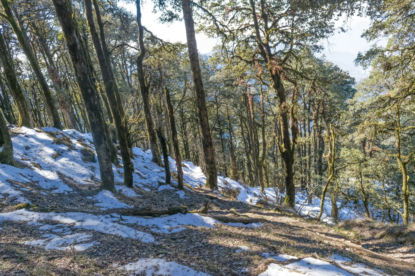
- Oak and rhododendron forest on the way up. The rhododendron flowers are red and pink and do not bloom in winter, so in the snow months you walk through the trees over dry leaves and patches of snow.
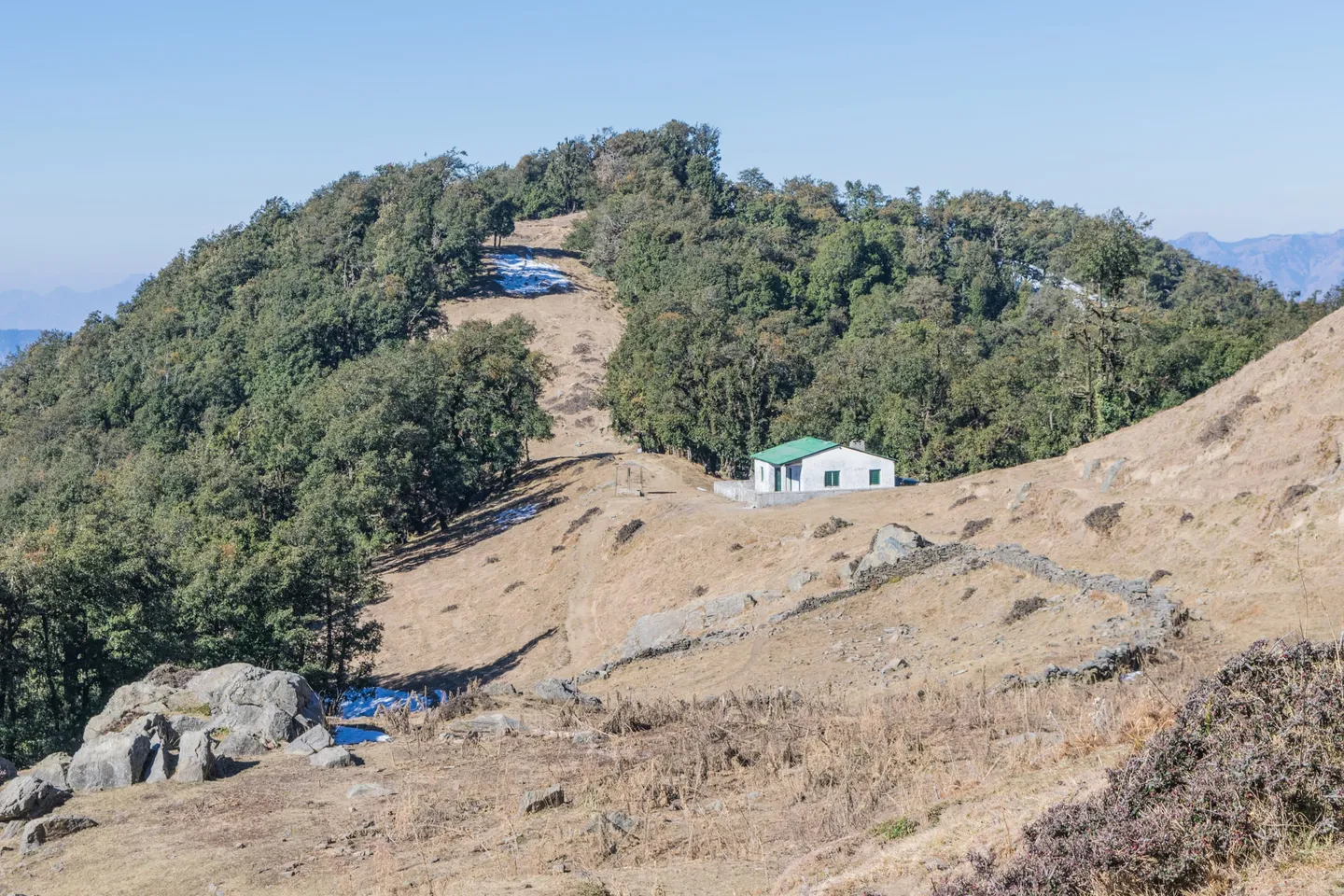
- The base camp at about 2,050 m (about 6,750 ft): a clearing in the forest where tents go up for the night, with the lights of the valley below.
- The Nag Mandir clearing at about 2,635 m, with a small temple to the serpent god. One of the photographs on this page shows the clearing just before the temple.
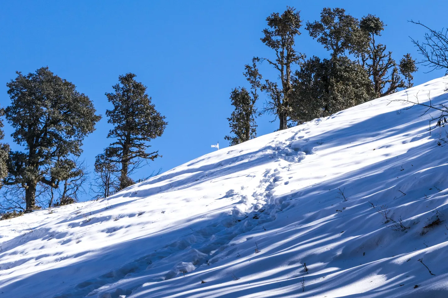
- The top of Nag Tibba at 3,022 m (about 9,915 ft), reached on day two. One of the photographs on this page shows a snow slope below the top, with the small white flag at the crest.
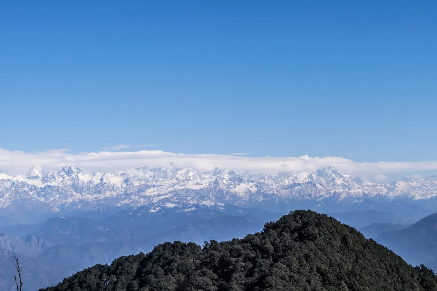
- From the top, pages name Bandarpunch (also written Bandarpoonch), Swargarohini, Srikantha (Srikanth), the Gangotri group and Kedarnath. The map's line-of-sight check agrees that all of them are in view from the top on a clear day.
- Several pages also name Black Peak (Kalanag), but the map's line-of-sight check puts it just behind Bandarpunch I from the top, so do not count on it.
- Snow cover varies by the week: the photographs on this page were all taken on one day, 31 December 2014, a week or two after a snowfall, and show patches in the forest and a snow slope near the top, so expect more or less in January and February.
Prepare for cold and a steady climb rather than for height. The walking days are short, about 2 km, 10 km and 4 km, but you gain about 1,607 m from Pantwari to the top, and day two is a long day for a short trek: about 10 km in 4 to 6 hours, with steep stretches in the forest and loose stones on the stone-laid trail. A travel magazine's rule of thumb is to be able to jog five kilometres in 40 minutes, or ten in 90, without difficulty; read it as a rough guide, not a pass mark. Walk with a loaded daypack on stairs or hills for a few weeks before you come. Practise in the cold. Test your layers, gloves and sleeping system on a cold night before you come: one operator quotes nights as low as -7 degrees in winter, and pages that sell the trek say the camp is cold after sunset. If you have never slept in tents at about 2,050 m, tell your guide at the first sign of a headache or poor sleep. Ask your operator, in writing, four things: what the snow was doing on the last departure, which forest permits are included and who obtains them, which camp you will sleep at and where the vehicle stops on day one, and what the evacuation arrangements are. Tell someone who is not on the trek where you are going and when you expect to be back.
- December to February is winter on every page we read. Pages that sell the trek say you meet a lot of snow, that nights can dip to -7 degrees, and that between January and March you may find patches or walk knee-deep. We found no first-hand report from February itself, and no month is guaranteed.
- The last stretch to the top is steep and shaded. One page says the last kilometre is very steep and runs through forest so shaded that the snow does not melt. A January first-hand party dropped the summit attempt in heavy snow.
- Take microspikes if there is plenty of snow. One page that sells the trek says to carry microspikes, gaiters and poles and that you can rent them in Pantwari village or Dehradun. Ask what your operator supplies.
- The vehicle goes on beyond Pantwari: one operator plan describes a 10 km off-road drive of about an hour to the Goat Village trailhead and a walk of 2.5 km, and OpenStreetMap maps a forest road from Pantwari that meets the trail about 8 km on, at about 1,750 m, about 2 km below the camp site. Pages that start the walk in Pantwari itself give 4 to 5.5 km. Ask your operator where the vehicle stops.
- Carry at least two litres of water. Pages name three water sources between Pantwari and the top, one after the Goat Village, a well and a second source at Nag Mandir (the well is sometimes not clean), and one beyond; a Commons caption says there is no water beyond the temple clearing.
- A guide is advisable. Pages say a guide who knows the trail well helps when there is snow, that there are three routes up the mountain, and that darkness raises the risk of losing the path. We found no official rule text either way.
- We could not read an official fee list or permit rule for the trail. Operators say forest entry fees and permits are included in their price, and the district website lists none. Ask your operator which permits are included and who obtains them.
- Mobile coverage is uncertain: one operator says most of the trail has good coverage; another says it is available on the first parts and becomes weak or erratic near the top. Do not rely on a phone.
- Medical help is a drive away. Landour Community Hospital in Mussoorie and Government Doon Medical College and Hospital in Dehradun are the named options; OpenStreetMap maps a sub-centre in Pantwari, and we could not confirm its hours or services.
- Dark comes early in winter, and the trail has no lighting. Bring a headtorch with spare batteries and be back at camp before dark.
- Check that your travel insurance covers evacuation and treatment at about 3,000 m.
The plan starts and ends in Mussoorie. Dehradun is the closest railway station to Mussoorie and Jolly Grant (Dehradun Airport) the nearest airport, about 20 km south-east of Dehradun; Mussoorie is about 26 to 29 km from Dehradun by road. From Mussoorie the drive to Pantwari is about 57 km in 1.5 to 2.5 hours (a routing service 57 km and 78 minutes free-flowing; pages 50 to 65 km). Dehradun to Pantwari is about 85 km (pages 85 to 104 km, 2 to 5 hours). From Pantwari the vehicle goes on up a forest road to the last road point on day one, about 7 to 10 km and an hour; on day three you walk down to Pantwari and drive back to Mussoorie. Leave a margin before any onward train or flight.
- Waterproof, ankle-supporting boots with a good grip, broken in before you come, plus warm socks and a spare pair.
- Microspikes if there is snow; gaiters and trekking poles are recommended with them. Ask what your operator supplies; they can be rented in Pantwari village or Dehradun.
- Several warm layers, an insulated jacket, a waterproof shell, warm gloves and a warm hat. Nights can dip to about -7 degrees in winter.
- A sleeping bag liner and a warm sleeping bag, unless your operator tells you in writing that one is provided.
- A headtorch with spare batteries.
- Sunglasses and sunscreen for the snow glare.
- A water bottle or flask that will not freeze solid (carry at least two litres from the start), and snacks.
- A personal first-aid kit, your own medicines, and a note of anything you are allergic to.
- Photo ID: your government ID is needed for the booking.
- A bag for your rubbish.
What's included
- Shared tents for 2 nights at the base camp
- Simple vegetarian meals on the trek
- Tempo Traveller transport from Mussoorie to the road head and back to Mussoorie
- Trek leader
- Permits
Safety details & FAQ
Where is the Nag Tibba trek, and where does it start?
It is in Tehri Garhwal district, Uttarakhand. The walk is measured from Pantwari (some pages write Panthwari), a village of Tehri Garhwal's Nainbag subdivision, about 57 km by road from Mussoorie. On this plan the vehicle goes on from Pantwari up a forest road and you walk the last stretch to a tented base camp in the forest.
What does the 3-day plan look like?
Mussoorie to Mussoorie, with the camp at the base camp. Day 1: drive Mussoorie to Pantwari, about 57 km in 1.5 to 2.5 hours, then on up the forest road (about 7 to 10 km, about an hour), then walk about 2 km in 2 to 3 hours to the base camp at about 2,050 m, and camp. Day 2: walk out to the top (3,022 m) and back, about 10 km in 4 to 6 hours, and camp at the base camp again. Day 3: walk about 4 km down to Pantwari in 2 to 3 hours and drive back to Mussoorie, about 57 km in 1.5 to 2.5 hours. The walking adds up to about 16 km; pages print totals from 14.5 to 19 km. Distances and hours are approximate.
Where does the vehicle stop, and how far do you walk on day one?
Pages disagree, so ask your operator. One operator plan describes a 10 km off-road drive of about an hour from Pantwari to the Goat Village trailhead and then 2.5 km of walking; OpenStreetMap maps a forest road from Pantwari that meets the trail about 8 km on, at about 1,750 m, about 2 km below the camp site; a first-hand report puts the Goat Village 1 km from the base camp. We publish about 7 to 10 km of forest road and about 2 km on foot. Pages that start the walk in Pantwari itself give 4 to 5.5 km and 2 to 5 hours.
How hard is Nag Tibba, and what fitness do you need?
Easy to moderate. Two operators grade it easy, two easy-moderate and a travel magazine moderate; several call it a beginner and family trek. We grade it moderate for the snow months. The walking days are short and the trail is marked, but day two is about 10 km in 4 to 6 hours, the last kilometre to the top is steep, and in snow the cold and the slips matter more than the distance. A travel magazine suggests being able to jog five kilometres in 40 minutes, or ten in 90.
What is Nag Tibba like from December to February?
A snow trek, though how much snow varies by the week. Pages that sell the trek say you meet a lot of snow in winter, that nights can dip to -7 degrees, and that between January and March you may find patches or walk knee-deep. A January first-hand party met heavy snowfall and dropped the summit attempt, and the descent from the temple clearing was slippery from melting snow and wet mud; a photographer on 31 December 2014, a week or two after a snowfall, found little or no snow on the trail from the temple to the top but snow under the tree shade beyond the temple. Carry microspikes if there is plenty of snow. We found no first-hand report from February itself.
How cold does it get at the camp?
One operator says nights can dip to -7 degrees in winter; another says winter nights at Pantwari, about 1,400 m up, can fall to around freezing and that the camp is much colder. No source gives a measured temperature record for the camp, so treat these as rough guides. Layers, a warm sleeping bag and a flask that will not freeze matter more than the number.
Do you need a permit or a guide?
We could not read an official fee list or permit rule for the trail; the district website lists none. Operators say forest entry fees and permits are included in their price, so ask yours which permits are included and who obtains them. A guide is advisable: pages say a guide who knows the trail well helps when there is snow, that three routes lead up the mountain, and that darkness raises the risk of losing the path. We found no rule text either way.
How tall is Nag Tibba, and why do pages give different heights?
3,022 m (about 9,915 ft) is the height we use: OpenStreetMap, Wikipedia, Wikidata and PeakVisor (3,023 m) agree, and several operators print it. The Tehri Garhwal district website prints 3,048 m, which Wikipedia's text repeats; one operator prints 3,004 m and one 3,000 m. Two independent elevation models read 3,009 and 3,010 m at the mapped top. The camp heights spread more: about 2,050 m for the mapped camp site, about 1,950 m on one page and 2,300 to 2,325 m on others.
Which peaks can you see from Nag Tibba?
Pages name Bandarpunch (also written Bandarpoonch), Swargarohini, Srikantha (Srikanth), the Gangotri group and Kedarnath from the top, and a line-of-sight check from the summit agrees that all of them are in view on a clear day. The map draws ten named peaks that the check puts in clear view, the farthest being Nanda Devi at about 176 km. Several pages also name Black Peak (Kalanag), but the check finds it marginal, its sight line grazing Bandarpunch I, so we do not promise it. Wikipedia and the district website describe the whole Bandarpunch range as the view.
How do you get to Pantwari?
The plan starts in Mussoorie: about 57 km in 1.5 to 2.5 hours to Pantwari. Dehradun is the closest railway station and Jolly Grant (Dehradun Airport) the nearest airport; Mussoorie is about 26 to 29 km from Dehradun, and Dehradun to Pantwari is about 85 km (pages 85 to 104 km, 2 to 5 hours).
Where does the water come from?
Carry at least two litres from the start. Pages name three main water sources between Pantwari and the top: one just after the Goat Village, a well and a second source at Nag Mandir (the well is sometimes not clean), and one beyond; a cemented tank with a pipe sits on the trail on one page, with no stream beyond it. A 2014 Commons caption says there is no water beyond the temple clearing.
Is there phone signal, and where is the nearest hospital?
Coverage is uncertain: one operator says most of the trail has good coverage, another says it is available on the first parts and becomes weak or erratic near the top. For help, call 112. The named hospitals are Landour Community Hospital in Mussoorie and Government Doon Medical College and Hospital in Dehradun; the Tehri Garhwal district hospital is at Baurari, New Tehri. OpenStreetMap maps a sub-centre in Pantwari; we could not confirm its hours or services.
How long is the Nag Tibba trek?
About 15.3 km on the mapped trail over 3 trekking days. Operators quote about the same, 16 km. Measured along the mapped trail from Road Head; the distance you walk can differ with the start point and route.
What is the highest point on the Nag Tibba trek?
Nag Tibba Summit, at 3,022 m, reached on Day 2.