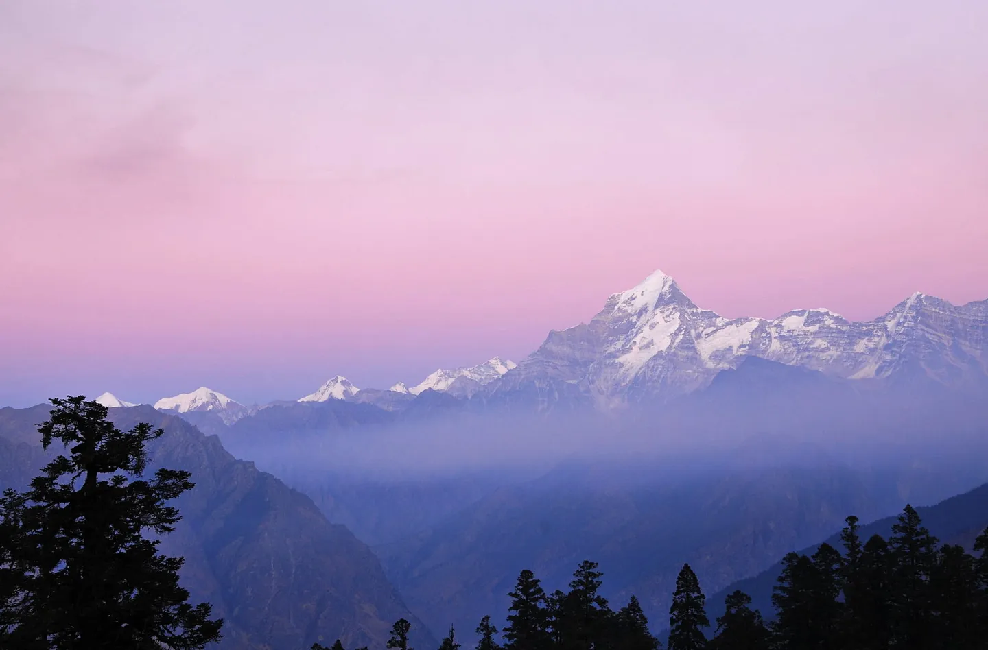
 1 / 3
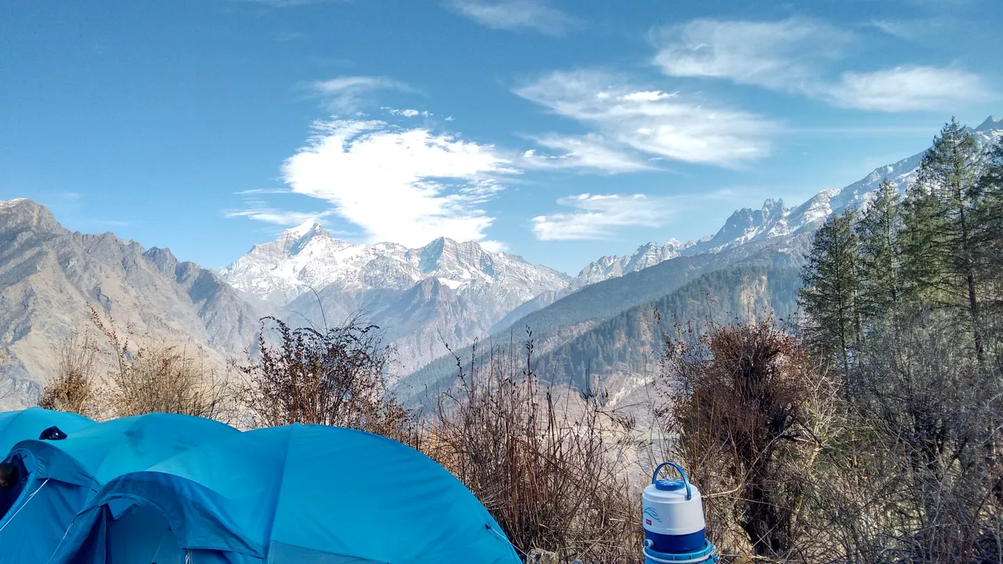
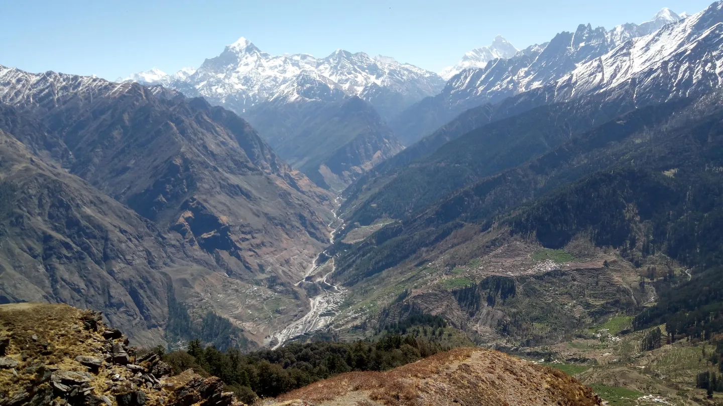
- Photo: Sumodm · CC BY-SA 4.0
- Photo: Hari4025 · CC BY-SA 4.0
- Photo: Hemanth200204 · CC BY-SA 4.0
Kuari Pass Trek
Hosted by Bharat Outdoors
A six-day winter trek from Rishikesh and back to Kuari Pass in Chamoli, Uttarakhand: a road day to Tugasi, a 3 km walk up through oak forest to a walnut-tree camp, a 4 km walk to the high camp at Khullara (3,350 m), a day out to the pass (3,800 m) and back, and a 7 km walk down to the road. About 23 km on foot, with a wide Garhwal skyline as the reward. In the cold months nights at the high camp are quoted at -5 to -15 °C, with snow and ice underfoot, so read the season notes first.
Trip details
Kuari Pass is a pass walk, not a summit climb, and on this plan it is short. After a road day from Rishikesh to the foot of the hills at Tugasi and Jyotirmath (Joshimath), you walk 3 km up through oak forest to a camp called Akhrotgeta, 4 km on to the high camp at Khullara (3,350 m), spend day four going out to Kuari Pass (3,800 m) and back, and walk 7 km down to the road on day five. That is about 23 km on foot, and you sleep at Khullara twice. Many pages describe a different Kuari Pass trek, one that carries on over Tali and Gorson Bugyal to Auli. This plan does not; it returns to the road at Tugasi. Where you stop is part of the day. The high point most people walk to is a ridge about an hour to an hour and a half above Khullara, with about 40 more minutes along it to the top. One page that sells the trek says the actual pass is a dip about half an hour further on, and a first-hand day hiker says it lies further down the trail but everybody turns round at the high point, for the views and the extra height. His GPS read 3,850 m there; elevation models read about 3,820 m at the trail's high point. We publish 3,800 m, and the safety details give the spread. Pages also call it the Curzon Trail and say Lord Curzon, who was Viceroy between 1899 and 1905, walked it for the views around 1905. We found no independent record of that visit, so read it as the trail's own story. This plan is run in the cold months, and that sets the character of the trek. Pages that sell the trek put the snow season between late November and February, with the trail under 3 to 4 ft of snow on one of them, and quote nights at the high camps of -5 to -15 °C. First-hand December and January accounts agree: a December 2017 party met deep snow from Gulling to Khullara and a night near -12 °C; a January 2019 party had nights near -10 °C, a windy, snowy descent past noon, and a writer who felt altitude sickness creeping in half an hour short of the top. Streams freeze, and snow that freezes overnight turns to hard ice on the way between Akhrotgeta and Khullara; one page calls Khullara one of the coldest campsites it uses. We found no first-hand report from February itself, and one page says the pass closes for two to three days in peak winter when snow is heavy. In late December 2025 seven of a group of 17 trekkers did not get back to Khullara on the evening they were due. Six were found; the seventh, who lost touch with the group close to the Mini Pangarchula area, was reported safe late that night after a search that police and the state disaster team joined from Jyotirmath. He said he was frightened because it got dark. The lesson is the ordinary one in winter: daylight is short, so stay with your guide and be back at camp early. The nearest village is Tugasi (some pages write Tugashi), in Jyotirmath (Joshimath) tehsil of Chamoli district, Uttarakhand; the walk starts at the neighbouring roadside village of Karchi, a kilometre east of it on the map, and day five ends back at Tugasi. One trip report says part of the Kuari Pass trail lies inside the Nanda Devi Biosphere Reserve, which is why it needed a forest permit; we could not find which zone of the reserve the stretch from Tugasi to Khullara falls in. By our own measurement, against a coarse map outline, the route stays at least 7 km clear of Nanda Devi National Park, one of the reserve's two core zones. Read the published numbers with care. Pages put the pass anywhere from 3,756 m to 3,900 m, the total walking at 22, 27, 28, 30, 33 or 35 km, and Khullara at about 3,350 m on most pages, with outliers of about 3,100 m and 11,800 to 12,000 ft. We use the figures a day-by-day plan adds up to, and the safety details say where each spread lies.
- Oak and rhododendron forest above the road-head, the first two days on foot; one page that sells the trek says the oaks are ancient, and a first-hand January 2019 account adds golden oak and pine. We promise no bloom.
- Akhrotgeta (about 2,800 m, about 9,250 ft), the first camp, in a forest clearing with one walnut ("akhrot") tree that gives it its name. Other pages write it Akhrotghetta.
- Khullara (3,350 m, about 11,000 ft), the high camp and the foot of the climb to the pass; on this plan you sleep here two nights. A page that sells the trek calls it one of the coldest campsites it uses.
- Kuari Pass (3,800 m, about 12,500 ft) on day four. First-hand accounts name Chaukhamba, Hathi Parbat, Gauri Parbat, Dunagiri, Neelkanth and Kamet (November 2021), and Chaukhamba, Kedarnath and Dronagiri (December 2017). Hathi Parbat (6,727 m) and Gauri Parbat (6,708 m) are two separate neighbours, and Dunagiri (7,066 m) is the mountain the trails also call Dronagiri.
- Nanda Devi, 7,816 m, the second-highest mountain in India behind Kangchenjunga, is the one most pages name. A December 2017 account names it from the top, but the map's line-of-sight check puts it behind nearer ridges from the pass's high point, so do not count on it from here.
- A long ridge walk at the top with the Garhwal skyline spread out. Snow cover varies by the week: the photographs on this page were taken in December and April and show little snow on the ground, so expect much more in January and February.
- The valleys below the ridge, with terraced fields and villages on the far slopes (see the third photograph) and, under a pink sky, blue haze filling the valleys (see the first photograph).
Prepare for cold and long days rather than for height. The walking days are short, 3 km, 4 km, 9 km and 7 km, but pass day is about 9 km in 7 to 9 hours on the plan and the night before it is at 3,350 m. Two pages that sell the trek give fitness benchmarks, jogging 3 km in 25 to 30 minutes on one and jogging steadily at 5 km/h on the other; read them as rough guides, not pass marks. Train for several long days on your feet with a pack, for stairs and hills, and for being cold and tired together. Take the altitude seriously even though the pass is modest. The first walking day climbs about 1,500 ft in under 3 km on one page, and a page that sells the trek says that above 10,000 ft altitude sickness is a real risk even for fit people; a first-hand January 2019 writer had a headache and nausea about half an hour short of the top. If you have never slept above 3,000 m, tell your guide at the first sign of a headache or poor sleep, and do not hide it to keep up. Practise in the cold. Test your layers, gloves and sleeping system on a cold night before you come; one page that sells the trek describes sleeping bags made for about -10 °C, and nights at the high camps are quoted at -5 to -15 °C, so ask what yours is rated to and add liners and layers. Ask your operator, in writing, four things: what the snow and ice were doing on the last departure, which permits are included and who obtains them, what the plan is if the weather closes the pass, and what the evacuation arrangements are. Tell someone who is not on the trek where you are going and when you expect to be back.
- February is winter on every page we read. Pages that sell the trek name November to February as the winter months, with snow from late November or early December to February; nights at the high camps are quoted at -5 to -15 °C, and one page rates December to February as for experienced winter trekkers only. We found no first-hand report from February itself, and no month is guaranteed.
- Winter changes the trek. Streams freeze and snow that freezes overnight turns to hard ice between Akhrotgeta and Khullara, which pages that sell the trek call extremely slippery; the itinerary and campsites can change in extreme weather, and one page says the pass closes for two to three days in heavy snow. Microspikes were what the 2021 day hiker carried.
- Khullara is cold. A December 2017 party wrote that the wind there almost froze them and that the guide told everyone to put on all their warm clothes before the sleeping bag.
- Dark comes early. In late December 2025, seven of 17 trekkers did not return to Khullara when due; six were found and the last was reported safe late that night after being separated near the Mini Pangarchula area. Stay with your guide and be back at camp early.
- A forest permit is needed. A 2021 first-hand account says the Forest Office in Jyotirmath (Joshimath) gave mixed answers, that camping, even for one night, means working with a local guiding agency and a guide, and that a day permit that year cost INR 60 (a day trip from Karchi, so it sets no fee for this trek). We found no official fee list, so we publish no fee.
- Part of the trail lies inside the Nanda Devi Biosphere Reserve, by the same account. We could not find which zone the Tugasi to Khullara stretch is in. By our measurement the route stays at least 7 km clear of Nanda Devi National Park.
- Published numbers disagree. The pass is 3,756 m to 3,900 m, total walking 22 to 35 km, Khullara about 3,350 m on most pages. We publish 3,800 m, about 23 km and 3,350 m.
- The plan is six days from Rishikesh and back. Day one is a road day of about 250 km and a night at Tugasi or Jyotirmath, so the first walking day starts only on day two.
- A guide is how this trail is done. Treat one as required; the 2021 account says camping goes through a guiding agency and a guide, and the route can be iced over.
- Medical help is far. Jyotirmath (Joshimath) has a community health centre; serious cases go to the district hospital at Gopeshwar, 60 km away, a trip of almost three hours in a 2023 report, or on to Dehradun. Getting someone out of a remote camp is slow.
- Mobile coverage is patchy to absent: a page that sells the trek says the network comes and goes along the trail and another says there is no mobile network beyond Jyotirmath. Do not rely on a phone.
- A March 2023 report said Jyotirmath (Joshimath) had been recording land subsidence since October 2021, with cracks in the community health centre, and a page that sells the trek says the Auli ropeway has been shut since 2023 for that reason. We did not verify the road or the town as current. Confirm both with your operator before you travel.
- Joshimath was renamed Jyotirmath, tehsil and town, by an order of 2024; the district website still says Joshimath. Searching either finds the place.
- Operators set their own minimum age: one page that sells the trek says 9, with 9 to 17 year olds accompanied by a parent or guardian, and another says below 15 with a parent or guardian and 15 to 18 alone only with a signed form. We found no rule text. Ask your operator in writing.
- Check that your travel insurance covers evacuation and treatment at 3,800 m.
The plan starts and ends at Rishikesh, the nearest railway station to the trek; Jolly Grant airport near Dehradun is the nearest airport. Day one is a road day from Rishikesh to Tugasi and Jyotirmath (Joshimath), about 250 km in 9 to 11 hours on the plan. A first-hand account of the drive puts it at about 250 km and 8 to 9 hours with a couple of breaks, and a page that sells the trek says 9 to 10; there was construction along the highway. Day two starts at Karchi, the roadside village a kilometre east of Tugasi, and goes straight into the walk. Pages that start from Jyotirmath give 7, 11, 12, 17 and 20 km for the road to the trailhead (some name Dhak, a village lower down, and some Karchi), which disagree with each other, so we publish no distance. Tugasi is mapped at about 30.48 N, 79.60 E, in Jyotirmath tehsil, Chamoli district. The way home reverses it: day five ends with the 7 km walk down to Tugasi and a night in the village or at Jyotirmath, and day six is the road back to Rishikesh, about 250 km in 9 to 11 hours. Landslides are listed among the hazards of the region on trek pages, so leave a margin before any onward flight or train.
- Microspikes (traction for ice and packed snow). Some operators supply them, so ask; the 2021 day hiker carried a pair. Add gaiters if your operator does not supply them.
- Waterproof, insulated boots with ankle support and a stiff sole that you have already broken in, plus warm socks and a spare pair.
- Several warm layers, an insulated jacket, a waterproof shell, warm gloves with a spare pair, and a warm hat. Nights at the high camps are quoted at -5 to -15 °C.
- A sleeping bag liner and, if your operator does not set the standard, a sleeping bag rated to at least -10 °C; ask what you are given.
- A headtorch with spare batteries. Dark comes early in winter.
- Sunglasses and sunscreen for snow glare and thin air.
- Trekking poles.
- A water bottle or flask that will not freeze solid, and snacks.
- A personal first-aid kit and your own medicines, and a note of anything you are allergic to.
- Copies of your ID and your permit paperwork.
- A power bank, and a downloaded offline map.
- A bag for your rubbish. There are no bins above the road.
What's included
- Microspikes and gaiters
- Stays in a homestay and in camps
- Vegetarian meals on the trek
- Sleeping bag, mattress and tent, triple sharing
- Kitchen, dining and toilet tents, and utensils
- Crampons if required
- All necessary permits and entry fees
- First-aid kit, stretcher and oxygen cylinder
- Qualified trek leader, guide and support staff
- Mules for the tents and kitchen gear
Safety details & FAQ
Where is the Kuari Pass trek, and where does it start?
It is in Chamoli district, Uttarakhand. The village nights are at Tugasi (some pages write Tugashi), a village in Jyotirmath (Joshimath) tehsil, mapped at about 30.48 N, 79.60 E; the walk itself starts at the neighbouring roadside village of Karchi, a kilometre east of it, and day five ends back at Tugasi. From there you climb through oak forest to Akhrotgeta and Khullara, spend a day on the pass, and walk back down. The plan starts and ends at Rishikesh.
What does the 6-day plan look like?
Rishikesh to Rishikesh, with the high camp at Khullara. Day 1: drive Rishikesh to Tugasi and Jyotirmath (Joshimath), about 250 km in 9 to 11 hours, with a night in a village room or dormitory. Day 2: walk 3 km from Karchi, the roadside village a kilometre east of Tugasi, to Akhrotgeta in 2 to 3 hours, and camp. Day 3: walk 4 km from Akhrotgeta to Khullara in 4 to 6 hours, and camp at 3,350 m. Day 4: walk about 9 km out of Khullara to the pass and back in 7 to 9 hours, and camp at Khullara again. Day 5: walk 7 km from Khullara down to Tugasi by way of Gulling in 5 to 7 hours, and spend the night in the village or at Jyotirmath. Day 6: drive back to Rishikesh, about 250 km in 9 to 11 hours. The walking adds up to about 23 km; pages that sell the trek print figures from 22 to 35 km. Distances and hours are approximate.
How hard is the Kuari Pass trek, and what fitness do you need?
Moderate. Pages that sell the trek grade it easy, easy to moderate, moderate, and one says moderate to difficult; we grade it moderate. The walking days are short and the ground is not technical, but in the cold months the cold, the snow and ice underfoot, and slow help make it harder than the distances suggest. Two pages that sell the trek give fitness benchmarks, jogging 3 km in 25 to 30 minutes on one and jogging steadily at 5 km/h on the other. A first-hand day hiker rated the trek easy to moderate over four days. Cold and a headache at height are the usual troubles, not steep ground.
What is the best season for Kuari Pass, and what is February like?
The pages disagree. One says December to March; one says October to March, with November to February for snow; one says the trek is open all year except the monsoon months of July and August, with mid-November to February as winter; one lists January, February, March and October to December; and one rates December to February as for experienced winter trekkers only. February is deep winter on all of them: snow on the trail, hard ice in the mornings, nights at the high camps quoted at -5 to -15 °C. One page says the pass closes for two to three days in peak winter during heavy snow, and the itinerary and camps can change. We found no first-hand report from February itself, and no month is guaranteed.
How cold does it get on the Kuari Pass trek?
At the high camps, nights are quoted at -5 to -15 °C by the pages that sell the trek (one says -6 to -12 in December and -8 to -15 in January); first-hand reports give about -12 °C in December 2017 and about -10 °C in January 2019. Daytime is quoted at 2 to 10 °C on one page and 8 to 14 °C on another. One page says Khullara is one of the coldest campsites it uses, and a first-hand party described a wind there that almost froze them. Sleeping bags described on a page that sells the trek are made for about -10 °C, so ask what you are given and carry liners and layers.
Do you need a permit, and is the trek inside a protected area?
A forest permit, in practice arranged through a local guiding agency, and we could not read an official fee list or rule text. A first-hand account says the Forest Office in Jyotirmath (Joshimath) gave mixed answers, that camping even for one night means working with a local agency and a guide, and that a day permit in November 2021 cost INR 60 (a day trip from Karchi, so it sets no fee for this trek). We publish no fee. Foreign nationals: one page that sells the trek says permit charges differ for them, and another says to check the current inner-line permit rules; we found no rule text, so ask your operator. The same account says part of the trail lies inside the Nanda Devi Biosphere Reserve; by our measurement the route stays at least 7 km clear of Nanda Devi National Park, one of the reserve's two core zones, and we could not find which zone the Tugasi to Khullara stretch is in.
Do you need a guide, microspikes or crampons?
Treat a guide as required. A first-hand account says camping on this trail goes through a local guiding agency and a guide, and a page that sells the trek says independent trekking without an authorised guide is generally not permitted. The ground in winter is the other reason: streams freeze and overnight snow turns to hard ice, which pages that sell the trek say is extremely slippery, and the descent in snow was harder than the climb for a January 2019 party. Microspikes were what the 2021 day hiker carried; ask your operator what traction it supplies and whether crampons are kept for icy sections.
How tall is Kuari Pass, and why do pages give different heights?
3,800 m (about 12,500 ft) is the height we use. Pages that sell the trek give it from 3,756 m (one guidebook) through 3,800, 3,814, 3,815, 3,817, 3,820, 3,850 and 3,876 m, 12,763 ft (about 3,890 m) and up to 3,900 m, and one travel piece prints 4,264 m. A first-hand GPS read 3,850 m at the high point. Two independent elevation models, SRTM and ASTER, both read 3,819 m at the trail's high point and about 3,690 m at the saddle OpenStreetMap marks 0.9 km away. One page that sells the trek says the actual pass is a dip about half an hour beyond the high point where people turn round, and a first-hand account says it lies further down the trail. The climb from Khullara (3,350 m) to the pass is about 450 m.
Which mountains can you see from Kuari Pass?
First-hand accounts name Chaukhamba, Hathi Parbat, Gauri Parbat, Dunagiri, Neelkanth and Kamet from the pass (November 2021), and Chaukhamba, Kedarnath and Dronagiri (December 2017). Hathi Parbat is 6,727 m, Gauri Parbat 6,708 m and Dunagiri 7,066 m (also called Dronagiri). Nanda Devi (7,816 m), the second-highest mountain in India, is named by most pages and by a December 2017 account from the top, but the map's line-of-sight check puts it behind nearer ridges from the pass's high point, so we do not promise it. Clear days matter more than the month.
How do you get to Tugasi, and where do you sleep on the way?
Rishikesh is the nearest railway station and Jolly Grant airport near Dehradun the nearest airport. Day one is a road day of about 250 km in 9 to 11 hours from Rishikesh to Tugasi and Jyotirmath (Joshimath), with a night in a village room or dormitory; a first-hand account of the drive says about 250 km and 8 to 9 hours with breaks. The first walking day then starts at Karchi, about a kilometre east of Tugasi. The way back reverses it, with a second night at Tugasi or Jyotirmath on day five. Pages that start from Jyotirmath give several different distances to the trailhead, so we publish none.
Is there phone signal, and where is the nearest hospital?
Coverage is patchy to absent: one page that sells the trek says the network comes and goes along the trail, another says there is no mobile network beyond Jyotirmath; do not rely on it. The nearest care is the community health centre at Jyotirmath (Joshimath), which a 2023 report says has about 56 staff including nine doctors and refers serious cases to the district hospital at Gopeshwar, 60 km away, almost three hours by road in that report. Pages that sell the trek say Dehradun is the better option for anything serious. The Chamoli district website lists 112 for emergencies, 1077 for rescue and relief, and 102 and 108 for ambulances; confirm the numbers before you go.
Has anyone got into trouble on this route?
In late December 2025, a group of 17 trekkers set out on Christmas Day; seven were not back at Khullara when due on the Saturday evening, six were found, and the last, separated near the Mini Pangarchula area, was reported safe late that night, saying he was frightened because it got dark. Police and the state disaster team were sent from Jyotirmath. Two news outlets agree on the figures; the outcome rests on one report. Earlier first-hand accounts describe cold nights, snow, windy descents and one case of altitude sickness, not emergencies. Stay with your guide and be back at camp early.
Why do trek pages disagree on the distance and the height?
Because the figures are rounded and cannot be traced to a survey. The walking is about 23 km if you add up the daily figures on this plan; other pages print 22, 27, 28, 30, 33 or 35 km, because they use different routes (some go on to Auli) or count different days. Heights run from 3,756 m to 3,900 m for the pass (elevation models read about 3,820 m at the trail's high point and about 3,690 m at the saddle OpenStreetMap marks 0.9 km away), about 3,350 m for Khullara on most pages (one says 3,100 m, others 11,800 or 12,000 ft), and 2,450 m or about 2,570 m for Tugasi (the models read 2,571 and 2,573 m at the village point). We publish the plan's figures and name the spread.