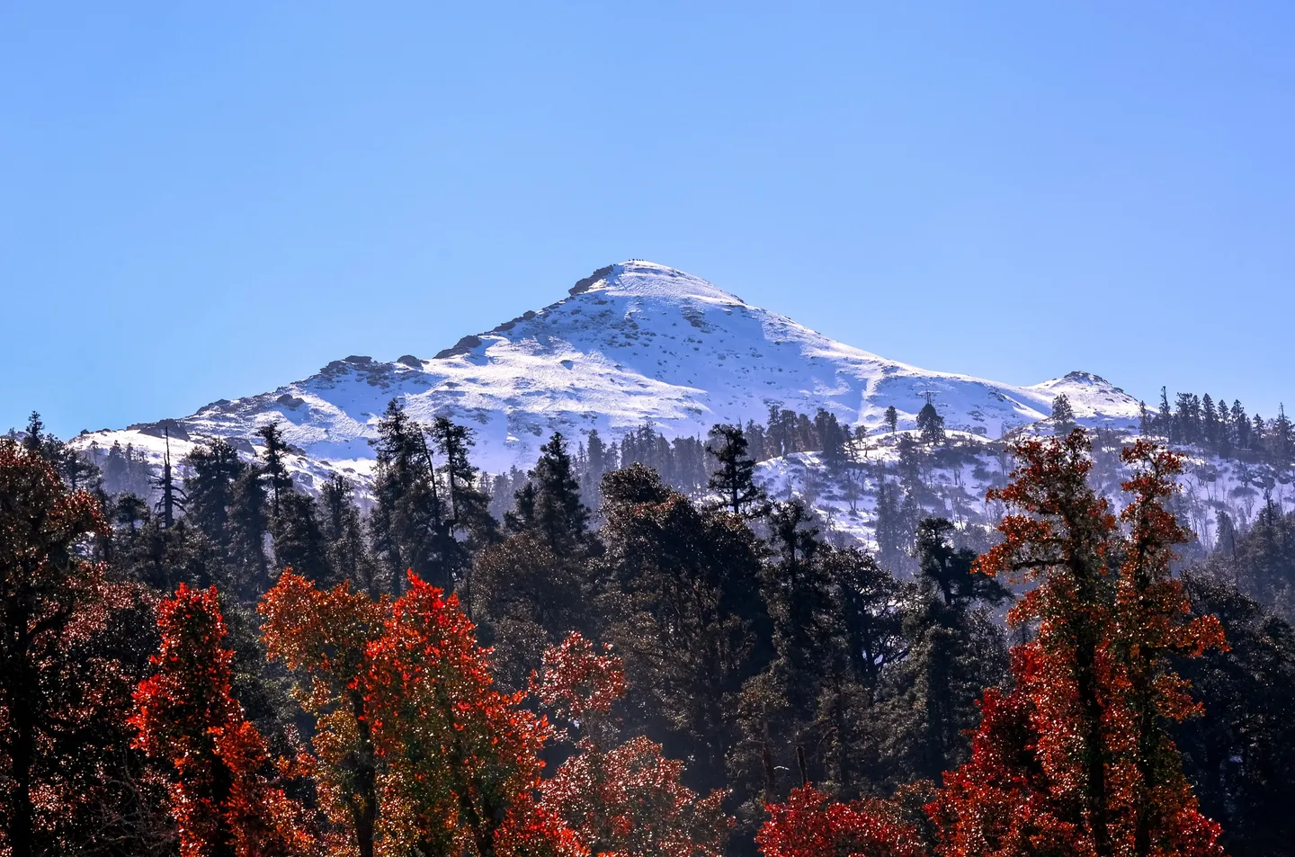
- Photo: Kanthi Kiran · CC BY-SA 4.0
Kedarkantha Trek
Hosted by The Crazy Mountaineers
India's most-walked winter summit: five days from Sankri to a 12,500 ft snow dome above the Govind sanctuary, with a pre-dawn push on the last morning.
Trip details
Kedarkantha is a rounded snow peak at the head of a side valley above Sankri, inside Govind Pashu Vihar in Uttarkashi district, and it has become the default first Himalayan summit for Indian trekkers. The reason is structural. The walking is short, four to six kilometres on most days, on a well-trodden trail through deodar, oak and pine; the campsites at Juda ka Talab and the base meadow are pretty and sheltered; and from mid-December to March the whole thing is genuinely under snow, which is what most people actually come for. The trek is not, however, a stroll. The last morning is the difference: a start in the dark, roughly 380 metres of climb on an open, wind-scoured snow slope that steepens near the top, in temperatures that sit between minus five and minus ten and feel far worse in wind. Cold injury, not altitude, is the realistic hazard here. The other thing to understand before booking is traffic. From about 15 December to mid-January the Sankri side is very busy, campsites are shared with several operators, and the summit ridge can have a queue on it. If solitude matters to you, go in late March, or in October and November instead.
- Sankri's deodar forest at about 6,400 ft, where the trail starts straight out of the village rather than at a gate.
- Juda ka Talab, a small lake in a clearing of oak and pine that freezes solid from about late December — the standard first camp, and for many people the picture that sold them the trek.
- Open snow meadow above the tree line at the base camp, with the summit dome visible from camp for the whole of the afternoon before you climb it.
- The pre-dawn summit climb by headlamp: roughly 380 m of steep, exposed snow with the sky going from black to grey behind Swargarohini.
- A 360-degree summit skyline at 12,500 ft — Swargarohini, Bandarpoonch, Kala Nag (Black Peak) and the Gangotri group all at once, which is why this modest peak is the most-walked winter summit in India.
- The shepherds' huts and grazing grounds of Govind Pashu Vihar under snow, empty for the season.
Drink 3 to 4 litres a day, which is harder than it sounds when everything is frozen and nobody wants to leave the tent at night. Avoid alcohol entirely and do not use sleeping tablets, which blunt the breathing drive at altitude. Use the spare afternoon at base camp to walk up 100 m and come back down rather than lying in the tent. Report headache at the time, not at dinner. Himalayan Hikers and Himalaya Shelter both state they take pulse oximeter and blood pressure readings twice daily and carry emergency oxygen; ask your operator to confirm the same in writing, and ask to see the oxygen cylinder and what its gauge reads before you leave Sankri. The non-negotiable rule is unchanged: if symptoms are not improving, or if there is confusion, loss of balance, breathlessness at rest or a wet cough, descend immediately, at night if necessary. Descent is the treatment; everything else buys time.
- The operator grades this Easy - Moderate; independent sources support Easy-Moderate in October, November and April; Moderate in deep winter. We list the sourced grade — see the sources below.
- Uttarakhand Forest Department, Govind Pashu Vihar National Park and Wildlife Sanctuary division; applications through the Divisional Forest Office at Purola, issued and verified at the Sankri forest check post about 300 m from the trailhead.
- Build for four to six weeks. A workable target is 5 km of jogging in 35 to 40 minutes, or a 45 minute brisk walk with 300 to 400 m of ascent, done comfortably three times a week. Add two sessions a week of stairs or hill repeats carrying a 6 to 8 kg pack. The distances here are short, so cardiovascular ceiling matters less than the ability to keep moving for eight hours in the cold and to descend steep snow under control. Anyone who cannot climb ten flights of stairs without stopping should postpone rather than book. Operators on this route commonly accept ages 8 to 60, subject to individual fitness.
- This trek turns dangerous in three specific ways. First, cold: an under-insulated trekker, in wet gloves and non-waterproof boots, standing still in a queue on an exposed summit slope at minus ten in wind, is a frostbite and hypothermia case, and this is by far the most likely serious incident here. Second, a fall on refrozen snow on the summit slope without microspikes, which produces ankle, wrist and head injuries a long way from a road. Third, a heavy snowfall event that traps a group at base camp or closes the Purola road behind them. Altitude illness is a real but secondary risk, and it becomes dangerous only when someone hides symptoms to avoid missing the summit.
Nearest railhead: Dehradun (DDN), approximately 190 to 200 km from Sankri by road, 8 to 10 hours via Mussoorie, Purola and Mori. The operator's own page prints 230 km on the outward leg and 200 km on the return, which reflects the route taken rather than a fixed distance.. Nearest airport: Jolly Grant, Dehradun (DED), approximately 210 to 225 km from Sankri, 9 to 11 hours by road. Basecamp: Sankri (6,400 ft / 1,950 m), Mori block, Uttarkashi.
- 1 x thermal base layer set, merino or synthetic, mid to heavy weight (200 to 260 gsm). A second set kept dry for sleeping only is the single best comfort purchase for this trek
- 2 x quick-dry trekking trousers plus 1 x insulated or fleece-lined trouser for camp. No denim, no cotton at any point
- 2 to 3 x quick-dry full-sleeve trekking t-shirts
- 2 x fleece or synthetic mid layers, roughly 200 and 300 weight, worn together on summit morning
- 1 x down or synthetic insulated jacket rated to about minus 15 C. This is the piece people under-buy for Kedarkantha and regret at 04:30
- 1 x waterproof and windproof hardshell jacket with a hood and taped seams, sized to go over everything else
- 1 x waterproof overtrousers. Snow at Juda ka Talab is soft by mid-morning and you will sit in it
- 1 x insulated beanie covering the ears, plus a balaclava or second buff for summit morning
- 2 x neck gaiters or buffs
- 3 x gloves in a layered system: a thin liner glove you can operate a camera in, an insulated fleece glove, and a waterproof shell mitt. Wet gloves at 12,500 ft is how frostnip starts
- 5 pairs of wool or wool-blend trekking socks, plus 1 thick pair reserved exclusively for sleeping
- 1 x pair of thermal leggings for camp and sleeping
- 1 x waterproof, insulated, high-ankle trekking boots with a lugged sole, broken in over at least 50 km beforehand. Non-waterproof boots will be wet by lunch on day two and frozen solid by dawn on day four
- Gaiters, mandatory from December to March. Snow depth on the base camp meadow routinely exceeds boot height
- 1 x lightweight closed-toe camp shoes or insulated booties. Do not plan on standing around camp in wet boots
- 1 x spare pair of insoles, so one set can dry inside your sleeping bag overnight
- 50 to 60 litre backpack with a padded hip belt and a rain cover if you carry your own load, or a 20 to 30 litre daypack if you offload to a mule
- Sleeping bag rated to a comfort temperature of about minus 15 C for December to February. Most operators supply one; ask for the comfort rating in writing and carry a fleece liner if they will not give you a number
- Sleeping mat with an R-value of 4 or better if you supply your own. On snow, the mat matters more than the bag
- 2 x trekking poles with snow baskets fitted. Baskets are the part people forget and the part that stops the pole disappearing to the grip
- Microspikes or instep crampons. Confirm whether the operator supplies them, as Himalayan Hikers and Himalaya Trekkers both state they do
- Headlamp with fresh batteries plus a full spare set, kept in an inside pocket. Summit morning starts in the dark and cold halves battery life
- 2 x 1 litre wide-mouth insulated bottles, stored upside down overnight so the ice forms at the base rather than sealing the lid. A hydration bladder hose will freeze on summit morning and is the wrong choice here
- Water purification tablets or a filter for the lower sections; higher up you will mostly be drinking boiled or melted water provided in camp
- UV400 wraparound sunglasses, category 3 or 4. Snow blindness on the base camp meadow is a real and entirely preventable injury; carry a spare pair or spare lenses
- Power bank of 10,000 mAh or more, carried inside your jacket. There is no charging beyond Sankri and cold flattens phones fast
- Dry bags or heavy-duty bin liners for the sleeping bag and spare clothes
- Toilet paper, a small trowel, sealable bags for carrying out waste, and a bag for all your own litter. This is one of the most heavily used trails in the Himalaya and it shows
- Original government photo ID (Aadhaar, driving licence or passport) plus 2 photocopies. Your photograph is taken and your details entered in a register at the Sankri forest check post
- 2 to 4 passport-size photographs
- Foreign nationals: passport and valid Indian visa plus copies, and expect the higher park fee and a separate register
- Medical fitness certificate. Govind Pashu Vihar has previously required online registration with a medical certificate and similar documentation is asked for in peak season
- Signed indemnity or self-declaration form, which most operators on this route require
- Travel or trekking insurance policy number and the insurer's 24-hour emergency line
- Emergency contact details written on paper, not only in a phone that will be dead by day three
- Blister kit: zinc oxide tape, hydrocolloid dressings and a needle. Cold, stiff boots produce more blisters than warm ones
- Paracetamol for headache and fever; ibuprofen or diclofenac for muscular pain, taken with food
- Diamox (acetazolamide) is the standard altitude prophylaxis, but whether you take it, and at what dose, is a decision for a doctor who knows your history and your sulfa allergy status. Do not start it for the first time on the trail
- An anti-emetic such as ondansetron, an anti-diarrhoeal such as loperamide, and oral rehydration salts
- Personal prescription medication in original packaging, at double the quantity you expect, split between two bags
- Antiseptic cream, a crepe bandage and a small roll of duct tape
- SPF 50+ sunscreen and SPF lip balm, reapplied. Reflected UV off snow burns the underside of the nose and chin, and a cracked lip at minus ten stays cracked for the whole trek
- Chemical hand and toe warmers, two pairs. Cheap, light, and the most useful thing in your bag on summit morning
- Personal hygiene items and, for women, enough sanitary supplies plus sealable bags to carry them out
What's included
- Guides
- Camping and all meals on the trek
Safety details & FAQ
Is Kedarkantha suitable for a beginner?
The trek overall is Easy-Moderate and days two and three really are gentle — just 4 km each. But summit day is a different trek: roughly 9 km and 7-8 hours, with a sustained climb on a 45-60 degree slope that's frozen hard in the dark, followed by a fast, tiring descent. A first-timer can do it with genuine leg fitness, but don't read "Easy" as a guarantee of an easy day.
When should I do Kedarkantha for snow?
December to February for a real snow climb, when the trail is continuous snow from Sankri and the summit slope is a proper winter ascent. March-April gives receding snow low down with snow still up high, plus rhododendron. May-June is green, warm and much quieter. Avoid July-August: the approach road through Purola and Mori is landslide-prone and views close in.
What permit do I need for Kedarkantha?
The Govind Pashu Vihar National Park entry and trekking permit, issued by the Uttarakhand Forest Department, usually arranged at the Sankri check post or in advance through the DFO at Purola. Your operator arranges it; carry original photo ID, two photocopies, and a medical fitness certificate, since Govind Pashu Vihar has required one at permit issue in past seasons.
Is altitude sickness a risk on Kedarkantha if the summit is only 12,500 ft?
Yes — the risk sits at the sleeping altitude, not the summit you touch and leave. Base camp is at 11,200 ft (3,413 m), reached after a 4,800 ft gain from Sankri, and the day-two gain rate of 2,700 ft in 4 km is the steepest on the trek. Fitness doesn't protect you here; fit people climbing fast are, if anything, more exposed. Walk slowly enough to talk, drink 3-4 litres daily, and report symptoms immediately.
What gear do people underestimate for Kedarkantha?
Wide-mouth water bottles over hydration bladders — bite valves and hose freeze on summit morning; a proper five-layer warm system for December-February rather than a two- or three-layer summer kit; and confirmed-fitted microspikes. Most operators issue them, but you need to confirm sizing before you leave, not discover a problem on the slope itself.
How far is Kedarkantha's trailhead from Dehradun?
About 195-200 km by road to Sankri, the last road head, taking anywhere from 7 to 11 hours depending on the season and who's driving — Bikat quotes 7-8 hours, Indiahikes 10-11 for essentially the same route. Budget the longer figure in winter or after rain, and don't book a same-day onward connection out of Dehradun on your return.
How crowded does Kedarkantha get in peak winter?
Very. The Sankri approach gets extremely crowded from 15 December to mid-January, with trekker accounts describing 500-1,000 people on the trail on peak days — congestion serious enough that India's largest trekking operator moved its own departures to different trailheads. If you want a quieter snow trek, aim for late November or after mid-February rather than the Christmas-New Year window.