 1 / 3
1 / 3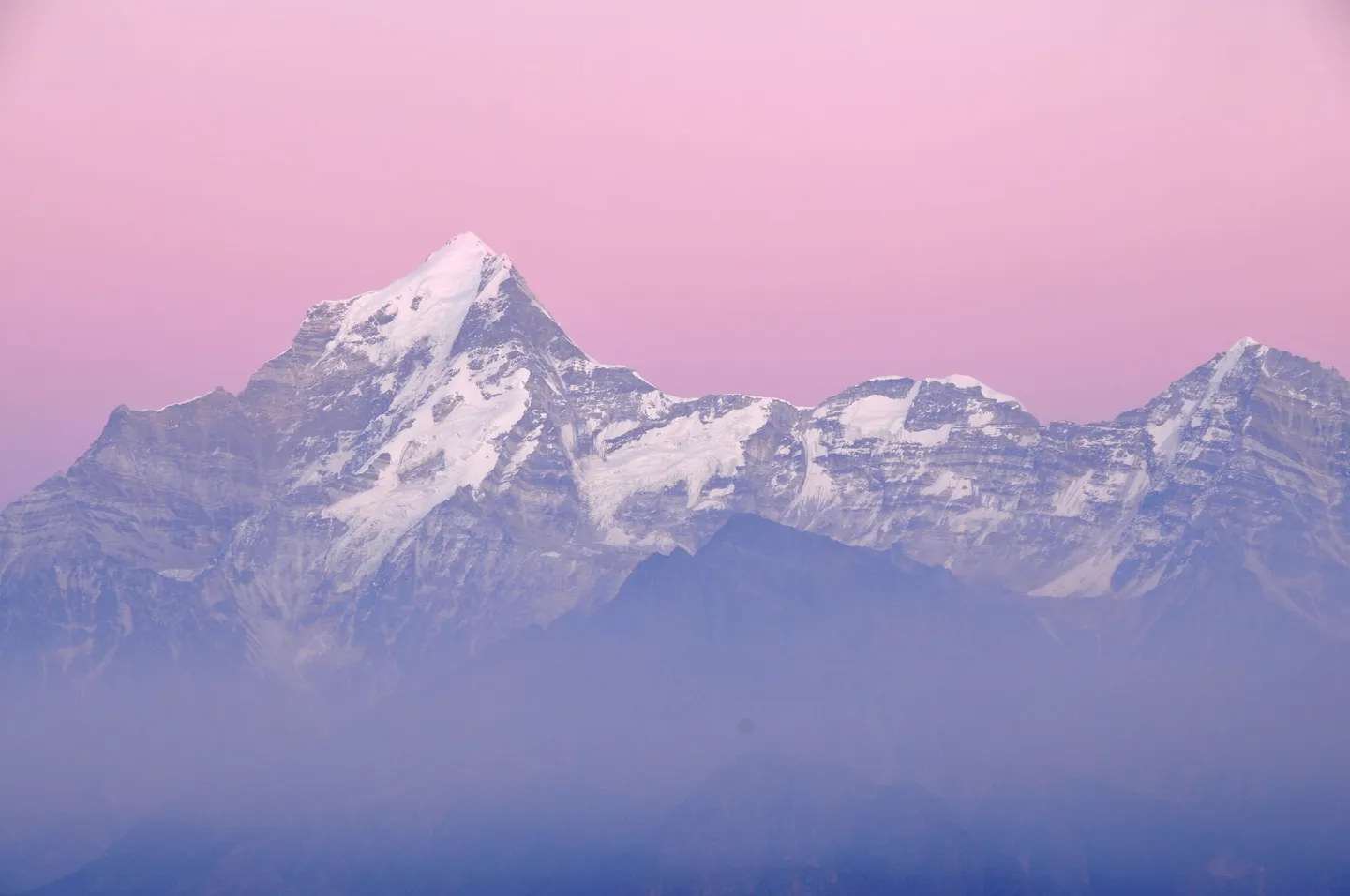
- Photo: ShwethaSulegai · CC BY-SA 4.0
- Photo: Sumodm · CC BY-SA 4.0
- Photo: Bidhubhusan Patel · CC BY-SA 4.0
Pangarchulla Peak Trek
A seven-day trek from Rishikesh and back to a 4,593 m snow summit in Chamoli, Uttarakhand: two days up from Tugasi through oak and deodar forest to the high camp at Khullara, an acclimatisation walk to Kuari Pass, then an 11 to 12 hour summit day over boulders, snow and a narrow ridge where an ice axe may be needed. About 37 km on foot. It is a spring snow climb, not a pass walk, so read the season, permit and turnaround notes first.
Route map
Real terrain from satellite imagery, 1 Nov 2024. Pick a day to fly it.
- Distance24.7 kmon the mapped trailoperators quote 37 km
- Days5 trekking7 with travel
Measured along the mapped trail, starting at Tugasi. The distance you actually walk can differ with where your trek starts, the route your team takes and any side trips.
Skip the 3D map
Day by day
Day 2 starts at Tugasi. Open start point in Google Maps (opens in a new tab)
| Day | From → To | Distance | Climb / descent | Highest | Map |
|---|---|---|---|---|---|
| Day 1 | Rishikesh → Pipalkoti by roadOvernight: Guesthouse in Pipalkoti | — | — | — | |
| Day 2 | Tugasi → Gulling TopOvernight: Tents at Gulling Top, 2,850 m | 1.8 kmoperators quote 3 km | +400 m 0 m | 2,850 m | |
| Day 3 | Gulling Top → KhullaraOvernight: Tents at Khullara, 3,350 m | 2.8 kmoperators quote 5.5 km | +500 m 0 m | 3,350 m | |
| Day 4 | Khullara → Khullara Top → Kuari Pass → KhullaraOvernight: Tents at Khullara, 3,350 m | 5.1 kmoperators quote 7 km | +450 m −450 m | 3,800 m | |
| Day 5 | Khullara → Pangarchulla Summit → KhullaraOvernight: Tents at Khullara, 3,350 m | 10.5 kmoperators quote 14 km | +1,243 m −1,243 m | 4,593 m | |
| Day 6 | Khullara → TugasiOvernight: Guesthouse in Pipalkoti (after the 50 km, 2-3 h drive) | 4.5 kmoperators quote 7.5 km | 0 m −900 m | 3,350 m | |
| Day 7 | Pipalkoti → Rishikesh by roadOvernight: Your own stay in Rishikesh (after the 8-9 h drive) | — | — | — |
Peaks you can see from Pangarchulla Summit
- Nanda Devi — 7,816 m, 37 km from Pangarchulla Summit
- Kamet — 7,756 m, 55 km from Pangarchulla Summit
- Chaukhamba I — 7,138 m, 47 km from Pangarchulla Summit
- Trisul I — 7,120 m, 22 km from Pangarchulla Summit
- Dronagiri — 7,066 m, 28 km from Pangarchulla Summit
- Kedarnath — 6,940 m, 65 km from Pangarchulla Summit
- Changabang — 6,864 m, 33 km from Pangarchulla Summit
- Hathi Parbat — 6,727 m, 31 km from Pangarchulla Summit
- Gauri Parbat — 6,708 m, 34 km from Pangarchulla Summit
- Neelkanth — 6,596 m, 39 km from Pangarchulla Summit
Imagery: contains modified Copernicus Sentinel-2 data 2024, processed by MadClub · Terrain: AWS Terrain Tiles (SRTM) · Trails, rivers: © OpenStreetMap contributors (ODbL) · Trail line may be approximate; not for navigation.
Route and day plan compiled from published trek guides and verified by MadClub. Satellite image date: 1 Nov 2024.
Trip details
Pangarchulla is two treks joined at Khullara camp. Up to there it is a Garhwal forest-and-meadow walk: oak and deodar woods above Tugasi, a first camp at Gulling Top, a high camp at Khullara, and then a rest day on Kuari Pass with Garhwal's big peaks along the horizon. On day five of the standard seven-day plan it becomes a climb. You leave Khullara in the dark and go up to a summit of 4,593 m (15,069 ft), about 1,240 m above the camp, across boulder fields, snow slopes and a narrow ridge to a final rock face, and you are back at camp the same day. There are two tops, and the day decides which one you reach. Pangarchulla has a sharper main summit, over 15,000 ft by one trip report, and a rounder, lower crest beside it, over 14,000 ft. A party in mid-March, its summit day delayed a day by a storm, turned to the lower crest because the route to the main summit was unmarked and untested, with no established trail and nobody ahead of them that season, and their guide had already been cutting the way with an ice axe. A party in early April stood on the main summit at 2:15 pm, a quarter of an hour after the turnaround time they had agreed, and came down through a storm to reach the forest at 6 pm. Read those as the shape of the day rather than as exceptions. What makes summit day long is the ground more than the height. Big boulders with gaps between them sit under the snow near the base of the peak, and when the snow is thin it hides the gaps and slows everyone down; one trip report calls the rock section "a level higher than trekking", done with hands and feet. Beyond that the route climbs a chain of snow ridges to a narrow, windy crest with a cornice, where trek pages expect the way to be cut with an ice axe and sometimes roped. An early-April party met a sheer drop of about 30 ft on the ridge, judged it was not the way up, and went round by the snowfields behind the peak, finishing at a rock face a couple of hundred metres tall. Trek pages advise crampons and a qualified guide to open the snow. One party left camp at 2:45 am with the temperature near -4 °C. The plan allows 11 to 12 hours for about 14 km out and back; one party's own count for its summit day was 21 hours 30 minutes. The season is narrow. Spring snow is what makes the summit climbable, and trek pages put the window in March and April, in April alone, or in April and May with a second window in September and October. One of them says that deep snow keeps the summit out of reach before April, and that after April the melt leaves exposed boulders and an unsafe route. One page that sells the trek advises against winter, when heavy snow hides the trail and raises avalanche risk, and against the monsoon, and warns that a thin early layer conceals large boulders; another sells departures from late October to late December and names October to December as a second season, for rocky ground with patches of hard snow. We found no first-hand report from midwinter or the monsoon. The trek starts at Tugasi (some pages write Tugashi), a village in Jyotirmath (Joshimath) tehsil of Chamoli district, Uttarakhand, at the end of the motor road. One trip report of the Kuari Pass trail says part of it lies inside the Nanda Devi Biosphere Reserve, which is why it needed a forest permit; we could not find which zone of the reserve the stretch from Tugasi to Khullara falls in. By our own measurement, against a coarse map outline, the route stays at least 8 km clear of Nanda Devi National Park, one of the reserve's two core zones. Read the published numbers with care. Pages put the summit anywhere from 4,481 m to 4,600 m, the total walking at 35, 39, 40, 44 or 52 km, Kuari Pass between 3,800 m and 3,850 m (elevation models read about 3,820 m at the trail's high point, where the map marks Kuari Pass, and about 3,690 m at the saddle OpenStreetMap marks 0.9 km away) and Tugasi at 2,090 m or 2,450 m. We use the figures a day-by-day plan adds up to, and the safety details say where each spread lies.
- Oak and deodar forest above Tugasi (2,450 m, about 8,000 ft), the first day on foot. Trail descriptions add maple, pine, walnut and rhododendron; we promise no bloom.
- Gulling Top (2,850 m, about 9,400 ft), the first camp, 3 km on foot from the end of the road. One itinerary says mobile coverage is good as far as here and patchy beyond.
- Khullara (3,350 m, about 11,000 ft), the high camp that serves both Kuari Pass and the summit; on the standard plan you sleep here three nights.
- Kuari Pass (3,800 m, about 12,500 ft) on the acclimatisation day. A first-hand account names Chaukhamba, Hathi Parbat, Gauri Parbat, Dunagiri, Neelkanth and Kamet from the pass. Hathi Parbat (6,727 m) and Gauri Parbat (6,708 m) are two separate neighbours, and Dunagiri (7,066 m) is the mountain the trails also call Dronagiri.
- Nanda Devi (7,816 m), India's second-highest mountain after Kangchenjunga, from the summit: the map's line-of-sight model puts it clear of the nearer ridges from the top but hidden behind them from Kuari Pass, though trek pages name it from both. We found no first-hand account that names it from this route.
- The two crests of Pangarchulla: the sharper main summit at 4,593 m (15,069 ft) and the rounder lower crest beside it, mapped as Mini Pangarchulla, which two elevation models read at 4,264 to 4,282 m.
- The summit ground, the part the whole trek is built around: boulder fields, snow, the narrow ridge and the last rock face. One 2017 account describes a trident (trishul) standing at the top; we cannot say it is still there.
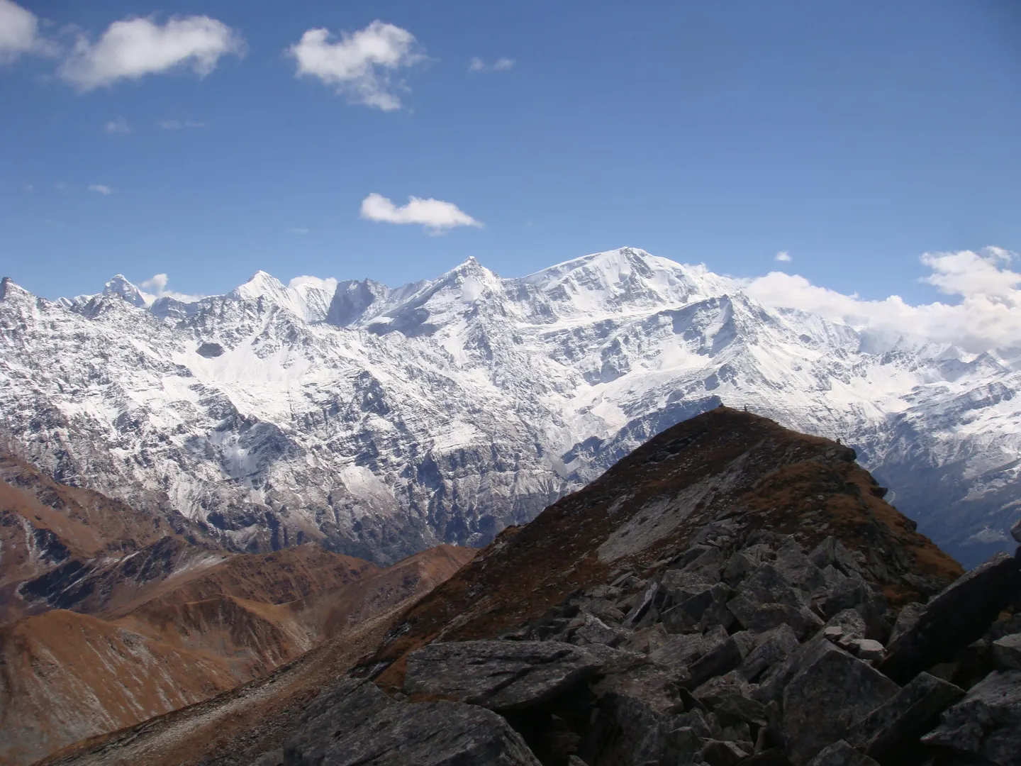
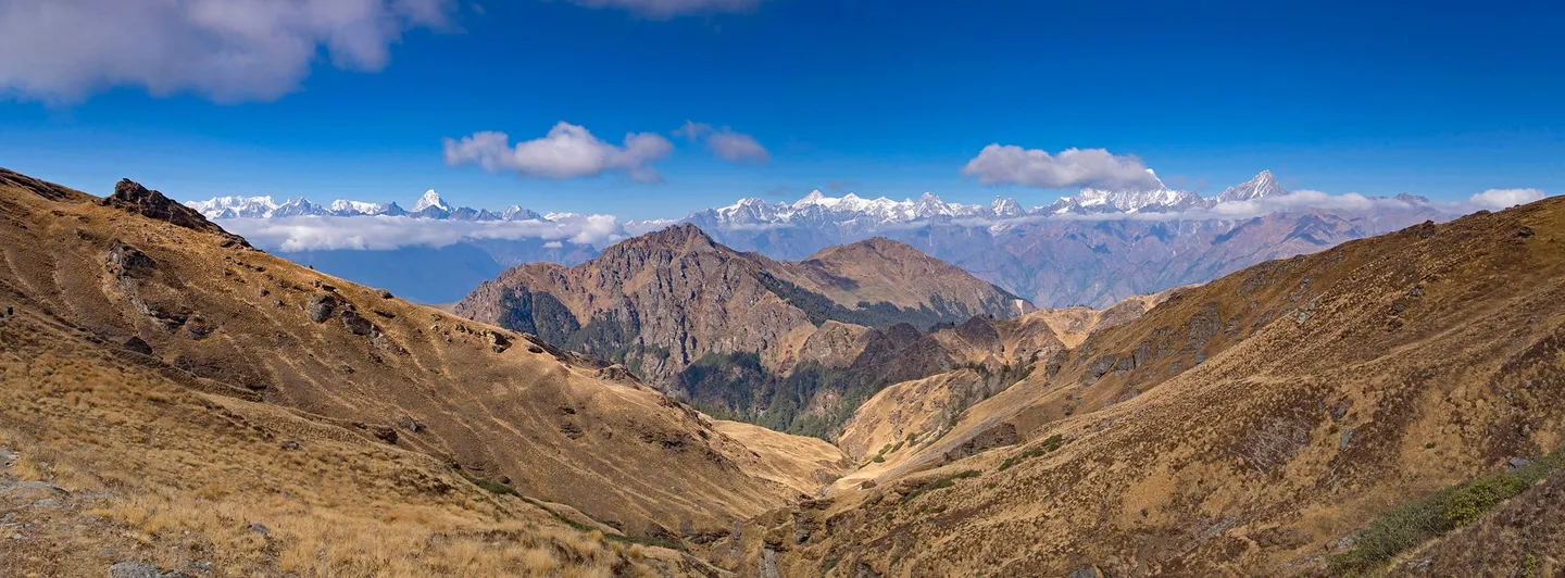
- A long Garhwal skyline from Kuari Pass. The panorama photograph on this page is titled by its photographer with Chaukhamba, Neelkanth, Kamet, Mana, Gauri Parbat and Hathi Parbat; all three photographs here were taken in October or December, outside the spring snow window, the summit-area view included, so expect far more snow on summit day than they show.
Prepare for the summit day, not for the average day. The first two walking days are short, 3 km and 5.5 km, and the rest-day walk to Kuari Pass and back is about 7 km. Day five is about 14 km in 11 to 12 hours with about 1,240 m of climbing, in the dark and the cold, on boulders and snow. Train for long days on your feet with a pack, for stairs and hills, and for several long days in a row. Fitness benchmarks on trek pages are for a 5 km run in 25 to 30 minutes on one itinerary and 45 minutes on another; read the spread as a rough guide, not a pass mark. Take the altitude seriously. Day one ends at about 1,350 m in Pipalkoti, and day two ends 1,500 m higher at Gulling Top (2,850 m) after a drive and a short walk. Khullara is 3,350 m and you sleep there three nights, with Kuari Pass (3,800 m) as the planned rest-day walk. Trek pages ask for previous trekking experience; if you have never slept above 3,000 m, do a lower Himalayan trek first rather than using this one to find out how you acclimatise. Learn to walk in crampons before you go, on steep snow if you can. The guide opens the route, but you have to move in the equipment on slopes where a slip does not stop quickly. Practise with the boots, gaiters and gloves you will wear. Ask your operator, in writing, four things: which month the departure is and what the snow was doing on the last one, what the summit-day turnaround time is, which permits are included and who obtains them, and what the rescue and evacuation arrangements are. Tell someone who is not on the trek where you are going and when you expect to be back.
- The summit is a decision made on the day, not a certainty you buy. First-hand accounts include a party that settled for the lower crest in mid-March, a party that summited at 2:15 pm past an agreed 2:00 pm turnaround and came down in a storm, and a party that was lost in the forest in the dark on the way down and reached its tents at 11:30 pm after a day it counted at 21 hours 30 minutes.
- The season is a snow window of March and April on most pages (April alone, or April and May plus September and October, on others). One page that sells the trek advises against winter and the monsoon; another sells late-October to December departures. No month is guaranteed.
- Published numbers disagree. Summit 4,481 m to 4,600 m, total walking 35, 39, 40, 44 or 52 km, Kuari Pass 3,800 m to 3,850 m, Tugasi 2,090 m or 2,450 m. We publish 4,593 m, about 37 km, 3,800 m and 2,450 m.
- The plan is seven days from Rishikesh. Day two moves your sleeping height up by 1,500 m in one day, from about 1,350 m at Pipalkoti to 2,850 m at Gulling Top, so tell your guide early about any headache or poor sleep.
- A forest permit is needed, and a 2021 account of the Kuari Pass trail says that camping there, even for one night, means working with a local guiding agency and a guide. We found no official fee list, so we publish no fee.
- Part of the Kuari Pass trail lies inside the Nanda Devi Biosphere Reserve, by the same account. We could not find which zone the Tugasi to Khullara stretch is in. By our measurement the route stays at least 8 km clear of Nanda Devi National Park.
- Pangarchulla, Kuari Pass and Khullara are not on any of the four peak lists published on the Indian Mountaineering Foundation site. That is a measured absence, not a ruling; whether the state's mountaineering rules ask for a permit or registration at this height we could not verify. Ask.
- A guide is how this trail is done. The summit route is opened with an ice axe, and a party that was the first of its season had to make the trail itself. Do not plan to go without one.
- Medical help is far. Jyotirmath (Joshimath) has a community health centre; serious cases go to the district hospital at Gopeshwar, 60 km away, a trip of almost three hours in a 2023 report, or on to Dehradun. Evacuation from a remote camp is slow.
- Mobile coverage is good as far as Gulling Top on one itinerary and patchy after that. Do not rely on a phone.
- A March 2023 report said Jyotirmath (Joshimath) had been recording land subsidence since October 2021, with an impact on buildings and roads and cracks in the community health centre. We did not verify the road or the town as current. Confirm both with your operator before you travel.
- Joshimath was renamed Jyotirmath, tehsil and town, by an order of 2024; the district website still says Joshimath. Searching either finds the place.
- Operators set their own minimum age: one page that sells the trek says 13, with 13 to 17 year olds accompanied by a parent or guardian, and another lists children below 12 among those who should avoid the trek. We found no rule text. Ask your operator in writing.
- Check that your travel insurance covers evacuation and treatment at 4,600 m.
The plan starts and ends at Rishikesh, the nearest railway station to the trek; Jolly Grant airport near Dehradun is the nearest airport. Day one is a road day from Rishikesh to Pipalkoti, 220 km in 9 to 10 hours on the plan. The Rishikesh to Jyotirmath (Joshimath) road, about 250 km, runs through Devprayag, Rudraprayag and Karnaprayag, and Pipalkoti comes before Jyotirmath. On day two you drive from Pipalkoti to Tugasi, 50 km in 2 to 3 hours on the plan, and start walking. Tugasi is the last point on the road. Pages that start from Jyotirmath give 11, 13 and 35 km for the distance to the trailhead, which disagree with each other and with the plan, so we publish only the plan's figure. The village is mapped at about 30.48 N, 79.60 E, in Jyotirmath tehsil, Chamoli district. The way home reverses it: day six ends with the 7.5 km walk down to Tugasi and the 50 km drive to Pipalkoti, and day seven is the 220 km road back to Rishikesh in 8 to 9 hours. Landslides are listed among the hazards of the region on trek pages, so leave a margin before any onward flight or train.
- Crampons that fit your boots. Trek pages call them highly advisable for the snow; one party took off its microspikes (lighter than crampons) on the boulders because they got in the way on rock, so be able to stow yours quickly. The guide cuts the route with an ice axe.
- A helmet for the boulders and the final rock face (a first-hand party was issued one, and one trek page lists helmets in its kit), and a harness if your operator ropes the team on the crest, which one trek page says it should.
- Waterproof, stiff-soled boots with ankle support that you have already broken in, and gaiters.
- Several warm layers, an insulated jacket, a waterproof shell, warm gloves with a spare pair, and a warm hat. A first-hand party left camp at 2:45 am near -4 °C.
- A headtorch with spare batteries. You start summit day in the dark, and one party came down in it.
- Sunglasses and sunscreen for snow glare and thin air.
- Trekking poles.
- A water bottle or flask and enough food and snacks for an 11 to 12 hour day.
- A personal first-aid kit and your own medicines, and a note of anything you are allergic to.
- Copies of your ID and your permit paperwork.
- A power bank, and a downloaded offline map.
- A bag for your rubbish. There are no bins above the road.
Safety details & FAQ
Where is the Pangarchulla Peak trek, and where does it start?
It is in Chamoli district, Uttarakhand. The walk starts at Tugasi (some pages write Tugashi), a village in Jyotirmath (Joshimath) tehsil, mapped at about 30.48 N, 79.60 E and at 2,450 m, the last point on the road. From Tugasi you climb through oak and deodar forest to Gulling Top and Khullara, spend a day walking to Kuari Pass, and then go for the summit. The plan starts and ends at Rishikesh, with a night at Pipalkoti on the way in and out.
How tall is Pangarchulla, and why do pages give different heights?
4,593 m (15,069 ft) is the height we use; four of the pages we read give it. Published values run from 4,481 m to 4,600 m (15,100 ft), with 4,572 m (15,009 ft) and 4,590 m in between. Two independent elevation models read the point mapped as the summit at 4,541 m and 4,527 m, but that is a mapper's point on a narrow top, so it is a check on the order of magnitude and not on the last metre. Summit day climbs about 1,240 m from Khullara at 3,350 m; from the road at Tugasi (2,450 m) the gain is 2,143 m.
What does the seven-day plan look like?
Rishikesh to Rishikesh, with the high camp at Khullara. Day 1: drive Rishikesh to Pipalkoti, 220 km in 9 to 10 hours. Day 2: drive Pipalkoti to Tugasi, 50 km in 2 to 3 hours, then walk 3 km in 2 to 3 hours to Gulling Top. Day 3: walk 5.5 km from Gulling Top to Khullara in 4 to 5 hours. Day 4: walk about 7 km from Khullara to Kuari Pass and back in 5 to 6 hours, the acclimatisation day. Day 5: summit day, about 14 km from Khullara to the top and back in 11 to 12 hours. Day 6: walk 7.5 km from Khullara down to Tugasi in 4 to 5 hours, then drive 50 km to Pipalkoti in 2 to 3 hours. Day 7: drive Pipalkoti to Rishikesh, 220 km in 8 to 9 hours. The walking adds up to about 37 km; the same daily ranges add to 35 km at the low end and 39 km at the high end, and other pages give up to 52 km. Distances and hours are approximate.
How hard is the Pangarchulla Peak trek, and what fitness do you need?
Hard. Trek pages grade it moderate to difficult; we grade it hard because summit day is 11 to 12 hours on boulders, snow and a ridge where an ice axe is used, because first-hand accounts include a storm and whiteout, a party that settled for the lower crest and a very late finish, and because help is far away. You need good fitness for long days with a pack and previous trekking experience, which trek pages ask for too. Their benchmark is a 5 km run in 25 to 30 minutes on one itinerary and 45 minutes on another. The first two walking days are short, 3 km and 5.5 km.
What is summit day on Pangarchulla like?
Long, cold and late. It is about 14 km out and back from Khullara in 11 to 12 hours on the plan, with about 1,240 m of climbing to 4,593 m, and first-hand parties took longer: one that reached the top at 12:08 was lost in the forest in the dark on the way down and reached its tents at 11:30 pm, a day it counted at 21 hours 30 minutes. Another left camp at 2:45 am with the temperature near -4 °C. The ground changes: boulder fields with gaps that thin snow hides, a chain of snow ridges, a narrow, windy crest with a cornice where trek pages expect the route to be cut with an ice axe, and a last rock face. Trek pages advise crampons and a qualified guide to open the snow. Weather turns fast; snowfall on one summit day became a full storm. Turnaround times quoted are noon in normal conditions by one trip report and 2 pm by another party.
Is Pangarchulla one summit or two?
Two crests. There is a sharper main summit at 4,593 m (15,069 ft) and a rounder, lower crest beside it, over 14,000 ft by one trip report and mapped as Mini Pangarchulla, which two elevation models read at 4,264 and 4,282 m. Which one a party reaches depends on the day. In mid-March one party turned to the lower crest because no one had opened a route to the main summit that season; an early-April party stood on the main summit at 2:15 pm, past the turnaround it had agreed. Ask your operator which top the plan aims for and what happens if the route is not open.
When is the best time to do the Pangarchulla trek?
March and April, in the spring snow, on most pages; one says April alone, and one says April and May plus September and October. One page says that deep snow keeps the summit out of reach before April, and that after April the melt leaves exposed boulders and an unsafe route. Two first-hand accounts are dated, mid-March and early April. One page that sells the trek advises against winter, when heavy snow hides the trail and raises avalanche risk, and against the monsoon; another sells departures from late October to late December and names October to December as a second season, for rocky ground with patches of hard snow. We found no first-hand report from midwinter or the monsoon, and no month is guaranteed.
Do you need a permit, and is the trek inside a protected area?
A forest permit, in practice arranged through a local guiding agency, and we could not read an official fee list or rule text. A first-hand account of the Kuari Pass trail says the Forest Office in Jyotirmath (Joshimath) gave mixed answers, that camping even for one night means working with a local agency and a guide, and that a day permit in November 2021 cost INR 60 (a day trip from Karchi, so it sets no fee for this trek). We publish no fee. Foreign nationals: one page that sells the trek says permit charges differ for them and a passport is needed for the permit; another asks for a passport and Indian visa at the base camp and Forest Department checkpoints. We found no rule text; ask your operator. The same account says part of the trail lies inside the Nanda Devi Biosphere Reserve. By our measurement the route stays at least 8 km clear of Nanda Devi National Park, one of the reserve's two core zones, and we could not find which zone the Tugasi to Khullara stretch is in. Pangarchulla is not on any of the four peak lists published on the Indian Mountaineering Foundation site.
Do you need a guide, crampons or an ice axe?
Treat a guide as required. A first-hand account of the Kuari Pass trail says camping there goes through a local guiding agency and a guide, and trek pages expect the leader to cut the summit route with an ice axe; a party that was the first of its season had its guide cut a path across a slope with his ice axe from 5 am. Trek pages call crampons highly advisable and advise a qualified guide to open the snow route; one party took off its microspikes (lighter than crampons) on the boulders because they got in the way on rock. Ask who carries the ice axe, the rope, harnesses and spare crampons, and whether a helmet is issued. Learn to walk in crampons before you go.
How do you get to Tugasi, and where do you stay on the way?
Rishikesh is the nearest railway station and Jolly Grant airport near Dehradun the nearest airport. Day one is a road day from Rishikesh to Pipalkoti, 220 km in 9 to 10 hours, passing Devprayag, Rudraprayag and Karnaprayag, with a night at Pipalkoti (about 1,350 m). On day two you drive 50 km in 2 to 3 hours to Tugasi, the last point on the road, and walk to Gulling Top. The way back reverses it, with a second night at Pipalkoti. Pages that start from Jyotirmath give 11, 13 and 35 km for the road to Tugasi; we publish only the plan's figure.
What is the acclimatisation day at Kuari Pass for?
Day four is a rest-day walk from Khullara (3,350 m) up to Kuari Pass (3,800 m, about 12,500 ft) and back, about 7 km in 5 to 6 hours, rising about 450 m before you sleep at Khullara again. It gives your body another day near height before the summit and a long view in return. A first-hand account names Chaukhamba, Hathi Parbat, Gauri Parbat, Dunagiri, Neelkanth and Kamet from the pass; Hathi Parbat is 6,727 m, Gauri Parbat 6,708 m and Dunagiri 7,066 m. Do not skip the day to save time.
Is there phone signal, and where is the nearest hospital?
Coverage is good as far as Gulling Top on one itinerary and patchy after that; do not rely on it. The nearest care is the community health centre at Jyotirmath (Joshimath), which a 2023 report says has about 56 staff including nine doctors and refers serious cases to the district hospital at Gopeshwar, 60 km away, almost three hours by road in that report. Trek pages say Dehradun is the better option for anything serious. The Chamoli district website lists 112 for emergencies, 1077 for rescue and relief, and 102 and 108 for ambulances, and the Gopeshwar district hospital at 01372252245; its helpline page is dated May 2019, so confirm the numbers.
What should you carry on summit day?
Crampons that fit your boots, gaiters, a helmet for the boulders and the final rock face, a headtorch with spare batteries because you start in the dark, several warm layers with a waterproof shell and a warm hat and gloves (one party left camp near -4 °C), sunglasses and sunscreen, trekking poles, a flask and enough food for 11 to 12 hours, and a personal first-aid kit. The guide carries the ice axe; ask in advance who carries the rope, harnesses and spare crampons, and whether your operator ropes the team on the crest.
Why do trek pages disagree on the distance and the height?
Because the figures are rounded and cannot be traced to a survey. The walking is about 37 km if you add up the daily figures, 35 to 39 km if you take the ends of each day's range, and other pages print 40, 44 and 52 km; one reads 12 km for summit day where the plan reads 14 km. Heights run from 4,481 m to 4,600 m for the summit, 3,800 m to 3,850 m for Kuari Pass (elevation models read about 3,820 m at the trail's high point, where the map marks Kuari Pass, and about 3,690 m at the saddle OpenStreetMap marks 0.9 km away), 3,350 m to 3,390 m for Khullara, and 2,090 m or 2,450 m for Tugasi. The 2,090 m figure is close to what the models read at Dhak, a lower village (2,052 and 2,064 m); at Tugasi itself they read about 2,571 and 2,573 m. We publish the plan's figures and name the spread.
How long is the Pangarchulla Peak trek?
About 24.7 km on the mapped trail over 5 trekking days. Operators usually quote about 37 km for the same route. Measured along the mapped trail from Tugasi; the distance you walk can differ with the start point and route.
What is the highest point on the Pangarchulla Peak trek?
Pangarchulla Summit, at 4,593 m, reached on Day 5.
Which peaks can you see on the Pangarchulla Peak trek?
On a clear day from Pangarchulla Summit: Nanda Devi, 7,816 m, about 37 km away; Kamet, 7,756 m, about 55 km away; Chaukhamba I; Trisul I and 6 more. Views depend on weather; mornings are clearest.