 1 / 3
1 / 3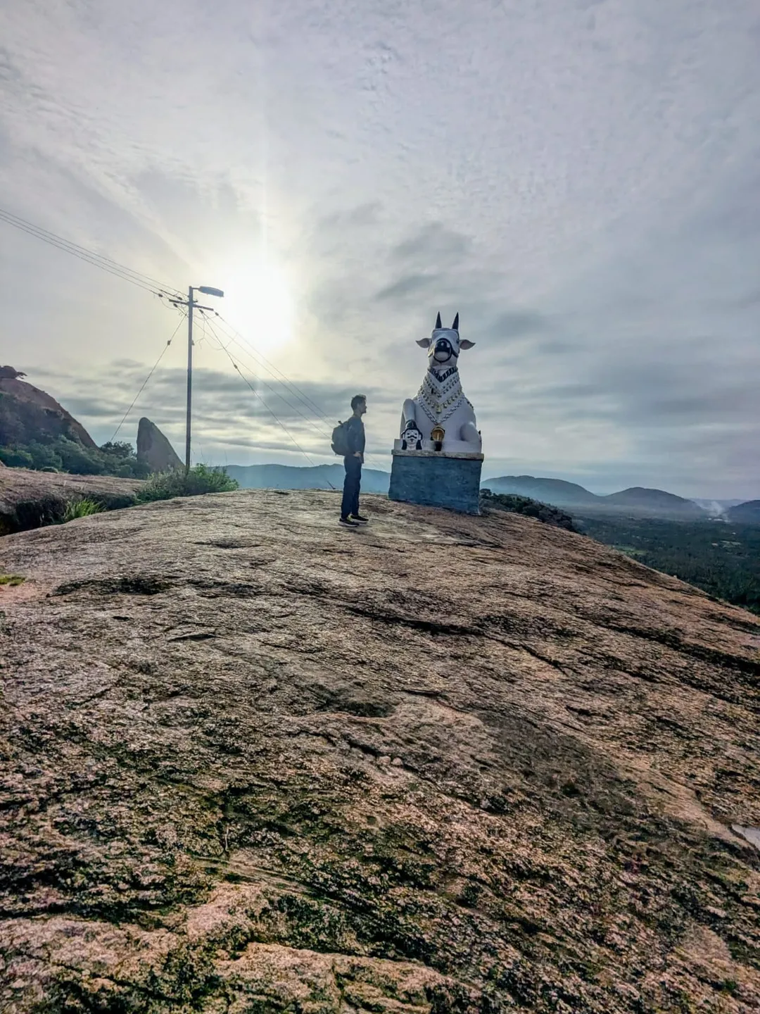
- Photo: Madclub · Courtesy Madclub
Kunagalu Betta Trek
A one-kilometre walk up a granite hill above Hunasanahalli in Ramanagara taluk, 56 km by road from central Bengaluru, that climbs 164 m past a Nandi, through a pitch-black cave full of bats and up rock-cut steps to a Hanuman shrine and a summit shelter. Three independent parties reached the top in about thirty minutes. Bring a torch, bring your water, and read the access note first: Karnataka has not reopened routes like this one.
Trip details
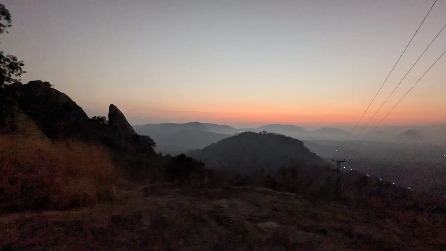
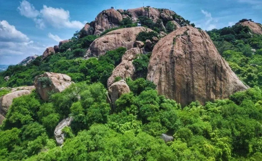
Kunagalu Betta is the smallest serious thing you can do with a morning near Bengaluru. The mapped path is 1,015 metres long. It starts at 674 m in the scrub below the hill and ends, 164 metres higher, on the bare granite dome at 838 m — and that is the whole walk. You can be on top in half an hour. What makes it worth the drive is not the climb but what is stacked along it. A concrete lane gives out into a mud track and then into jagged rock. Custard apple trees line much of the lower stretch. Partway up a stone Nandi sits on the flatter ground, a demon's head under one of its front legs, facing out over the plain — the same posture as the Nandi on Achalu Betta, twenty-five kilometres south. Then the hill does the thing nobody expects of a hill this size: the path goes into the rock. A cave passage runs through the upper half, cool enough that the temperature drop is the first thing you notice and dark enough that one party in May 2026 described a section as literally pitch black, with old trees growing up out of the rock and the smell of bats unmistakable in the enclosed air. Steps cut into the granite climb out of it to a small Anjaneya shrine, and five minutes beyond that the ground opens into a summit clearing with a shelter and the whole Ramanagara plain below. Somewhere near the bottom is the rock the hill is really known for — a boulder weathered into the unmistakable profile of a puppy's face, which is why people call the place Puppy Betta and why it turns up on lists of easy hikes out of the city. Read the published figures for this hill with care. Commercial listings advertise 2,788 feet, 890 metres, five kilometres, two and a half to three hours. Two independent 30-metre elevation models sampled at all 68 nodes of the mapped trail read 838 m and 831 m at the top and 674 m at the trailhead, and the path is a kilometre. The longer numbers are measuring the drive-in from the village, or the length of a day trip, or nothing we could trace at all. The harder thing to be honest about is access. This summit is not inside any protected area — Handigundi Reserved Forest comes within about 1.2 kilometres to the north-west, and the hill is next to it rather than in it. But Karnataka suspended trekking on forest routes in May 2026, and the August 2026 standing order requires a route-by-route assessment before anything reopens. Nobody has assessed this one. There is no check post, no ticket, no ranger and no rescue. Treat it as a hill to plan for, not one to turn up at.
- The puppy-faced rock near the bottom — a boulder weathered into a dog's profile, which is why the hill is nicknamed Puppy Betta. Two published guides describe it; none of the first-hand trip reports we found mentions it, so do not count on picking it out.
- A small roadside Hanuman shrine tucked under a large rock, where cars and bikes are left, and a Ganesha idol at the start of the walk.
- Custard apple trees along most of the lower track, and a surface that turns from concrete lane to mud to jagged rock as you climb.
- A stone Nandi on the flatter upper ground with a demon's head under one front leg, looking out over the Ramanagara plain.
- The cave passage through the upper half of the hill — a real temperature drop, old trees rooted in the rock, bats, and a stretch dark enough to need a torch.
- Steps cut into the granite climbing out of the cave to a small Anjaneya (Hanuman) shrine.
- A summit clearing on bare rock with a shelter, five minutes past the shrine, and the whole plain below — the Arkavati river runs within about half a kilometre of the summit and passes within 150 metres of where you park.
- Peacocks. One party in May 2026 saw them on the way up.
This is a short walk, not a light one. Treat the preparation as if help is far away, because it is. Fitness: if you can climb fifty flights of stairs without stopping you have enough for this hill. It is 164 metres of ascent over a kilometre, which is a steady gradient with short steep steps rather than a grind, and the steepest thirty-metre section reads 38% on one elevation model and 56% on the other. Children manage it — one operator selling the trek sets its floor at six years, and others at ten and twelve — but the rock steps and the dark passage mean small children need a hand free for them, not for a phone. Start early. Sunrise at the summit is 06:33 in mid-December and 05:54 in mid-June, with usable light about twenty minutes before each. Groups routinely leave Bengaluru between 04:00 and 05:30 to be walking at first light. The upper half of this hill is bare granite with no shade at all, and April afternoons in this district run to a mean daily maximum of 34 °C. Carry everything. There is no drinking water, no shop, no tea stall and no toilet mapped within four kilometres of the trailhead — the Arkavati runs close by the road but is not a water source. We checked the map rather than taking anyone's word for it, and the fullest published guide says the same: "no facilities are available near the trek's base". Two litres per person in the cool months, more if you are going up after nine. Tell someone. There is nobody at the bottom of this hill who knows you went up unless you stop and say so in the village. Agree a turnaround time with a person who is not on the walk.
- The access position is unresolved, and that matters more than anything else on this page. Karnataka suspended trekking on forest routes on 11 May 2026 and its 30 August 2026 standing order requires a route-by-route assessment before any trail reopens. No assessment, certification or reopening has been published for this hill. Confirm before you travel — Forest Department helpline 1926, or [email protected].
- The summit itself is not inside any mapped protected area. Handigundi Reserved Forest reaches to within about 1.2 km to the north-west and about 1.6 km to the east, but the peak sits outside it on open scrub and bare rock.
- Do not confuse this hill with Handi Gundi Betta. That is a different hill, and the widely repeated line about collecting a forest permit at the base in about fifteen minutes belongs to it, not to Kunagalu Betta. The similar name and the neighbouring reserved forest make this an easy and common mistake.
- Published altitudes are wrong or untraceable. Two independent elevation models read 838 m and 831 m at the summit; listings advertise 2,788 ft (850 m) and 890 m, and the OpenStreetMap tag says 867 m but is a contributor's entry from August 2026, not a survey.
- You need a torch, and a headtorch is better than a phone. The upper half of the route runs through a cave passage with a stretch one party described as literally pitch black.
- There is no drinking water, no food, no toilet and no formal parking anywhere near the trailhead — the Arkavati runs close to the roadside parking but is not a drinking source. Vehicles are left by the roadside near the small Hanuman shrine; ask in the village rather than assuming.
- There is no guide service, no check post and no ranger on this hill. The Forest Department's April 2026 procedure — one nature guide per ten trekkers, a guide even for a single registered trekker — governs trails under its management and none of that machinery reaches here.
- Leopards and sloth bears are reported in this belt, along with snakes and monkeys. No first-hand report we found records an encounter on this hill, and none records elephants here.
- The district was renamed from Ramanagara to Bengaluru South on 23 May 2025. Ramanagara is still correct as the taluk and the town; every published page about this hill still uses the old district name.
- Mobile coverage on the upper hill is not something to rely on. Carry 112 and 1926 written down, not only in a phone.
The hill stands above Hunasanahalli village in Ramanagara taluk, Bengaluru South district, Karnataka. The map gives the postal code as 562159, though trek listings for the hill print 562112. The summit is at 12.6898 N, 77.3183 E and the trailhead at 12.6850 N, 77.3171 E. The hamlet directly at the foot is known locally as Kunagalu, which is the name every trip report uses; the mapped village about a kilometre away is Hunasanahalli. Searching either will find the place. By road it is 56.0 km from MG Road in central Bengaluru to the trailhead, about an hour clear of traffic. Take the Bengaluru–Mysuru Expressway or the old Mysore Road through Bidadi and exit at Ramanagara, then head south on the Ramanagara–Kanakapura road, SH3. That last detail resolves an apparent contradiction in the trip reports: parties who say they approached on the Kanakapura road and parties who say they came via Ramanagara are describing the same highway. The final few kilometres are narrow rural lanes in poor repair. One report has you cross the level crossing beside Ramanagara railway station, which is 5.4 km from the trailhead and the nearest station. There is no car park. Vehicles are left on the roadside near the small Hanuman structure under a large rock, and at least one party parked in the village after asking locally — which is the right way to do it. Some of the approach can be driven, and one page claims you can cover almost forty per cent of the way up by two- or four-wheeler; that is the main reason published trek lengths run to 2.5, 4.5 and 5 km while the mapped footpath is one kilometre each way. Ramanagara town, 5–6 km away, is the nearest place with a hospital, fuel and taxis. The nearest mapped hospital of any kind is Government Hospital Kailancha, 2.5 km from the summit.
- A headtorch, with spare batteries — the cave section is genuinely dark and a phone light leaves you no free hand on the rock steps.
- Two litres of water per person, more after nine in the morning. There is no drinking water on the hill or anywhere within 4 km; the Arkavati runs close to the parking but is not a drinking source.
- Shoes with real grip. The route crosses mud, jagged rock and cut steps, and the granite is slick when wet.
- Sun protection — hat, sunscreen, sunglasses. The upper half is bare rock with no shade.
- Full-length trousers for the scrub, and something with sleeves.
- A basic first-aid kit including blister cover and an antiseptic, since the nearest help is a 3.8 km drive and not a rescue service.
- Emergency numbers written on paper: 112 all-India, 1926 Forest Department.
- Snacks. There is no shop or eatery at the hill.
- A downloaded offline map — coverage on the upper hill is unreliable.
- A bag for your rubbish. There is no bin and nobody to empty one.
Safety details & FAQ
Where exactly is Kunagalu Betta?
Kunagalu Betta is a granite hill above Hunasanahalli village in Ramanagara taluk, Bengaluru South district, Karnataka; the map gives the postal code as 562159 and trek listings give 562112. OpenStreetMap puts the summit at 12.6898 N, 77.3183 E and records the Kannada name as ಕುಣಗಲು ಬೆಟ್ಟ. It is 56.0 km by road from MG Road in central Bengaluru, about an hour's drive. The hamlet at the foot is called Kunagalu locally, which is the name trip reports use; the mapped village about a kilometre away is Hunasanahalli. The district was called Ramanagara until it was renamed Bengaluru South on 23 May 2025, and Ramanagara remains the name of the taluk and the town.
How high is Kunagalu Betta?
About 831 to 838 metres, roughly 2,730 to 2,750 feet. Two independent 30-metre elevation datasets, NASA's SRTM and ASTER, read 838 m and 831 m at the summit when sampled at the exact peak coordinate. Published figures are higher and we could not trace any of them: commercial listings advertise 2,788 ft, which is 850 m, and one travel site states 890 m. The OpenStreetMap peak node carries an ele tag of 867 m, but that is a contributor's entry made in August 2026 rather than a survey. No official survey height for this hill appears to be published anywhere.
How long is the Kunagalu Betta trek?
The mapped footpath is 1,015 metres one way, so about 2 kilometres return. We measured it over all 68 nodes of the OpenStreetMap way that runs from the trailhead to the summit. Published lengths of 2.5 km, 4.5 km and 5 km are measuring from further down the approach, and one of those pages notes you can drive almost forty per cent of the way up, which explains the gap. The climb is 164 metres, from 674 m at the trailhead to 838 m at the top.
How long does it take to climb Kunagalu Betta?
About 30 minutes up at a relaxed pace, and the same down. Three first-hand parties agree, and a fourth published guide says the same: one party started at 07:15 and stood on the summit at 07:45 in May 2026, another records 'about 30 minutes to reach the top at a relaxed pace' in April 2025, a third says the same in December 2024, and that published guide puts it at 20 to 30 minutes. Allow two hours on the hill to include the cave, the Nandi and the shrine. One travel site says one to one and a half hours, and a guided group operator's itinerary allows ninety minutes from base to summit, which is group pace with stops. The commercial listing advertising '2.5 – 3 hours' is quoting the length of the whole outing, not the climb.
How difficult is Kunagalu Betta, and is it suitable for beginners or children?
It is an easy hike and it suits beginners. One kilometre of path and 164 metres of ascent is a steady gradient rather than a grind, and published guides grade it 'Easy' and call it 'suitable for families and even first-time trekkers', though two of the three are selling the trek. Operators set their own age minimums at 6, 10 and 12 years. Two things stop it being trivial: a pitch-black cave passage, and steps cut into the granite that one report calls 'a bit tricky, but nothing too difficult for most people'. Children need an adult with a free hand on those steps. The steepest thirty-metre section reads 38 per cent on NASA's SRTM and 56 per cent on ASTER.
Is there really a cave on Kunagalu Betta, and do you need a torch?
Yes, and yes. The route runs through a cave passage in the upper half of the hill. A party who walked it on 8 May 2026 recorded that 'temperatures plummeted, and the smell of bats was unmistakable' and that one section was 'literally pitch black', with old trees growing amid the rock. Another describes it as dark but easily manageable, and a third calls the caves 'relatively safe' and 'equipped with proper steps'. Carry a headtorch rather than a phone, so you keep both hands free on the rock-cut steps that climb out of the cave to the Hanuman shrine.
Why is Kunagalu Betta called Puppy Betta?
Because of a rock formation near the base weathered into the shape of a puppy's face. Two published guides note it, one describing the hill as having 'a rock structure that resembles the face of a puppy'. It is the reason the nickname sticks on lists of easy hikes near Bangalore. Note that none of the first-hand trip reports we found mentions it, so do not count on picking it out.
Do you need a permit to trek Kunagalu Betta, and is it open?
No permit is issued for this hill, and that is the problem rather than the convenience. There is no Forest Department check post, ticket counter or booking page, and travel guides variously state that no prior permit is required, that there is no entry or parking fee, and that no official booking exists. But two circulars of 11 May 2026 suspended trekking on Karnataka forest routes, and a standing order of 30 August 2026 requires a route-by-route assessment, trained escorts, daily entry caps and GPS tracking before any trail reopens. The first reopenings under it went to the Kudremukh Wildlife Division, not to this district. The summit itself sits outside any mapped protected area, with Handigundi Reserved Forest reaching to within about 1.2 km, so whether the orders formally reach it is not something the published circulars settle. What is settled is that nobody has assessed this route and nothing has reopened it. Confirm the current position on the Forest Department helpline 1926 or at [email protected] before you travel. One warning: the widely repeated advice about collecting a forest permit at the base in fifteen minutes refers to Handi Gundi Betta, a different hill.
How do you get to Kunagalu Betta from Bangalore?
It is 56.0 km by road from MG Road in central Bengaluru to the trailhead, about an hour in clear traffic. Take the Bengaluru–Mysuru Expressway or the old Mysore Road through Bidadi, exit at Ramanagara, and head south on the Ramanagara–Kanakapura road, which is SH3. Reports that mention the Kanakapura road and reports that mention Ramanagara are describing the same highway. The last few kilometres are narrow, poorly maintained rural lanes; one guide has you cross the level crossing next to Ramanagara railway station, which is 5.4 km from the trailhead. Published distances of 50, 57 and 60 km all bracket the measured 56 km.
Where do you park at Kunagalu Betta?
There is no car park. Vehicles are left on the roadside near a small Hanuman structure built under a large rock at the foot of the hill, and one party parked in the village after asking locally, which is the right approach. A map search for parking, fuel, drinking water, toilets, cafes, restaurants or any shop within four kilometres of the trailhead returns nothing at all, so arrive self-sufficient.
What is the best time of year to trek Kunagalu Betta, and what time should you start?
November to February, and start at first light. Those months are the driest: India Meteorological Department 1991–2020 normals for Bengaluru, the nearest long-record station, give 64.5 mm of rain in November, 15.4 mm in December, 1.6 mm in January and 7.1 mm in February, against 208.3 mm in September and 186.4 mm in October. Avoid March to May, when the mean daily maximum reaches 34 °C in April and the upper half of this hill has no shade whatsoever. Published recommendations disagree with each other — September to February, October to February, February to July, June to February — which is why we go by the rainfall. For a sunrise walk, the sun rises at the summit at about 06:33 in mid-December and 05:54 in mid-June, with usable light roughly twenty minutes earlier.
Is there water, food or a toilet at Kunagalu Betta?
None of the three, anywhere near the hill. A map query for drinking water, toilets, restaurants, cafes, fuel or any shop within four kilometres of the trailhead returns zero results, and Solopassport says the same from the ground: 'There are no shops or eateries directly at Kunagalu Betta' and 'no facilities are available near the trek's base'. One tour operator's listing does advertise 'Restroom Available' — we found nothing on the map or in any first-hand account to support it. The Arkavati river runs close to the road, but it is not a drinking water source. Carry two litres of water per person in the cool months and more if you start late, plus your own food, and take your rubbish home — there is no bin and nobody to empty one.
Is Kunagalu Betta safe, and what wildlife is there?
The walk itself is short and the trail is clearly marked, with arrows drawn on the rock; the one party that left it to explore the adjacent hills had trouble finding its way back. The risks are the ones that come from being alone: a dark cave, unprotected rock steps on the steepest part of the hill, no water, no check post, no ranger, and nobody at the bottom who knows you went up. Snakes and monkeys are reported, and one guide notes that leopards and sloth bears have been reported in the area, though no first-hand account we found records an encounter on this hill and none mentions elephants. Bats live in the cave and peacocks were seen on the hill in May 2026. The nearest hospital is Government Hospital Kailancha, 2.5 km away in a straight line and 3.8 km by road, with Ramanagara town's district hospital 5 to 6 km off; neither is a mountain rescue service. Carry 112 and the Forest Department helpline 1926 written down.
Can you combine Kunagalu Betta with another hike?
Yes, and it is the usual advice, because half a day is not enough of a day out. One trip report suggests pairing it with Achalu Betta or another hill on the Kanakapura road to make a full day. The two sit on the same road south out of Ramanagara, and both end at a stone Nandi looking out over the plain — one report notes the resemblance between them directly. Achalu is the longer and considerably more serious of the two: 3.3 km, over 200 m of climb, granite that has to be climbed rather than walked, and elephants on the trail.