 1 / 2
1 / 2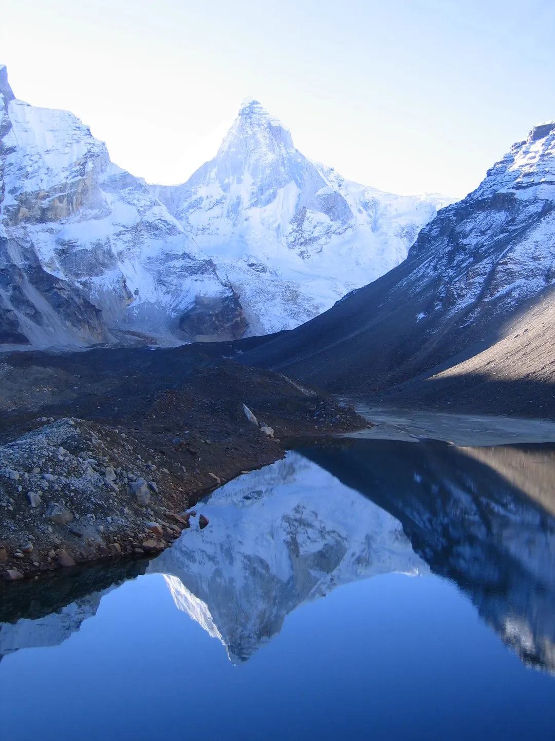
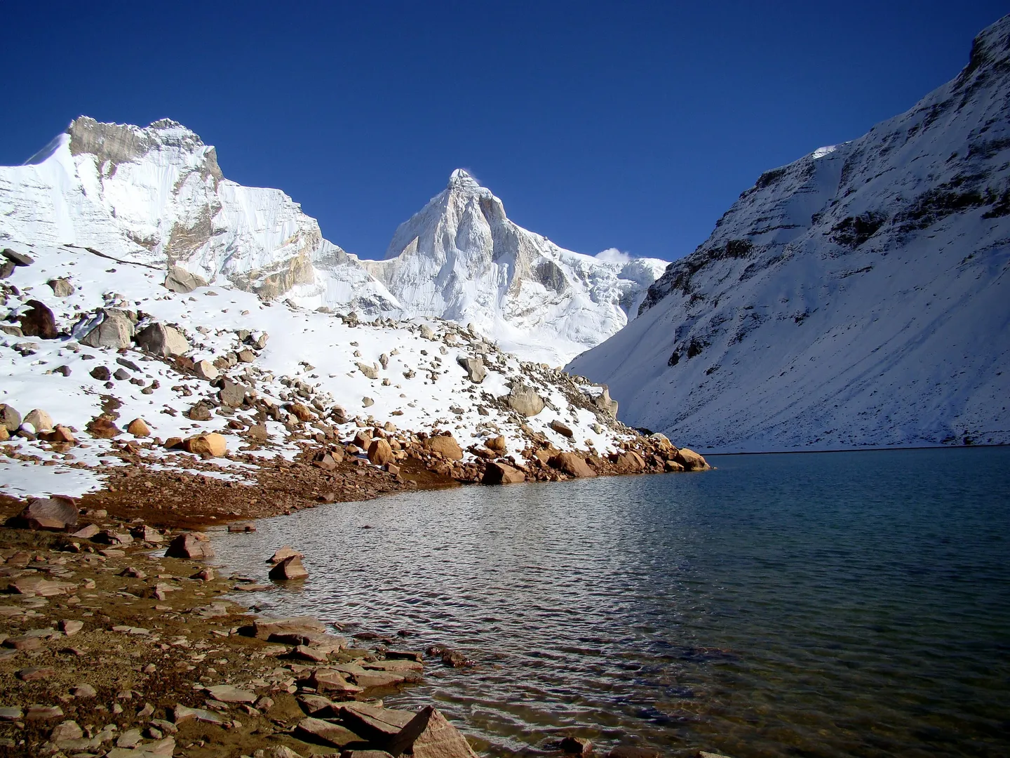
- Photo: Kailas98 · CC BY-SA 3.0
- Photo: Peter Andersen · CC BY-SA 3.0
Kedar Tal Trek
Five walking days out of Gangotri to Kedar Tal — Kedartal — a glacial lake at about 15,580 ft directly under the north face of Thalay Sagar. Roughly 17 km each way, and one of the most exposed trails in Garhwal.
Trip details
Kedar Tal is the source of the Kedar Ganga, the tributary that joins the Bhagirathi at Gangotri, and the whole trek is simply that stream followed to where it begins. The distance is short — Wikipedia's figure is 17 km from Gangotri, in three stages of 8 km, 4 km and 5 km — and that shortness is what misleads people. There is no gentle valley walk here. From the first hour the trail is cut into the true-left wall of the Kedar Ganga gorge, climbing on loose rock and scree with the river a long way below, and it stays that way almost the whole distance. The route camps twice: at Bhoj Kharak, a sloping ledge in the last birch, and at Kedar Kharak, a boulder-strewn grazing ground above the tree line. Between the two the trail crosses the section trekkers call the Spider Wall — a short, exposed traverse across a rock slab where the footing narrows and a slip has nowhere to end — and a landslide-erased stretch that has to be picked across on whatever line is stable that season. The lake is usually visited on a day walk from Kedar Kharak rather than camped beside; the far shore rises straight into Thalay Sagar. This is a hard trek by consensus rather than by marketing. Operators grade it Moderate-to-Difficult and ask for prior high-altitude experience — Himalaya Trekker's stated prerequisite is at least two multi-day treks around 4,500 m. Treat that as a floor, not a formality: the difficulty here is terrain and exposure, and neither responds to willpower.
- The Kedar Ganga meeting the Bhagirathi at Gangotri — the stream you will follow for the next 17 km, joining the river it feeds. In local telling it is Shiva's contribution to the Ganga.
- Birch forest at Bhoj Kharak, around 12,800 ft: bhojpatra, the Himalayan birch whose bark was used as writing material long before paper reached the hills. This is the tree line, and the last forest on the route.
- The Spider Wall — a short slab traverse beyond Bhoj Kharak where the path thins to boot width across bare rock, with the Kedar Ganga gorge dropping away below it.
- Kedar Kharak's boulder meadow at roughly 14,350 ft, the highest camp on the trek and an old grazing ground, ringed by moraine.
- Thalay Sagar (6,904 m) rising straight out of the far shore of the lake. Wikipedia records Kedartal as sitting at its base; its north face carries about 1,400 m of climbing through a notorious shale band, and it is the single sight the whole trek is built around.
- Bhrigupanth (6,772 m) and Meru (6,672 m) beside it — the three peaks whose snowfall feeds the lake, and part of the Gangotri group.
- Bharal, the blue sheep, on the scree above Kedar Kharak. The Wildlife Institute of India notes Gangotri National Park as the only protected area where bharal are habituated to people; Himalayan tahr and monal are also resident. Sightings are common here by Himalayan standards, which is not the same as guaranteed.
- The lake itself, changing colour through the day from grey to a hard glacial blue-green as the light moves off the ice above it.
Train for eight to ten weeks, and train for terrain rather than for distance. The daily kilometres are small; what breaks people on this route is hours of movement on unstable rock at altitude. Build to 8-10 km of brisk walking or running four times a week, add two weekly sessions of stair or hill repeats carrying a 10-12 kg pack, and do dedicated single-leg and ankle-stability work — the scree traverses punish weak ankles far more than weak lungs. Break in stiff-soled boots well before the trip; soft trail shoes do not hold an edge on a loose slab. If you have not slept above 3,500 m in the past year, do a lower Himalayan trek first rather than using this one to find out how you acclimatise.
- Sources disagree on the lake's altitude. Wikipedia gives 4,750 m (15,580 ft) and most operators quote 4,725-4,750 m; a 4,912 m / 16,116 ft figure also circulates widely and appears to be wrong. Nothing about the trek changes either way, but do not use the higher number to buy insurance cover.
- The exposure, not the altitude, is the defining hazard. The trail contours a gorge wall on loose rock for most of its length, and a landslide has erased a stretch between Bhoj Kharak and Kedar Kharak that is re-picked each season.
- Gangotri sits at about 3,100 m and is reached by road in one day from Dehradun — a gain of roughly 2,400 m before you take a single step. This is the largest and least-noticed altitude jump of the trip.
- Overnight camping at the lake itself is not the norm; the standard pattern is to camp at Kedar Kharak and visit Kedar Tal on a day walk. Confirm what your operator actually plans.
- Gangotri National Park's season runs roughly April to November and the trail is snowbound outside it. Permits are not issued in bad weather, so build a buffer day into your arrival.
- There is no reliable mobile signal past Gangotri, and no road, shop or medical post on the route. Uttarkashi, about 100 km back down the valley, is the nearest hospital.
Fly to Jolly Grant, Dehradun (DED), or take a train to Haridwar (HW) or Rishikesh (RKSH), then drive. Dehradun to Gangotri is roughly 240 km and about 9 hours up the Bhagirathi gorge through Uttarkashi, Bhatwari and Harsil — the same approach road as the Gaumukh Tapovan trek. Uttarkashi is the last town with a hospital, a pharmacy and dependable fuel. Operators normally assemble in Dehradun and drive as a group; the road is landslide-prone in and just after the monsoon, so an extra day either side is worth having.
- Stiff-soled, ankle-height trekking boots, thoroughly broken in — the single most important item on this route
- Two trekking poles with locking mechanisms you trust; on scree they are balance, not luxury
- Sleeping bag rated to -10°C or colder, plus an insulated mat of R-value 4 or above
- Down jacket, plus a windproof and waterproof outer shell
- Helmet — this route crosses loose rock below steeper ground, and most operator kit lists omit one. Ask.
- Headlamp with a full spare set of batteries
- Sunglasses rated for glacier glare, and SPF 50+ sunscreen with lip protection
- 3 litres of water capacity in bottles rather than a bladder — hoses freeze
- Personal first-aid kit, any prescription medication, and a copy of your insurance policy
Safety details & FAQ
Is Kedar Tal a good first Himalayan trek?
No. The distance is short — about 17 km each way — but the trail is cut into a gorge wall on loose rock and scree for most of its length, including an exposed slab traverse and a landslide-erased section. Operators grade it Moderate-to-Difficult and ask for prior high-altitude experience; Himalaya Trekker's stated prerequisite is a minimum of two multi-day treks around 4,500 m. Do a valley trek such as Har Ki Dun or Dayara Bugyal first.
How high is Kedar Tal, really?
Wikipedia gives 4,750 m (15,580 ft), and most operators quote 4,725-4,750 m. A figure of 4,912 m / 16,116 ft circulates widely on booking sites and appears to be an error that has been copied between them. We use 4,750 m. Either way the camps are the number that matters for acclimatisation: Bhoj Kharak at roughly 12,800 ft and Kedar Kharak at roughly 14,350 ft.
When can I do the Kedar Tal trek?
Two windows: May to mid-June, and mid-September to late October. The monsoon closes the route from late June to mid-September — the approach road slides and the gorge trail becomes genuinely dangerous — and the trail is snowbound from November to April. The two open windows are different trips: May-June is warmer, greener and hazier; late September-October gives the sharpest views of Thalay Sagar and nights well below freezing.
What permits does Kedar Tal need?
A Gangotri National Park entry and trek permit from the Uttarakhand Forest Department, obtained at the forest office in Gangotri or at the DFO office in Uttarkashi, and normally arranged by your operator. Uttarakhand has tightened requirements on the harder Uttarkashi-district routes since September 2024: a registered guide, trekking insurance and a medical fitness certificate. Carry a government photo ID throughout. Permits are not issued in bad weather and processing can take a day or two, so arrive with a buffer.
What is the Spider Wall?
The trekkers' name for a short rock-slab traverse between Bhoj Kharak and Kedar Kharak where the path narrows to roughly boot width across bare, sloping rock above the gorge. It is not technical climbing and needs no rope in normal conditions, but it demands balance and a steady head, and it becomes markedly more serious when the rock is wet or iced. If heights genuinely frighten you, this is the section to think hard about before booking.
Do we camp at the lake?
Usually not. The standard itinerary camps at Kedar Kharak, roughly 14,350 ft, and walks up to Kedar Tal and back in a day. Some operators do camp at the lake; it means a night at a higher sleeping altitude with correspondingly less margin. Ask which your operator plans and why, and treat the answer as a signal about how they think.
How does Kedar Tal compare to Gaumukh Tapovan?
They share a trailhead, a national park and a permit regime, and both are hard. Gaumukh Tapovan is longer, crosses the Gangotri Glacier's terminal moraine and climbs a steep loose gully, and sleeps at 4,463 m. Kedar Tal is shorter and has no glacier crossing, but is more continuously exposed: it spends far more of its length on a steep gorge wall. Neither is a beginner trek.