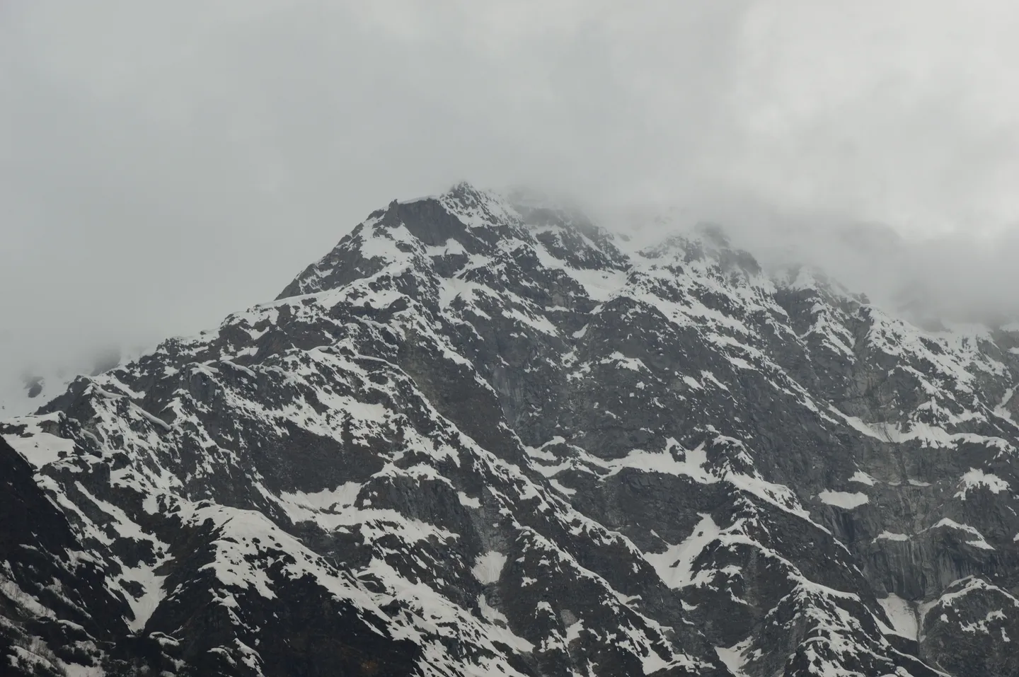
- Photo: Biswarup Ganguly · CC BY 3.0
Friendship Peak
Hosted by The Crazy Mountaineers
A 5,289 m snow-and-ice climb above Beas Kund, widely sold as a first mountaineering peak - with a glacier, a crevasse field and a summit ridge that have killed.
Trip details
Friendship Peak rises at the head of the Beas Kund cirque in the Pir Panjal, above Solang and Dhundi and within sight of Manali. It is the most-climbed mountaineering objective in Himachal Pradesh - the state's own peak register marks it 'most expeditions' - and it is the peak the mountaineering institute at Manali uses for its climbing excursions. That popularity is why it is marketed as an entry-level 5,000er, and the marketing is only half true. The walk-in is genuinely easy: a short drive to Dhundi, then two straightforward days up grazing meadows at Bakarthach and Lady Leg. What follows is not trekking. From the high camp the route crosses moraine onto glacier, is roped for crevasse hazard, and then climbs a long snow slope to a col, a shoulder and finally a corniced summit ridge - eight to fourteen hours of continuous movement in crampons with an ice axe in hand, starting somewhere between midnight and 2 am. In November 2022 a climber was swept by an avalanche twenty metres below the summit; his body was never found, and the search was abandoned because of hidden crevasses on the glacier below. The honest description is a short, accessible, non-expedition climb that still demands real snow-and-ice competence, a rope team and the discipline to turn around. Treat any listing that calls it a trek as a listing that has not read the mountain.
- Solang and Dhundi at the road end, with the Beas coming down beside you.
- Bakarthach's grazing meadow, and Lady Leg camp above it, where the walking ends and the mountaineering starts.
- The Beas Kund cirque — the source basin of the Beas, ringed by Hanuman Tibba, Shitidhar, Ladakhi and the Seven Sisters.
- The glacier and its crevasse field, crossed roped and in crampons. This is the section that makes Friendship a climb rather than a trek, whatever the marketing says.
- The summit ridge at 5,289 m, corniced and narrow.
- Indrasan, Deo Tibba and the Pir Panjal from the top, with the Chandra valley beyond.
- Hanuman Tibba (5,928 m) directly across the cirque for most of the climb.
Protect the acclimatisation and training day at Lady Leg - it is the structural difference between a defensible itinerary and a cheap one, and it doubles as the day you learn to self-arrest. Prefer itineraries that include a load ferry to the summit camp and a return to Lady Leg to sleep, which is textbook climb-high-sleep-low. Drink 3-4 litres a day, eat when you do not want to, and skip alcohol in Manali the night before you leave. Insist that the group carries supplementary oxygen, a pulse oximeter with readings logged twice daily, dexamethasone and nifedipine under the leader's control, and a written evacuation plan naming Dhundi as the road head and the receiving hospital in Manali or Kullu. The descent is the mitigation that always works: Lady Leg is only 8-9 km of trail above a road, and losing 1,000 m from the summit camp can be done in an afternoon. If symptoms are worse in the morning than they were the night before, you are not summiting - you are descending.
- This is the part most listings understate, so it is stated plainly. You must be able to: walk confidently in crampons on hard snow and 30-45 degree slopes, including traversing and descending, for hours rather than minutes; hold and use an ice axe in the uphill hand and perform a reliable self-arrest on your front, back and head-first; move as a member of a roped glacier team - keeping the rope at the right tension, not stepping on it, and knowing what to do if the person ahead disappears; and, on operators who fix line on the steeper section, clip and manage an ascender and a descender with gloves on. Group gear that should be on the mountain includes rope, snow stakes or pickets, ice screws or pitons, carabiners and slings; Kahlur Adventures lists fixed rope, snow stakes and ice pitons as operator-supplied on a comparable Himachal peak, and Ascent Descent lists ropes, anchors and slings as group gear here. Personal technical gear - crampons, axe, harness, helmet, boots - is usually rented from the operator, which makes the day-1 fitting check load-bearing rather than administrative. Prior formal mountaineering training is not demanded by most operators. It should be: the single training day on the mountain is a demonstration, not a course, and the mountain does not distinguish between the two.
- This is not a first Himalayan objective, whatever the grade on the listing says. The most demanding independent prerequisite published for it - TrekNomads - asks for a prior successful trek above 5,000 m plus a measured fitness standard: 5 km run under 35 minutes, or 10 km cycling under 40 minutes, or 1 km swim under 40 minutes, or 50 floors of stairs in 30 minutes, with a medical certificate and indemnity bond. Trekking in India asks for 5 km in 30 minutes or 10 km in 70 minutes, a 10-12 kg pack, BMI 18-26, and prior high-altitude experience. Himalayan Frontiers asks for prior trekking above 3,000-4,000 m. Train for 8-12 weeks: build to 8-10 km of running or fast walking four times a week, two weekly sessions of stair or hill repeats with a 10-12 kg pack, and single-leg strength and ankle-stability work, because the descent off the moraine on tired legs is where people get hurt. If you have never used crampons or an ice axe, the training day on the mountain is a demonstration, not a course - consider a basic mountaineering course first.
- IMF trekking peak booking (Friendship Peak) — Indian Mountaineering Foundation (IMF), 6 Benito Juarez Marg, New Delhi — Friendship Peak appears by name on the IMF's own trekking-peaks register at 5,289 m - this is the one permit fact on this peak that is verifiable from a primary source rather than from operator copy. IMF's published peak-fee schedule puts trekking peaks at US$200 for a party of 2, plus US$50 per additional member for members 3-7 and US$100 each for members 8-12; applications are asked for 90 days ahead and the peak is booked on a first-come basis. Operator statements on what a foreign national actually pays vary widely - Himalayan Frontiers quotes 'from US$250 per person', others quote US$500 for a team of two - so get the number in writing. The fee document I read did not show a separate Indian-national rate, and several Indian operators simply fold 'peak fee' into the package price. Indian climbers should ask the operator to confirm which permit was actually filed and in whose name.; Himachal Pradesh forest entry and camping permit (Beas Kund / Dhundi) — Himachal Pradesh Forest Department, Kullu division - the forest office at Manali — The Beas Kund approach runs through forest-department land and needs an entry and camping permit; every operator lists it as included and independent trekkers are told to apply at the Manali forest office. Carry original photo ID. Note that the Beas Kund trail is one of the routes on which high-altitude trek registration is described as strictly enforced. Himalaya Destination's page states that the wildlife department has waived the forest permit and camping fee for foreign nationals - I could not verify that against a departmental notification and it should be treated as an operator claim, not a fact.; Registered operator and certified guide (Himachal adventure activity rules) — Himachal Pradesh Department of Tourism and Civil Aviation, under the Himachal Pradesh Miscellaneous Adventure Activities Rules — Adventure operators in Himachal must be registered with the state tourism department, guides and instructors must hold valid certification, and operators are required to hold an emergency action plan for the specific route and a first-aid kit including an oxygen cylinder and pulse oximeter. Tourists are advised to hire only government-registered guides and porters and to leave trip details with local authorities before departure. Kangra district separately moved in 2025 to require registration of every trekker, GPS tracking on every trek and a maximum guide-to-trekker ratio of 1:10 - that measure is Kangra-specific and does not automatically apply in Kullu, but it indicates where the state is heading. Ask for the registration number.; Not required: Rohtang permit or e-Aagman registration — n/a — Worth stating because bookers confuse this with the Lahaul-side trips. Friendship Peak is approached entirely from the Kullu side via Solang and Dhundi - you do not cross Rohtang, you do not use the Atal Tunnel, and you do not enter Lahaul-Spiti district. The Rohtang Pass vehicle permit and the mandatory free e-Aagman registration for entering Lahaul-Spiti are irrelevant to this climb. Indian citizens need no inner-line or protected-area permit anywhere in Himachal; foreign nationals need a Protected Area Permit only for the restricted Kinnaur and Spiti zones, which this route does not touch.
- Two authorities, in parallel. The peak itself is booked through the Indian Mountaineering Foundation, on whose trekking-peaks register Friendship Peak is listed at 5,289 m. Access, entry and camping on the Beas Kund approach are permitted by the Himachal Pradesh Forest Department, Kullu division, through the Manali forest office. The operator must additionally be registered with the HP Department of Tourism and Civil Aviation under the state's adventure-activity rules, and the guide must be certified. There is no single window - ask which permits your operator actually filed and see them.
- Four situations. First, being on the summit ridge after fresh snowfall, or late in the day when the snow has warmed - that is the avalanche scenario that killed a climber here in November 2022. Second, an unroped or badly managed rope team on the glacier: the crevasses are real, they are hidden under snow in the main season, and a solo or loosely roped party has no recovery. Third, pushing past the turnaround time. Summit day runs 8-14 hours and every hour past the agreed turnaround is an hour of descent in worse snow, worse light and worse judgement. Fourth, going in the shoulder or winter months, which is precisely when the peak looks quiet and appealing from Manali. The 2022 party set out on 17 November. One turned back sick, one died, and his body was never recovered.
- A certified guide is effectively mandatory and should be treated as non-negotiable regardless of what the letter of the rules says. Himachal's adventure-activity rules require operators to be state-registered and guides to hold valid certification, and the state advises hiring only government-registered guides and porters. Beyond the regulation: the route crosses a crevassed glacier and finishes on a corniced ridge, which means rope-team management, anchor placement and the turnaround decision all sit with someone who has to be competent. Ask for the guide's certification (ABVIMAS or NIM basic/advance mountaineering course), the client-to-guide ratio on summit day, and who has the authority to turn the party around - and get that last answer before you pay. The November 2022 fatality was a self-organised party of three.
Nearest railhead: Joginder Nagar (JDNX) at about 160 km is the nearest station but is narrow-gauge with very limited connectivity. For practical purposes the railheads are Chandigarh (CDG) at about 310 km and Ambala Cantt (UMB) at about 350 km, both followed by an overnight bus or car to Manali.. Nearest airport: Bhuntar / Kullu-Manali Airport (KUU), about 50-52 km south of Manali. It is a small strip with a poor weather record and frequent cancellations; most people fly to Chandigarh or Delhi and drive..
- 3-4 quick-dry full-sleeve base tops - full sleeve, because UV reflected off snow at 5,000 m burns anything exposed
- 2 fleece or synthetic mid-layers, one light and one heavy
- 1 down jacket, 650-fill or better, genuinely rated for around -15 C for the summit-camp night and the pre-dawn start
- 1 waterproof breathable hardshell jacket with a helmet-compatible hood, taped seams
- 1 pair of hardshell or softshell climbing trousers, plus waterproof overtrousers - jeans and cotton track pants are not a joke on this route, they are a hypothermia mechanism
- 2 thermal base-layer sets, one kept strictly dry for sleeping
- Insulated beanie plus a balaclava or buff - the summit ridge is windy and there is nothing to shelter behind
- Two pairs of gloves minimum: thin liners for handling hardware and rope, plus insulated waterproof outers or mitts. Carry a spare pair; a glove dropped on the ridge is gone
- 5-6 pairs of wool or synthetic socks plus one thick dedicated sleeping pair
- Category 4 glacier sunglasses with side protection, and a spare pair. Snow blindness on a glacier is not a discomfort, it is a rescue
- Rigid or semi-rigid mountaineering boots that take a crampon properly. Most operators rent these (Himalaya Destination lists Scarpa climbing boots as a rental) - if you are renting, fit them on day 1 with the crampons you will actually use, not on summit night
- Trekking boots for the walk-in to Lady Leg, broken in beforehand
- Gaiters - mandatory once you are on snow
- Camp shoes for the evenings
- Crampons, ice axe, climbing harness, helmet, carabiners, sling, ascender/descender - almost always issued as group or rental gear by the operator, but confirm in writing what is provided and what you are expected to bring. A helmet is not optional on a route with moraine, rock and a corniced ridge
- 50-60 litre rucksack with a rain cover, plus a small summit pack if the operator uses one
- Sleeping bag rated to around -10 to -15 C comfort, plus a sleeping mat with an R-value of 4 or better - the summit camp is on moraine and cold comes up from underneath
- Two trekking poles for the approach and the descent; they are not a substitute for an axe and you will stow them once roped
- Headlamp with a fresh set plus a full spare set of batteries - summit day starts in the dark and cold flattens batteries fast
- 2-3 litres of insulated water capacity in bottles, not a bladder; bladder hoses freeze on summit day
- Water purification tablets or a filter - everything above Dhundi is glacial melt
- SPF 50 sunscreen and SPF lip balm, reapplied. Reflected UV burns the underside of the nose, chin and ears
- High-calorie snack food you will actually eat when your appetite has gone
- Powerbank - there is no charging above Dhundi and no signal above Solang
- Original government photo ID plus photocopies - checked at the forest post and required for the peak permit paperwork
- Passport and valid Indian visa for foreign nationals, plus passport photographs - foreign climbers go through the Indian Mountaineering Foundation process and pay a peak fee
- Medical fitness certificate from a registered doctor - required as standard by operators on this peak (TrekNomads lists it as mandatory alongside an indemnity bond)
- Adventure or mountaineering insurance explicitly covering climbing above 5,000 m and helicopter evacuation. Standard travel insurance excludes mountaineering; read the exclusion clause, not the brochure
- Signed indemnity/NOC form as required by the operator
- Your operator's registration details and your guide's certification - Himachal requires adventure operators to be registered with the state tourism department and guides to hold valid certification
- Acetazolamide (Diamox) is routinely discussed on this profile, but whether you take it and at what dose is a decision for a doctor who knows your history. Never take it for the first time on the mountain
- Dexamethasone and nifedipine are the emergency drugs for severe AMS, HACE and HAPE. These belong in the trek leader's controlled kit, administered by someone trained, and are a bridge to descent - never a substitute for it
- A personal pulse oximeter is worth carrying in addition to expecting one in the group kit; two evenings of falling saturation is information you want before committing to summit day
- Paracetamol or ibuprofen, oral rehydration salts, antiemetic tablets
- Blister and foot-care kit - rented rigid boots on unfamiliar feet is the classic way to lose a summit
- Antiseptic, sterile dressings, crepe bandage - moraine produces gashes and turned ankles
- Personal prescription medication in original packaging with three days spare
- Sunburn and cold-injury care: high-SPF lip balm, and know what early frostnip on fingers and toes feels like before you are on the ridge
What's included
- Accommodation in Manali on twin/triple sharing basis
- Accommodation and camping during the expedition
- All meals during the trekking/expedition period
- Breakfast
- Lunch
- Dinner
- Hot tea/coffee at camps
- Manali to Dhundhi transportation
- Solang/Dhundhi to Manali transportation
- Manali to Bharatpur transportation
- Bharatpur to Manali transportation
- All required local transportation as mentioned in the itinerary
- Experienced Expedition Leader / Mountaineering Guide
- High-altitude support staff
- Technical climbing support
- Cook and support staff
- Camping equipment: high-altitude tents
- Dining tent
- Kitchen tent
- Toilet tent
- Sleeping mats
- Common technical expedition equipment
- Ropes and essential climbing equipment
- Ice axe and crampon support, wherever required
- Load ferry support
- Trekking/expedition permits and local forest charges
- Camping and campsite charges
- Porter/mule support for common expedition equipment
- First-aid and basic medical kit
- Emergency communication support
- Expedition briefing and technical orientation
- 2 buffer days for weather/route delays
Safety details & FAQ
Is Friendship Peak good for beginners?
It is a good first mountaineering peak; it is not a good first mountain. The walk-in to base camp is easy, but summit day is 8-14 hours in crampons with an ice axe, roped across a crevassed glacier, finishing on a corniced ridge. A climber died here in November 2022 when an avalanche caught him 20 metres below the summit, and the search was abandoned because of hidden crevasses on the glacier. Independent operators ask for a prior trek above 5,000 m and measured fitness standards. If a listing calls this a trek, it has not read the mountain.
Do I need mountaineering experience for Friendship Peak?
Most operators say no and provide a one-day training session at base camp. Be honest about what that day can deliver: it is a demonstration of crampon technique, ice-axe self-arrest and roped movement, not a course. You need to be able to walk in crampons on 30-45 degree hard snow for hours, self-arrest reliably from your front, back and head-first, and move as a member of a rope team. If you have never done any of that, do a basic mountaineering course first — this is the peak people go to after a course, not instead of one.
What permits do I need for Friendship Peak?
Two, in parallel. The peak is booked through the Indian Mountaineering Foundation — Friendship Peak is on the IMF's own trekking-peaks register at 5,289 m, and IMF's published trekking-peak fee is US$200 for a party of two plus US$50 per extra member up to seven. Separately you need a Himachal Pradesh forest entry and camping permit for the Beas Kund approach, issued through the Manali forest office. You do not need a Rohtang permit or e-Aagman registration — those are for Lahaul, and this route never leaves Kullu district.
When is the best time to climb Friendship Peak?
Two windows that give you different climbs. Mid-May to mid-July is the snow season: continuous snow cover on the summit slope, crevasses bridged, warmer, busier. September and October is post-monsoon: clear air, superb views, far fewer people, but more bare ice and rock, open crevasses and real cold. Avoid mid-July and August entirely for the monsoon, and avoid November through April — the one documented fatality on this peak was a 17 November attempt.
How hard is Friendship Peak summit day?
It is the whole trip. You leave the high camp between midnight and 2 am, cross moraine onto the glacier and rope up, then climb a long snow slope for four to five hours to a col, about three hours more to the shoulder, and a final two hours along the exposed, corniced summit ridge — 8 to 14 hours round trip and roughly 900 to 1,250 metres of gain, depending on where your camp is. Agree the turnaround time at camp the night before and hold it. Most accidents in mountaineering happen on the way down.
How high is Friendship Peak exactly?
5,289 m / 17,352 ft is the best-supported figure and what most operators use. Sources disagree slightly: Wikipedia gives 5,287 m / 17,346 ft, the Himachal Pradesh peak register gives 5,290 m, and IMF's trekking-peaks register gives 5,289 m. Watch for the common '5,289 m / 17,346 ft' pairing — those two numbers don't convert to each other. Ignore the outliers you'll see quoted at 5,394 m and 17,490 ft; neither is supported.
What happens if someone gets hurt or sick on Friendship Peak?
You are closer to help than on most Himalayan climbs and still a long way from it. Lady Leg base camp is 8-9 km of trail above the Dhundi road head, and Dhundi is 21-22 km from Manali, so a walking casualty can reach hospital the same day. A non-walking casualty cannot: there is no vehicle access and no mule track above Bakarthach. There is no mobile signal above Solang. Rescue draws on ABVIMAS Manali, the local operator association, the Army and ITBP — capable people who in 2022 still could not recover a body and called the search off after thirteen days.