 1 / 3
1 / 3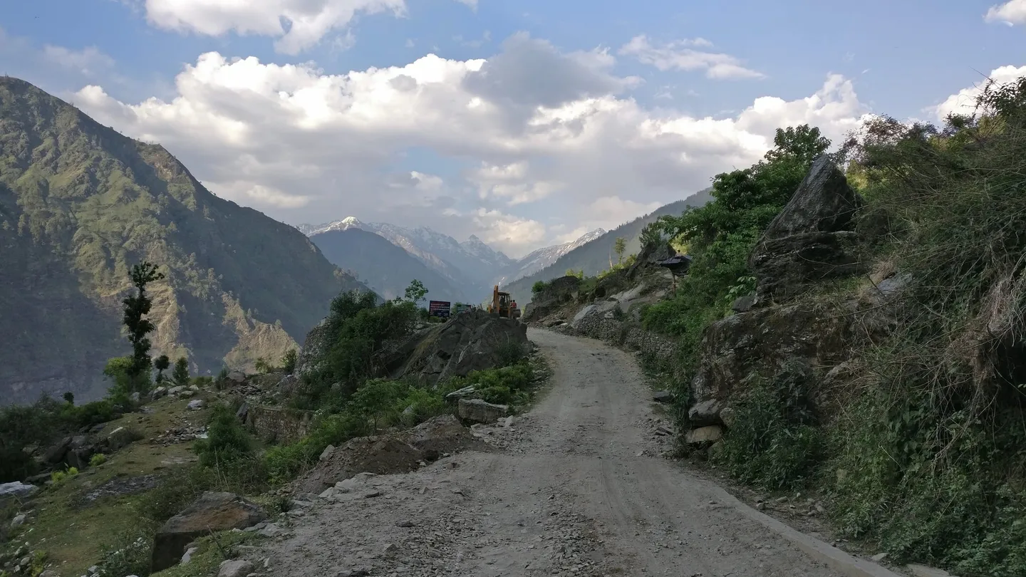
- Photo: Govind Shirude · CC BY-SA 4.0
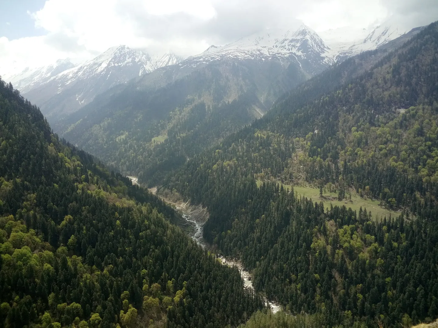
- Photo: Pathaharapathik · CC BY-SA 4.0
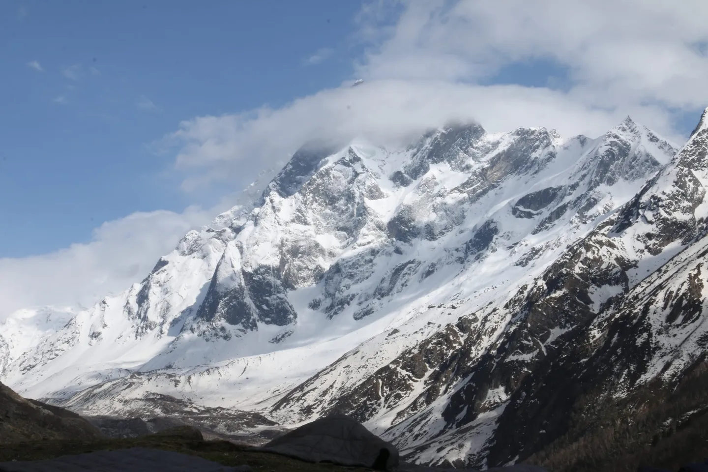
- Photo: Govind Shirude · CC BY-SA 4.0
Dev Kyara Bugyal Trek
A high meadow in the Supin valley above Sankri, inside Govind Pashu Vihar National Park — published between 3,850 m and 4,100 m, walked on the quiet side of the same forest that carries the crowds to Har Ki Dun.
Trip details
Start with the thing most likely to send you to the wrong valley. Dev Kyara is not Dayara. Dayara Bugyal is the well-known winter meadow above Raithal and Barsu, on the Gangotri road, and it is a separate trek on this site. Dev Kyara — also written Devkyara — is in the Supin valley above Sankri, about 150 km away by road, inside Govind Pashu Vihar National Park. The names rhyme and almost nothing else about the two treks matches. What Dev Kyara offers is the Har Ki Dun forest without the Har Ki Dun traffic. It leaves from the same roadhead, shares the first part of the same approach along the Supin, and then turns off up a tributary into a meadow that very few people walk. Published altitudes for the top of it range from 3,850 m to 4,100 m, and published distances from about 32 km to 50 km, which tells you plainly how lightly documented this route still is compared with its famous neighbour. That obscurity is the whole proposition and also the whole caution. There is no established consensus itinerary, no Wikipedia article, and no photograph of the meadow in any free archive we could find. What there is, consistently across every operator who runs it, is a long walk through old forest to open grazing ground with Swargarohini and Kala Nag on the skyline, and hardly anyone else on it.
- Sankri at 1,950 m, the roadhead village at the end of a nine- to ten-hour drive from Dehradun, and the last place on the route with a dependable mobile signal.
- The Supin river valley on the walk in — the same approach that carries trekkers towards Har Ki Dun, before your route turns off up a side stream and the traffic does not follow.
- Oak, deodar and rhododendron forest inside Govind Pashu Vihar National Park, a protected area that also holds snow leopard and Himalayan brown bear on paper, though seeing either is not a thing to plan a trip around.
- Osla, the old Supin-valley village whose carved wooden temple is dedicated to Duryodhana — a dedication you will find in very few places in India, and one the villagers take seriously.
- The Obra Gad, the tributary the route follows up out of the main valley towards the meadow, and the camp beside it that most itineraries use.
- The bugyal itself: open summer grazing ground somewhere between 3,850 m and 4,100 m depending on whose figure you believe, still used by shepherds who bring flocks up for the short season.
- Swargarohini on the skyline, along with Kala Nag — Black Peak, 6,387 m — Bandarpunch and Ranglana, most of which you can also reach from this same roadhead if you come back.
- Almost nobody else. This is the practical difference between Dev Kyara and every other trek out of Sankri, and it is the reason to choose it.
Train for distance on consecutive days rather than for one steep push, and train for at least 4,000 m. Build to 6-8 km of brisk walking four or five times a week over eight weeks, and add a weighted pack on hills, because the days here are long and the trail is not manicured. If you have never slept above 3,500 m, do a lower Himalayan trek first — this one tops out near 4,000 m in a place where a road is several days behind you. Expect to be self-sufficient in a way that Har Ki Dun does not demand: fewer teahouses, fewer people on the trail, and much less written down about where you are going.
- This is not Dayara Bugyal. Dayara is above Raithal and Barsu on the Gangotri road and is a separate, easier, better-documented winter trek. If a quote mentions Raithal, Barsu or Bhatwari, you are being sold the other meadow.
- The route is inside Govind Pashu Vihar National Park. Entry permits are issued through the forest check-post on the Netwar-Sankri road, normally arranged by your operator, and camping is regulated.
- Published altitudes disagree by 250 m — from 3,850 m to 4,100 m — and published distances by nearly 20 km. Ask for a day-by-day with distances and camp altitudes before you book, and treat any operator who will not give you one as a warning.
- This is a camping trek, not a teahouse trek. Tents, a cook and porters or mules are part of what you are paying for.
- It is not a winter route. Unlike Dayara Bugyal, no source we found sells Dev Kyara as a snow trek; the season is late spring and post-monsoon autumn.
- Purola is the last real market and the last dependable mobile coverage on the drive in. Buy what you have forgotten there, not at Sankri.
Fly to Jolly Grant airport at Dehradun or take a train to Dehradun, then drive. It is roughly 200 km and nine to ten hours to Sankri, via Mussoorie, Purola, Mori and Netwar, and it is a full day however you do it — most operators leave Dehradun early and assemble at Sankri that night. Sankri sits at 1,950 m and is 195 km from Uttarkashi town by the Mori road, which matters because Uttarkashi, not Sankri, is where the district hospital is. Purola, about 30 km back down the valley, is the nearest town with a market and basic medical care.
- Broken-in trekking boots with ankle support — this is a rough, lightly-maintained trail, not a graded path
- Insulated jacket and thermal base layers; nights near 4,000 m drop below freezing even in June
- Waterproof shell, top and bottom, and a pack cover — the Supin valley catches weather off the monsoon edge in both shoulder seasons
- A sleeping bag rated well below the temperature you expect, since you are in tents throughout
- Sun hat, sunglasses and SPF 50+ for the open meadow, where there is no shade at all
- Headlamp, spare batteries, and a power bank — no charging after Sankri
- 2 litres of water capacity and purification
- Government photo ID for the national park check-post
Safety details & FAQ
Is Dev Kyara the same as Dayara Bugyal?
No, and this is the single most common mistake made about this trek. Dayara Bugyal is a meadow above the villages of Raithal and Barsu in the Bhagirathi valley, reached from the Uttarkashi-Gangotri road, and it is popular as a winter snow trek. Dev Kyara is in the Supin valley above Sankri, inside Govind Pashu Vihar National Park, roughly 150 km away by road in a different river system, and it is walked in late spring and autumn rather than in snow. Both are on this site as separate adventures. The names are similar and nothing else is.
How high does it actually go?
Published figures disagree by a wide margin, and we would rather say so than pick a flattering one. Operators variously give the top of the meadow as 3,850 m, 3,900 m, 4,000 m and 4,100 m, with 4,100 m (about 13,450 ft) the most frequently repeated. There is no government survey figure and no encyclopedic entry to settle it. Plan and acclimatise for 4,100 m, and ask your operator which figure their itinerary is built on.
How long is the trek?
Between five and eight days on the trail depending on the operator, with seven the most common, plus a day of driving at each end. Published distances run from 32 km to 50 km, a spread that mostly reflects where the vehicle drops you and how far up the valley the route goes rather than a genuine disagreement about the path.
When should I go?
May and June, or September through October and sometimes into November. The monsoon closes it in July and August, when the trail is unsafe and the valley gives you cloud rather than a view. It is not a winter trek and should not be sold to you as one.
What permits do I need?
A Govind Pashu Vihar National Park entry permit, issued at the forest check-post on the Netwar-Sankri road and normally arranged by the operator as part of the trip. Carry government photo ID. Uttarakhand has been tightening trekking regulation generally, including registration and medical-fitness requirements on some routes, so confirm the current position with your operator rather than with a blog.
Why are there no photographs of the meadow on this page?
Because no freely-licensed photograph of Dev Kyara Bugyal exists in any public archive we could find, and we will not caption a picture of somewhere else as if it were this place. The images here are the Supin valley on the approach, the road into Sankri, and Swargarohini photographed from the neighbouring valley — each one labelled as exactly what it is. We will replace them the day an operator who runs this route sends us real ones.
Is this a good first Himalayan trek?
No. It is a reasonable second or third one. The altitude is close to 4,000 m, you sleep in tents throughout, the route is far less travelled and far less documented than Har Ki Dun or Kedarkantha out of the same village, and help is days rather than hours away. Do one of those first, then come back for this.