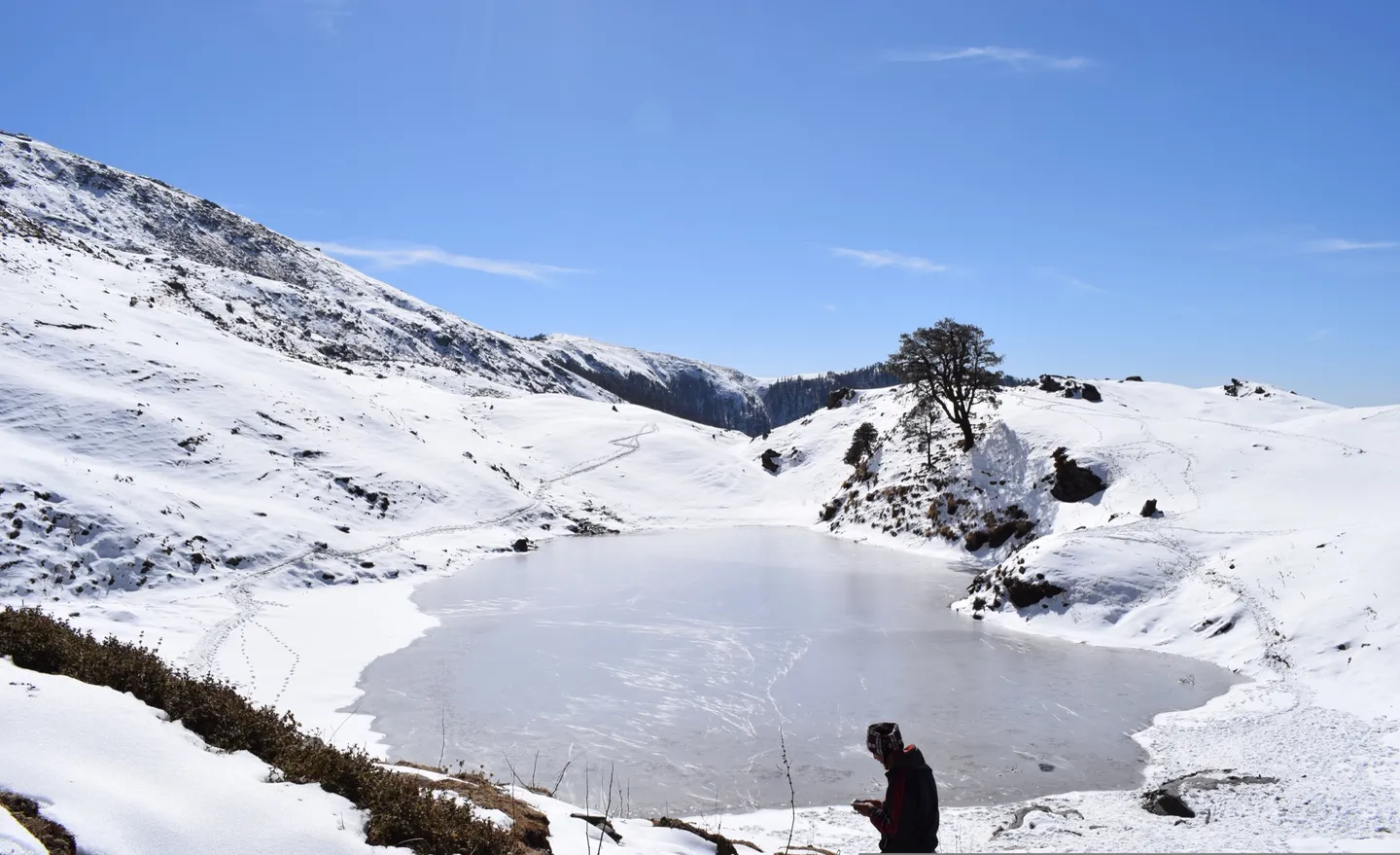
- Photo: Arijit95jitu · CC BY-SA 4.0
Brahmatal Trek (Bhekal Tal - Brahmatal)
Six days from Lohajung over two frozen lakes to a ridge at about 12,250 ft, staring straight at Trishul and Nanda Ghunti across the Roopkund valley.
Trip details
Brahmatal runs along the ridge west of the Roopkund trail, out of the same base village at Lohajung in Chamoli district, and it exists as a winter trek in a way few Indian routes genuinely do. From Lohajung the trail climbs through oak and rhododendron to Bekal Tal, a small lake in the forest at about 9,900 ft that the operator's own name for the trip renders as Bhekal Tal, and which local usage translates as frog lake. From there it gains the ridge, passing Jhandi Top, to Brahmatal itself, a second lake at roughly 10,450 ft in a bowl below the crest. The summit day climbs to the Brahmatal top at about 12,250 ft and delivers what people actually come for: an unusually close, unobstructed view of Trishul and Nanda Ghunti, with the Ali and Bedni meadows and the Roopkund ridge laid out opposite. From December to March the whole upper route is snow, both lakes freeze solid, and night temperatures on the ridge fall to minus ten or lower. This is a beginner-friendly route in gradient and distance, but the combination of a 10-hour drive from Kathgodam, two nights above 3,000 metres and real cold makes it a step up from a meadow walk.
- Oak and rhododendron forest out of Lohajung, in flower in March and April and bare under snow from December.
- Bekal Tal at 9,900 ft, the first lake, frozen through the winter months.
- Jhandi Top's ridge, where the forest ends and the walk turns into a skyline traverse.
- Brahmatal lake at 10,450 ft, in a bowl below the ridge and frozen from about December to March.
- Trishul (7,120 m) and Nanda Ghunti (6,309 m) from Brahmatal Top at 12,250 ft, close and unobstructed — the closest either peak comes to a trek of this grade.
- The Ali and Bedni meadows and the Roopkund ridge across the valley, laid out from the top.
- Night skies at camp in a valley with almost no settlement light below 10,000 ft.
Sleep well before you travel, because the drive alone leaves most people dehydrated and short of sleep. Drink 3 to 4 litres a day, which is harder in the cold and harder still because water sources at the higher camps are scarce and everything freezes. Avoid alcohol entirely and do not take sleeping tablets, which suppress the breathing drive at altitude. Use the afternoons at Bekal Tal and Brahmatal to walk up a hundred metres and come back rather than lying in the tent. Report headache when it starts. Himalayan Hikers state they carry out twice-daily oximeter checks and carry emergency oxygen, and The Searching Souls state they run a medical tent with oxygen at each campsite; ask your operator to confirm the same in writing and to show you the cylinder before you leave Lohajung. If symptoms are not improving, or there is confusion, loss of balance, breathlessness at rest or a wet cough, descend immediately, at night if necessary.
- The operator grades this Easy - Moderate; independent sources support Easy-Moderate in spring and autumn; Moderate in deep winter. We list the sourced grade — see the sources below.
- Uttarakhand Forest Department; the forest entry permit for the Brahmatal trail is issued at the check post at Lohajung, within the Badrinath Forest Division of Chamoli district. Brahmatal lies outside the restricted core of Nanda Devi National Park and no Inner Line Permit applies.
- Build for six weeks. A workable target is 5 km of jogging in 35 minutes, or a 45 minute brisk walk with 400 m of ascent, done comfortably three times a week, plus two sessions a week of stairs or hill repeats carrying a 6 to 8 kg pack. Train for the summit day, which is 7 to 9 hours with about 500 m of climb and a long descent, in cold. Anyone who cannot climb ten flights of stairs without stopping should postpone. This route is regularly sold to complete beginners and is a reasonable choice for one, provided they arrive genuinely fit and properly insulated rather than merely enthusiastic.
- Three realistic scenarios. First, cold and wind on the summit ridge: an under-insulated trekker with wet gloves standing in wind at minus ten on an unsheltered crest is a hypothermia and frostbite case, and this is the most likely serious incident on the route. There are documented instances of trekkers being evacuated from Brahmatal in bad weather. Second, an ignored altitude illness at the Brahmatal camp, where you are two days from a road head and three from a hospital. Third, a heavy snowfall event that pins a group on the ridge or closes the road behind them, which on a route with a 10-hour drive at each end is a serious logistical problem as well as a safety one. Walking on the frozen lakes deserves a specific mention because it is common, unmonitored and entirely avoidable.
Nearest railhead: Kathgodam (KGM), approximately 210 to 234 km from Lohajung, 9 to 11 hours by road via Bhowali, Almora, Kausani, Gwaldam and Dewal. This is the operator's pickup point. The alternative approach from Rishikesh or Haridwar via Devprayag, Rudraprayag and Karnaprayag is roughly 250 km and 8 to 11 hours; different operators use each and the choice determines where your onward travel has to be booked from.. Nearest airport: Pantnagar (PGH), approximately 256 to 267 km from Lohajung, is the nearest airport to the Kathgodam approach. Jolly Grant, Dehradun (DED) is roughly 220 km via the Rishikesh approach but a longer drive in practice. Neither is convenient; most trekkers arrive by overnight train to Kathgodam.. Basecamp: Lohajung (about 7,600 ft / 2,330 m), Tharali block, Chamoli. There is no ATM, petrol pump or restaurant at Lohajung, so draw cash and fill up at Dewal or earlier..
- 1 x thermal base layer set, merino or synthetic, mid to heavy weight (200 to 260 gsm), plus a second dry set reserved for sleeping
- 2 x quick-dry trekking trousers plus 1 x insulated or fleece-lined trouser for camp
- 2 to 3 x quick-dry full-sleeve trekking t-shirts
- 2 x fleece or synthetic mid layers, roughly 200 and 300 weight
- 1 x down or synthetic insulated jacket rated to about minus 15 C. The ridge camps are exposed and this is the layer that decides whether you enjoy the evening or hide in the tent
- 1 x waterproof and windproof hardshell with a hood and taped seams, sized to fit over everything. Wind on the summit ridge is the defining condition of this trek
- 1 x waterproof overtrousers
- 1 x insulated beanie covering the ears, plus a balaclava or second buff for the summit ridge
- 2 x neck gaiters or buffs
- 3 x gloves in a layered system: thin liner, insulated fleece, waterproof shell mitt
- 5 pairs of wool or wool-blend trekking socks, plus 1 thick pair reserved exclusively for sleeping
- 1 x pair of thermal leggings for camp and sleeping
- 1 x waterproof, insulated, high-ankle trekking boots with a lugged sole, broken in over at least 50 km
- Gaiters, mandatory from December to March and worth carrying in late March and April
- 1 x lightweight closed-toe camp shoes or insulated booties
- 1 x spare pair of insoles so one set can dry inside your sleeping bag overnight
- 50 to 60 litre backpack with a padded hip belt and rain cover if you carry your own load, or a 20 to 30 litre daypack if you offload. The operator charges separately for porter and mule support
- Sleeping bag with a comfort rating of about minus 15 C for December to February and about minus 5 C for April and May. Ask for the number in writing
- Sleeping mat with an R-value of 4 or better in winter; 3 or better in spring
- 2 x trekking poles with snow baskets fitted. The summit-day descent to Tilbudi is the longest continuous descent on the trek
- Microspikes or instep crampons for December to March. The Bangalore Mountaineering Club and Himalayan Hikers both list crampons and gaiters as supplied; confirm with your operator
- Headlamp with fresh batteries and a full spare set kept in an inside pocket
- 2 to 3 litres of capacity in wide-mouth insulated bottles, stored upside down overnight so ice forms at the base rather than sealing the lid. ClanStays specifically notes that water sources become scarce at the higher camps and advises carrying 2 to 3 litres daily. A bladder hose will freeze on the ridge
- Water purification tablets or a filter for the lower forest section
- UV400 wraparound sunglasses, category 3 or 4, plus a spare pair. Two frozen lakes and an open snow ridge is a lot of reflected light
- Power bank of 10,000 mAh or more, carried inside your jacket. There is no charging above Lohajung and, with a 10-hour drive at each end, you will want the phone alive
- Dry bags or heavy-duty bin liners for the sleeping bag and spare clothes
- Chemical hand and toe warmers, two pairs, for the summit ridge
- Toilet paper, a small trowel, sealable bags for waste, and a bag for your own litter
- Original government photo ID (Aadhaar, passport or driving licence) plus 2 photocopies. A valid government ID is required to obtain the forest entry permit at the Lohajung check post
- 2 to 4 passport-size photographs
- Foreign nationals: passport and valid Indian visa plus copies. Operators levy a separate and higher foreign-national permit charge
- Medical fitness certificate and a signed indemnity, which several operators on Uttarakhand routes now require
- Travel or trekking insurance policy number and the insurer's 24-hour emergency line
- Cash. There is no ATM at Lohajung and the last one is well back down the road at Dewal or beyond
- Emergency contact details on paper
- Blister kit: zinc oxide tape, hydrocolloid dressings and a needle
- Paracetamol; ibuprofen or diclofenac taken with food
- Diamox (acetazolamide) only on the advice of a doctor who knows your history and sulfa allergy status. Two nights above 3,000 m make this more relevant here than on Dayara, but do not start it for the first time on the trail
- An anti-emetic such as ondansetron, an anti-diarrhoeal such as loperamide, and oral rehydration salts
- Personal prescription medication in original packaging at double the expected quantity, split between two bags
- Antiseptic cream, a crepe bandage, and duct tape
- SPF 50+ sunscreen and SPF lip balm, reapplied. Reflected UV off frozen lakes and snow ridge burns the underside of the nose and chin
- Personal hygiene items and, for women, enough sanitary supplies plus sealable bags to carry them out
Safety details & FAQ
Is Brahmatal an easy winter trek?
It's graded Easy-Moderate and the terrain is genuinely non-technical, but one operator rates the route a full level harder than its own Kedarkantha and Dayara Bugyal treks, because of two back-to-back long days: roughly 7-8 hours up to the top on day four, immediately followed by another 7-8 hours of descent on day five. The other thing "Easy" hides is wind — this trek's defining hazard is sustained exposure on an open ridge, not altitude.
When's the best time for Brahmatal?
December to February is why people come — snow from the base, both lakes frozen, the closest big-mountain views of Trishul and Nanda Ghunti you get on any short winter trek. Early spring, March into April, is the best compromise, with rhododendron flowering while snow still lies above Tilandi. Avoid July-September: the Rishikesh and Kathgodam approach roads both run through monsoon-landslide corridors.
What permit do I need for Brahmatal?
Standard forest entry and trek tickets from the Uttarakhand Forest Department's Badrinath Forest Division, arranged at local outposts and check posts on the Lohajung and Wan side by your operator — this isn't a national park permit, since Brahmatal doesn't sit inside one. Carry ID and permit copies; they're checked on the trail.
Is altitude sickness a real risk on Brahmatal?
Low to moderate. Brahmatal Top at 12,250 ft isn't high by Himalayan standards and the gain is spread over four days, but you do sleep above 10,000 ft at both Tilandi (10,495 ft) and the Brahmatal campsite (about 10,190 ft), where AMS is a documented real possibility for anyone, fit or not. Walk at a pace you can talk at, and report headache or breathlessness the first time you notice it.
What do people underpack for Brahmatal?
Face and wind protection specifically — a balaclava or full face buff plus a beanie that covers the ears. Two of the three campsites and most of day four sit on an open ridge known for fast, strong winds, and wind chill at -6C on exposed ground is what actually causes cold injury here, not the still-air temperature. Also carry the full day's water before the climb to Tilandi — there's no water source on that stretch at all.
How do I get to the Brahmatal trailhead?
The nearest railhead is Kathgodam, about 200-215 km and 10-12 hours by road via Almora, Baijnath and Gwaldam — genuinely correct for this trek, since Lohajung sits in Chamoli district, a different region from the Sankri treks. If you're travelling with a Dehradun-based operator, though, confirm your actual pickup city: many drive in from Rishikesh (270-280 km) or Dehradun (294 km) instead, and those two cities are about 350 km apart.
Is Brahmatal in the same area as Sankri treks like Kedarkantha?
No — this is a common mix-up worth clearing up before you book. Brahmatal starts at Lohajung, in Tharali tehsil, Chamoli district, roughly 175 km east of Sankri (Mori tehsil, Uttarkashi district), which is where Kedarkantha, Har Ki Dun and Bali Pass all start. They're different regions, different approach roads, and different railheads — don't assume you can combine a Sankri-based trek with Brahmatal on the same transfer.