 1 / 2
1 / 2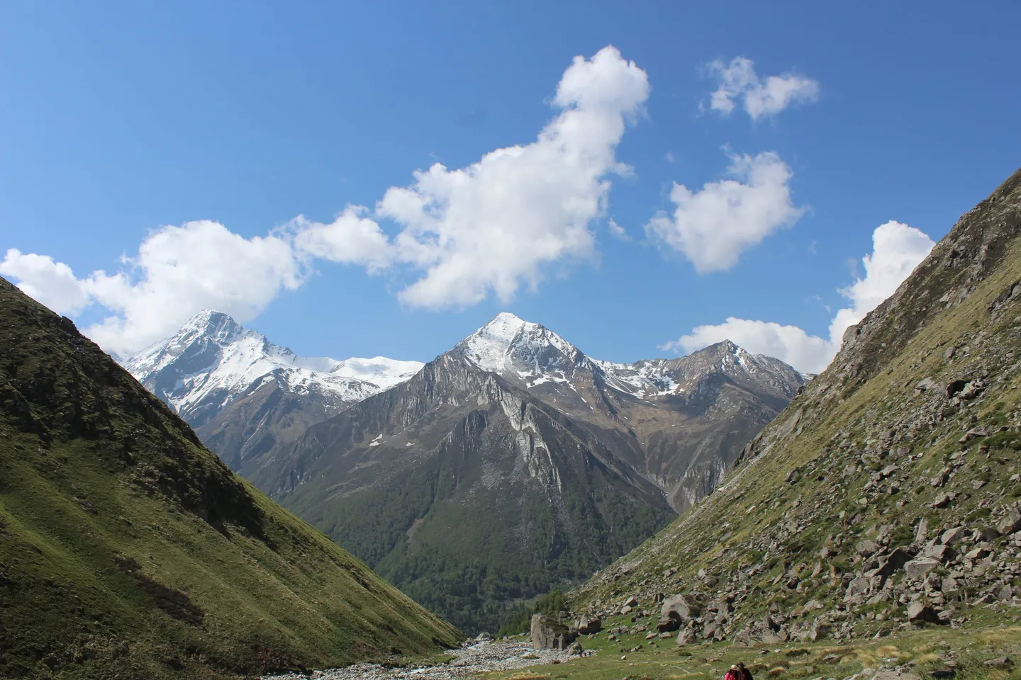
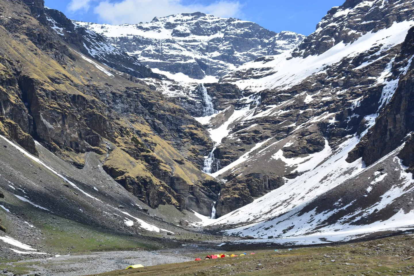
- Photo: Fossegrimx · CC0 1.0 (public domain)
- Photo: Anshul24Sharma · CC BY-SA 4.0
Bharadsar Lake Trek
A long, lightly-walked trek out of the Sankri side of Govind Pashu Vihar to Bharadsar — Baraadsar — a glacial lake on the Uttarakhand-Himachal watershed, with a ridge walk between the Supin and Rupin valleys.
Trip details
Bharadsar — written Baraadsar as often as not — is the least-walked trail out of Sankri, which is remarkable given what else starts there: Har Ki Dun, Bali Pass, Kedarkantha, Ruinsara and Phulara Ridge all leave from the same village. The lake sits high on the divide between the Supin and Rupin valleys, effectively on the Uttarakhand-Himachal boundary, and the route to it is long, remote and quiet in a way the neighbouring trails stopped being years ago. The shape of the trek is a slow build through inhabited country and then a long stay on open ridge. Early days climb from the roadhead through oak and pine and past Himalayan villages, including Bitri, whose carved wooden houses and temple belong to a building tradition shared across this corner of Garhwal and neighbouring Kinnaur. Above the last village the trail leaves the forest for good and gains a ridge system it then follows for days, with the Supin drainage falling away on one side and the Rupin on the other. The final approach crosses boulder field and old snow to a cirque holding the lake. Two honest caveats. First, this trek is graded inconsistently across the industry — one operator's own page calls it Easy in a summary box and 'one of the most difficult treks in Uttarakhand' in the text below. It is a hard trek: long, high, committing and a long way from a road. Second, published altitudes for the lake vary by 300 m between operators. Ask any operator you are considering to state the altitude, the daily distances and the evacuation plan in writing, and treat vagueness as an answer.
- Sankri at about 1,950 m, in deodar forest above the Supin — the roadhead shared by Har Ki Dun, Bali Pass, Kedarkantha and Ruinsara, and the last shop, signal and fuel on the route.
- Oak, pine and deodar forest on the lower days, giving way to birch near the tree line — the standard sequence of the Govind Pashu Vihar valleys, walked here with almost nobody else on the path.
- Bitri village, whose carved wooden houses and temple belong to the timber-and-slate building tradition of upper Garhwal and neighbouring Kinnaur — the same craft that draws people to Osla on the Har Ki Dun trail, without the foot traffic.
- A ridge walk of several days between two river systems, with the Supin valley falling away on one side and the Rupin on the other. This, rather than the lake, is what people who have done the trek talk about afterwards.
- Swargarohini and Kala Nag (Black Peak) across the valleys, with Bandarpunch further east — the skyline that Har Ki Dun looks up at, seen here from the opposite side and from much higher.
- Bharadsar itself: a glacial lake in a boulder cirque on the Uttarakhand-Himachal divide, holding old snow around its rim well into summer. It is a sacred lake to the surrounding villages, which is worth knowing before you decide what to do at its edge.
- Govind Pashu Vihar's high-altitude wildlife across roughly 958 km² of protected ground — monal, Himalayan tahr, bharal and musk deer are all resident, and the park runs a snow leopard conservation programme. Encounters above the tree line are a matter of luck.
- Empty campsites. The strongest single reason to walk this route instead of its famous neighbours is that on most days you will not meet another group.
This is a long trek with several consecutive days above 3,500 m and no road bail-out once you are on the ridge, so endurance matters more than any single hard day. Train for 10 weeks: build to 10 km of brisk walking or running four to five times a week, and add two weekly sessions carrying a 10-12 kg pack over stairs or hills, because you will do consecutive long days rather than one summit push. Prior Himalayan experience is expected — at least one multi-day trek with nights above 3,500 m. Practise camp routine in cold and wet: on a route this remote, being able to look after yourself efficiently at the end of a long day is a safety skill, not a comfort.
- Published altitudes for the lake disagree by roughly 300 m: 4,300 m, 4,400 m (14,435 ft, the figure most consistently quoted for the Bharadsar meadow) and 4,600 m all appear. Ask your operator which they use and what their itinerary's sleeping altitudes are.
- The difficulty grading is inconsistent across operators — the same page can say Easy in a box and 'one of the most difficult treks in Uttarakhand' in the prose. Plan for hard.
- Itinerary lengths vary widely, from about 6 days on the trail to 10 days door to door out of Dehradun, and the route can start from Sankri, Himri or Dhaula depending on the operator. Get the actual day-by-day before you book.
- It is remote. Several days are spent on ridge with no village, road or reliable signal, and an evacuation means walking or being carried out the way you came in.
- The lake is sacred to the surrounding villages. Do not bathe or swim in it, and follow your guide on where camping and cooking are acceptable.
- Govind Pashu Vihar requires a forest entry permit and government photo ID; camping is restricted to designated sites and everything you carry in comes out with you.
Fly to Jolly Grant, Dehradun (DED) or take a train to Dehradun (DDN) or Haridwar (HW), then drive to Sankri — about 200 km, and normally reckoned at 8 to 10 hours through Mussoorie, Purola and Mori. Purola is the last dependable fuel stop and Mori the last of any size. Depending on the operator's route, the trek may start at Sankri or after a further short drive to Himri or Dhaula. Uttarkashi and Purola have the nearest hospitals. The road is landslide-prone in the monsoon, so keep a buffer day at each end.
- Waterproof, ankle-height trekking boots, broken in — you will be in them for consecutive long days
- Sleeping bag rated to -10°C or colder, plus an insulated mat of R-value 4 or above
- Down jacket plus a genuinely waterproof shell, top and bottom — ridge days have no shelter
- Two trekking poles
- Gaiters and microspikes for old snow on the upper sections, if your operator's briefing calls for them
- Headlamp with a full spare set of batteries
- Sunglasses rated for snow glare, sun hat, SPF 50+ sunscreen and lip protection
- 3 litres of water capacity plus purification tablets — sources are streams and snowmelt
- Personal first-aid kit, prescription medication, and a copy of your insurance policy
- A dry bag or liner for your sleeping bag and spare layers
Safety details & FAQ
Where exactly is Bharadsar Lake?
High on the divide between the Supin and Rupin valleys in Uttarkashi district, Uttarakhand, effectively on the Uttarakhand-Himachal Pradesh boundary, inside Govind Pashu Vihar. It is often described as a Himachal trek because of where it sits on the map; the route, the permits and the base village are all Uttarakhand, out of Sankri.
How high is the lake?
Sources genuinely disagree. Figures of 4,300 m, 4,400 m (14,435 ft — the number most consistently quoted for the Bharadsar meadow) and 4,600 m all appear in print. We quote roughly 4,400 m and flag the spread rather than picking the highest. What matters more for your safety is the itinerary's sleeping altitudes and how many consecutive nights you spend above 3,500 m; ask for those in writing.
Is Bharadsar harder than Har Ki Dun?
Considerably. Har Ki Dun is a valley trek with villages, a well-trodden path and a maximum of about 3,566 m. Bharadsar goes roughly 800 m higher, spends several days on open ridge with no village or road, and is walked by a fraction of the numbers. Expect at least one prior multi-day Himalayan trek with nights above 3,500 m to be asked for.
When is the best time to go?
Mid-May to late June, and September to mid-October. The monsoon rules out July and August — the approach road slides and the ridges are exposed and wet — and snow closes the upper route from November to April. Late May and June still hold old snow on the final approach; September and October are colder at night but clearer.
How long is the trek?
It depends on where the operator starts. Trail time is commonly quoted at about 6 days, and full door-to-door itineraries from Dehradun run to 9 or 10 days, with total walking distances in the region of 60 km. Some operators start at Sankri, others drive on to Himri or Dhaula first. Ask for the day-by-day with distances and altitudes before you book — the variation between operators on this route is unusually large.
Do I need permits?
Yes. A forest entry permit for Govind Pashu Vihar, normally arranged by the operator, and a government photo ID carried throughout. Uttarkashi district has tightened requirements on its harder routes since September 2024, including registered guides, trekking insurance and medical fitness certificates on some trails — confirm with your operator what applies to your dates.
Can I swim in the lake?
No. It is a sacred lake to the surrounding villages and is treated as such. Beyond the etiquette, it is a glacial lake near 4,400 m: the water is close to freezing, and cold-water shock at that altitude, days from a road, is a genuinely serious risk.