 1 / 2
1 / 2
- Photo: Dhwani Shree · CC BY-SA 4.0
- Photo: A. J. T. Johnsingh, WWF-India and NCF · CC BY-SA 4.0
Auden's Col Trek
A glaciated pass crossing from Gangotri to Ghuttu over a col published between 5,091 m and 5,550 m, with roped glacier travel, a 45-50 degree snow ascent and an abseil descent onto the Khatling glacier — among the hardest routes walked in the Indian Himalaya.
Trip details
John Bicknell Auden was a geologist with the Geological Survey of India, and the elder brother of the poet W. H. Auden, who dedicated The Ascent of F6 to him. The col that carries his name links the Rudugaira valley above Gangotri with the Khatling glacier that drains towards Ghuttu, threading between the Jogin peaks on one side and the Gangotri group on the other. The usual account has him identifying it in 1935 and crossing in 1939. That account is repeated everywhere and corroborated thinly, which is a fair warning about how much of what is written about this route is copied rather than checked. The crossing is not a trek in the ordinary sense. You walk up the Rudugaira valley to a base below the col, climb a snow slope of 45 to 50 degrees to reach it, and then abseil off the other side onto the Khatling glacier, which is broken, crevassed and has icefall sections. Parties carry ropes, harnesses, ice axes and crampons and use them. The Himalayan Club's own note on the route says plainly that the approach is easier from the Rudugaira side and the descent through the Khatling glacier is the hard part, which is why almost everyone walks it from Gangotri towards Ghuttu rather than the other way. Two things deserve saying without decoration. The first is that the published altitude of the col ranges from 5,091 m to 5,550 m depending on the source, and nobody appears to have settled it; we give the spread rather than the flattering number. The second is that we searched hard for the documented fatalities this route is often said to have, and could not substantiate a single specific one. The frequently-repeated story of a Japanese team lost to an avalanche here in 1955 appears, on tracing it, to describe Thalay Sagar — a different mountain. The danger of this crossing is real and heavily corroborated in first-hand accounts of hidden crevasses and long falls. It does not need a borrowed death to make the point.
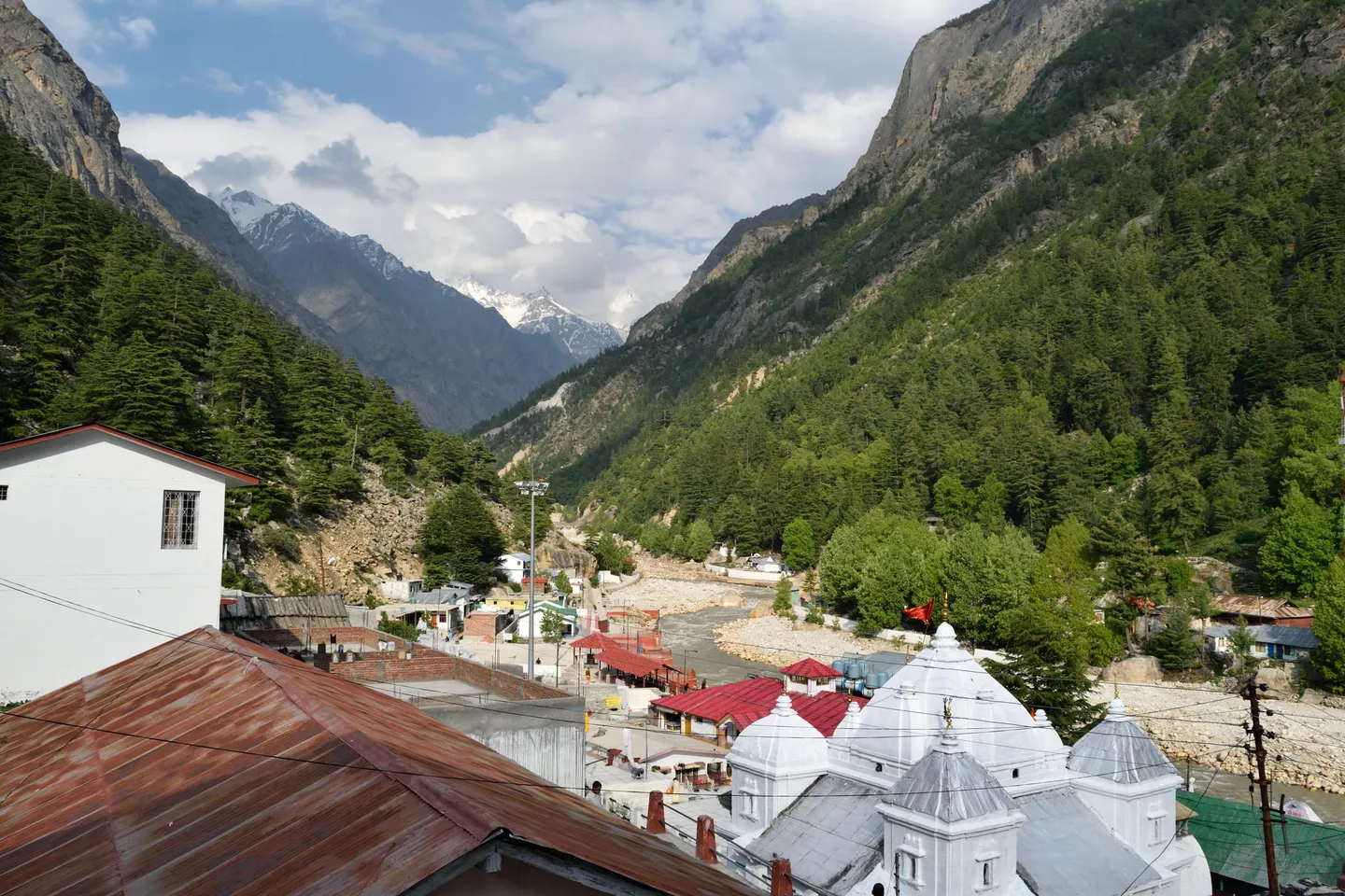
- Gangotri at somewhere between 3,042 m and 3,415 m — sources disagree, including Wikipedia with itself — a temple town at the end of the road, and the last place with anything resembling a shop.
- The Rudugaira valley, walked up over several days away from the pilgrim route, with the Gangotri peaks closing in behind.
- Jogin I at 6,465 m and its neighbours Jogin II and Jogin III, the wall on the eastern side of the col; Gangotri III at 6,577 m stands on the other.
- The col itself: a snow saddle reached up a 45 to 50 degree slope, with the Rudugaira valley behind and the Khatling glacier dropping away in front.
- The abseil off the far side, onto a glacier that is broken enough that the descent, not the ascent, is what parties talk about afterwards.
- The Khatling glacier: crevasse fields under snow bridges, icefall sections, and adjacent glaciers described in the Himalayan Club's own notes as broken.
- Masar Tal, a lake roughly 7 km off the glacier, taken as a side trip on most itineraries.
- Gangi, the last inhabited village on the descent, and then Reeh and the road at Ghuttu — the first vehicle in a week or more.
Treat this as an expedition you train for over months. You need to arrive already able to move roped on a glacier, arrest a fall with an ice axe, walk in crampons on a 50 degree slope and abseil with a pack on, because all four are used and none can be learned safely on the route. Operators expect prior high-altitude trekking above 4,500 m and ideally a hard trek above 5,000 m, and explicitly discourage this as anyone's first big Himalayan objective. Build cardiovascular capacity to expedition standard and train carrying 10 to 15 kg. Then read a first-hand account of the crossing rather than a tour listing, and decide honestly whether it describes something you want.
- This is a technical glacier crossing, not a hard trek. Ropes, harnesses, ice axes, crampons and an abseil off the col are all part of the route.
- The published altitude of the col ranges from 5,091 m to 5,550 m across otherwise reputable sources, with 5,490 m the most repeated. There is no settled figure.
- Direction matters. Gangotri to Ghuttu is the normal direction because the ascent is gentler from Rudugaira and the Khatling descent is the dangerous half; going the other way puts the hard part at the start when you are least acclimatised.
- Itineraries run 13 to 18 days and distances from about 75 km to over 100 km depending on whether the trip finishes at Ghuttu or continues to Kedarnath over the Mayali pass.
- There is no mobile coverage on the route and only unreliable 2G at Gangotri. A satellite communication device is not optional equipment on this crossing.
- Once you are over the col you are committed. There is no bail-out back over it and no road for several days in either direction.
- Since September 2024 Uttarakhand has required a registered guide, trekking insurance and a medical fitness certificate on routes inside Gangotri National Park. Confirm the current scope with your operator.
Fly to Jolly Grant airport at Dehradun or take a train to Dehradun or Rishikesh, then drive roughly 240 to 250 km and eight to ten hours to Gangotri via Mussoorie, Uttarkashi and Harsil. The trek finishes at the other end of the range, at Ghuttu in Tehri Garhwal, around 140 km from Dehradun via Rishikesh, Tehri and Ghansali — so transport has to be arranged at both ends and they are not near each other. Uttarkashi, about 100 km below Gangotri, has the district hospital and the last dependable ATMs; there are none at Gangotri.
- Mountaineering boots that take crampons, worn in — trekking boots will not do on this route
- Ice axe, crampons, harness, and a descender you have used before; ropes and anchors are normally expedition equipment
- Down jacket and a layering system rated for nights above 4,500 m in a tent
- Sleeping bag rated to -20°C or colder, with an insulated mat
- Glacier glasses and SPF 50+ — you will spend days on reflective snow
- Gaiters, mittens, spare gloves and a warm hat
- Headlamp with spare batteries; alpine starts are the norm on the col day
- Personal first-aid and medication, and your own knowledge of the party's evacuation plan
Safety details & FAQ
How high is Auden's Col?
Published figures do not agree, and we would rather show you the spread than pick one. 5,490 m (about 18,010 ft) is the most repeated figure and appears in Wikipedia, the Himalayan Club and most operator listings. But one established operator's own itinerary gives 5,091 m, a first-hand trip report gives 5,550 m, and one operator page manages to give 5,500 m, 17,200 ft and 5,400 m in three different places on the same page. Plan for 5,490 m and treat anyone quoting a single figure with total confidence as not having checked.
Who was Auden?
John Bicknell Auden (1903-1991), an English geologist who joined the Geological Survey of India in 1926 and was, by one account, the last Englishman to leave its employ in 1953. He was the elder brother of the poet W. H. Auden, who with Christopher Isherwood dedicated the play The Ascent of F6 to him, drawing on his Himalayan work. The col is generally said to have been identified by him in 1935 and crossed in 1939, though that specific chronology is repeated far more often than it is corroborated.
Is this a trek or a mountaineering route?
Functionally it is a mountaineering route that happens to connect two roadheads. The ascent to the col is a snow slope of roughly 45 to 50 degrees, the descent onto the Khatling glacier is made on fixed rope or by abseil, and the glacier itself is crevassed with icefall sections. No source assigns it a formal alpine grade, which is itself telling. If a trip listing describes this as a difficult trek without mentioning ropes, that listing is wrong.
Have people died on Auden's Col?
We could not verify a specific documented fatality on this crossing, and we will not repeat one we cannot stand behind. The widely-copied story of a Japanese team killed by an avalanche here in 1955 appears on tracing to describe Thalay Sagar, a different peak in the same range, and we found no primary corroboration for it on either mountain. What is documented is a first-hand 2016 account of a fall of roughly 20 m near the col stopped only by an ice axe catching a crack, and repeated breakthroughs into hidden crevasses on the Khatling descent. Also relevant: Auden himself is said to have nearly fallen and self-arrested during his own crossing. The hazard is real and well attested. It does not need an unverified death attached to it.
When can it be done?
Two narrow windows: mid to late May into June, and September into early or mid October. Before that the snow load on the col is too high, and in between the monsoon makes the glacier and the approach unsafe. The window is genuinely narrow compared with other Himalayan routes, and a trip that slips by two weeks may not be a trip at all.
What happens if someone is hurt after the col?
This is the question to ask your operator before you book, and to be unsatisfied with a vague answer. There is no road, no mobile coverage and no helicopter you can count on, and the col cannot be reversed with a casualty. Working from a published itinerary, the descent from the col to the roadhead at Ghuttu is on the order of six to seven trekking days at normal pace, which is our own arithmetic rather than a stated rescue time. The party carries the casualty lower and raises the alarm by satellite phone. Any operator without a satellite device on this route should be declined.
Do I need an Indian Mountaineering Foundation permit?
For the Gangotri side you certainly need a Gangotri National Park entry permit, issued by the forest department, and since September 2024 a registered guide, insurance and a medical certificate have been required on park routes. Whether a mountaineering-federation permit is additionally required for crossing the col, as distinct from climbing a named peak, we could not establish from an authoritative source — operators say permits are included without specifying which body issues what. Ask your operator to name the permits and the issuing offices in writing.